Key Points – Tuesday, August 15, 2017:
Synopsis: Good Tuesday morning! Heavy storms worked across northern Nebraska overnight, dumping heavy rain. Storm chances will ramp up later today into tonight, shifting eastward through mid-week. Severe storm risks are in place as well. The video goes into all the details regarding the timing of storms and where we think the heaviest rains fall.
Today’s video (6:39):
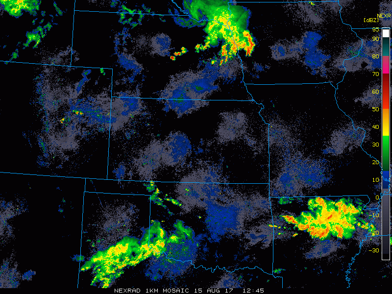
Current radar (loop ending at 9:20 am):
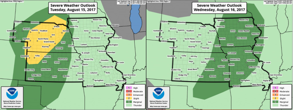
Here are the severe storm risks for today and Wednesday. Severe weather concerns target the western half of the area today, especially areas from central Nebraska into northwest Kansas. This is where the greatest threat exists for damaging winds and hail…along with the possibility for an isolated tornado or two. Severe threat shifts further east into Wednesday across Iowa, Missouri, and eastern Kansas.
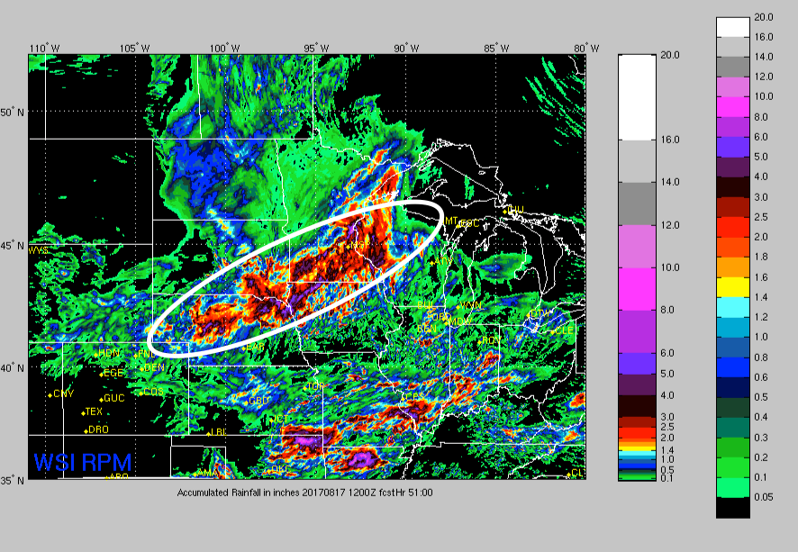
Rainfall guidance over the next 51 hours….watching for heavy rain potential, especially from central Nebraska into northwest Iowa where flash flooding is a real concern with the best forcing tracking across that area. Note that everyone else in the region will have solid rain/storm chances with a locally heavy rain threat…with a more hit and miss nature.
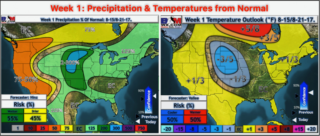
Week 1 temperatures and precipitation from normal.
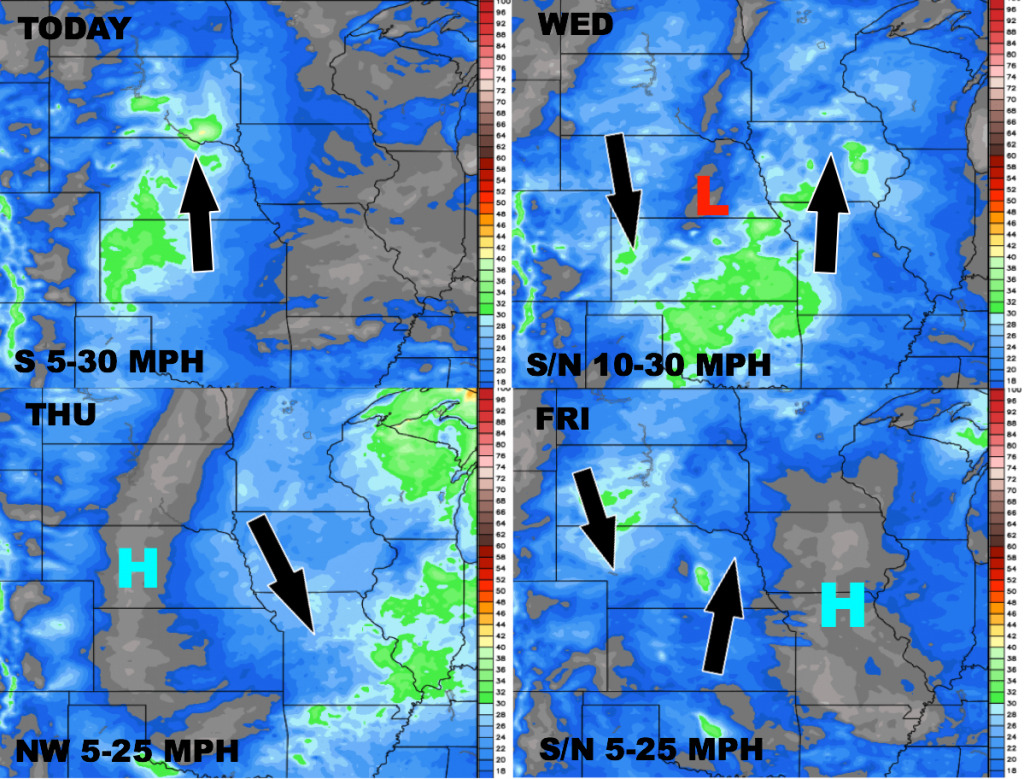
Wind forecast over the next 4 days.
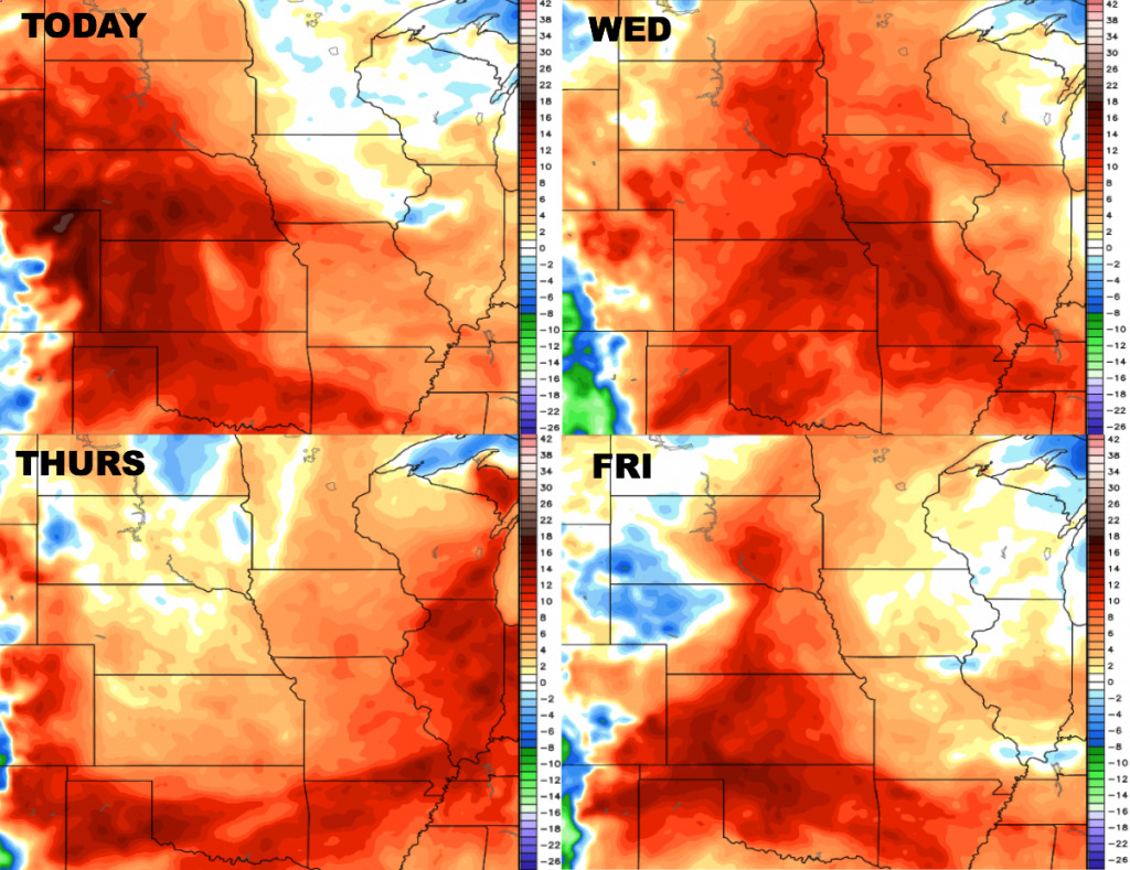
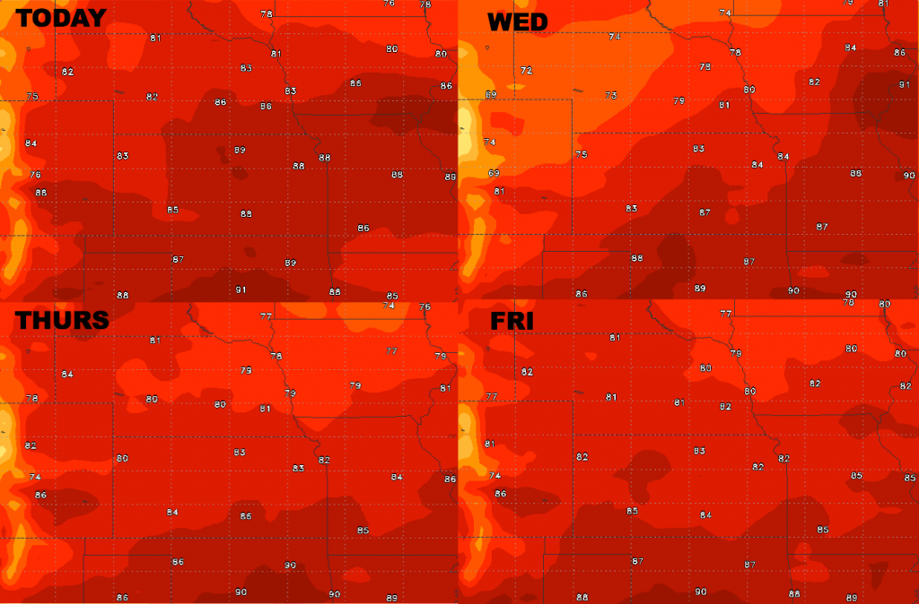
High temperature guidance into late week.
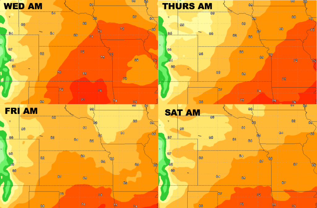
Low temperature guidance over the next 4 days.
Dew points from normal..humid mid-week with a slight drop late week.