Key Points – Thursday, August 10, 2017:
Synopsis: Good Thursday morning! In today’s video we continue to discuss the overall cooler pattern hold strong across the central Plains, we are on par for one of the coolest Augusts on record across the Ag Belt. Still seeing risks for scattered storms mainly moving west to east across the forecast area over the next 2 days, some of these may be strong with some localized heavy rainfall as well. It is worth a note that the focal point of the rainfall with be south and west overall. If you have any questions, please don’t hesitate to reach out…have a blessed day!
Today’s video (8 min):
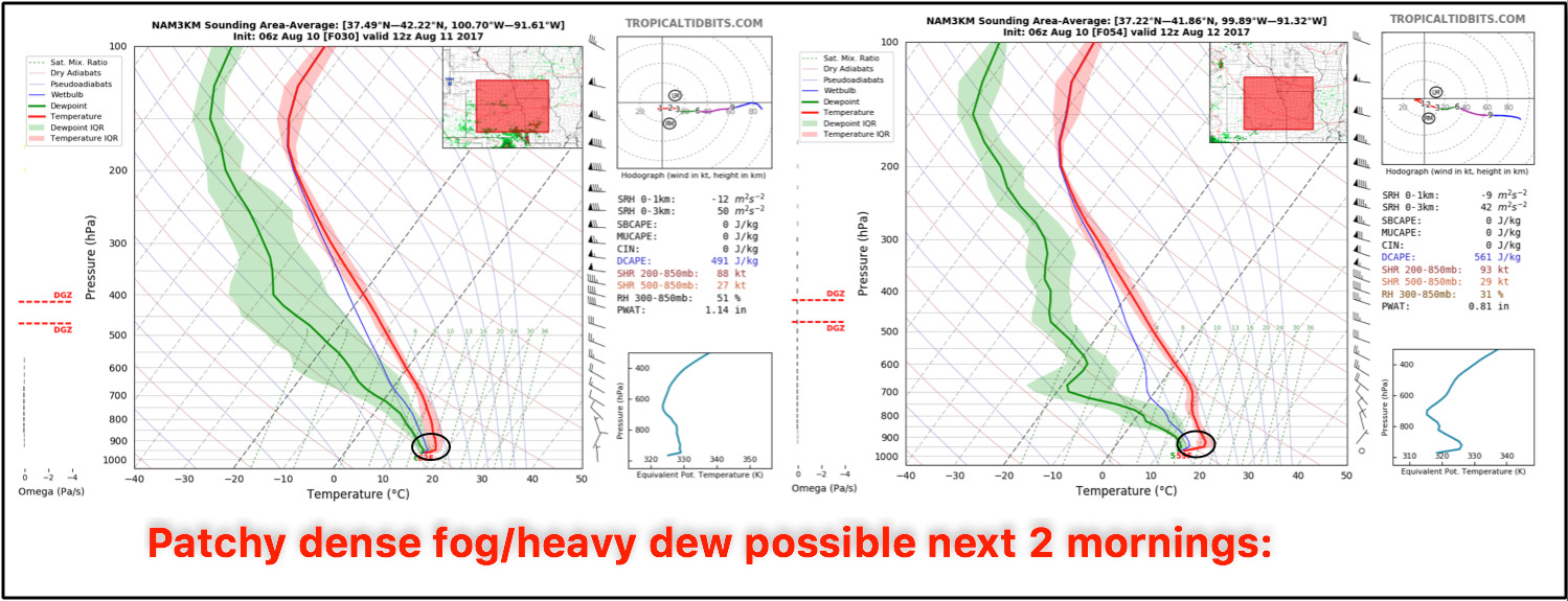
Still seeing decent signatures for patchy dense fog over the next 2 days, some heavy dew may also be possible as well…expecting any inversion to break by mid-morning as the sun rises:
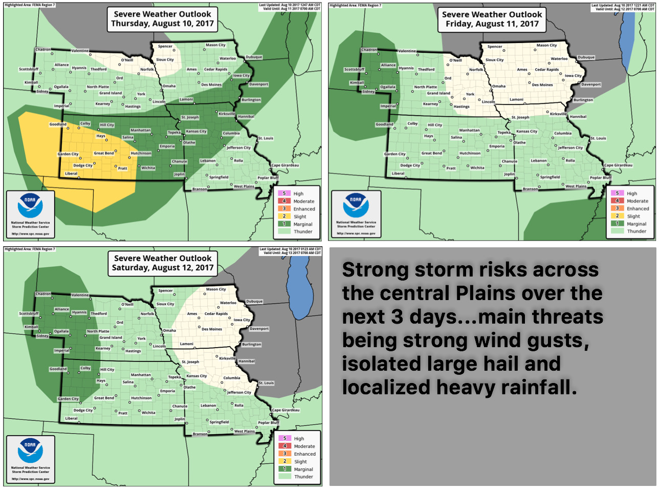
Strong storm risks over the next few days:
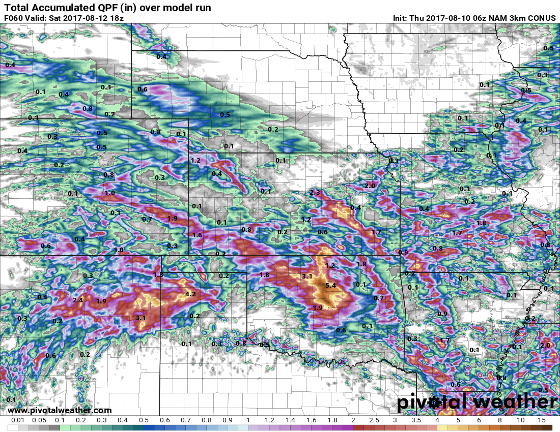
In terms of precipitation over the next 60 hours, ~0.5-1.0″ possible across parts of south and east Iowa with storms later tonight, otherwise 0.5-1.5″ (isolated higher localized) is forecasted in scattered amounts across parts of Nebraska, Kansas and Missouri.
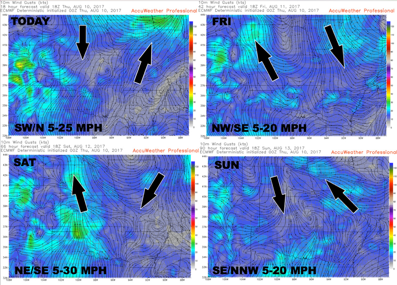
Here’s your wind forecast guidance as we head into the weekend:
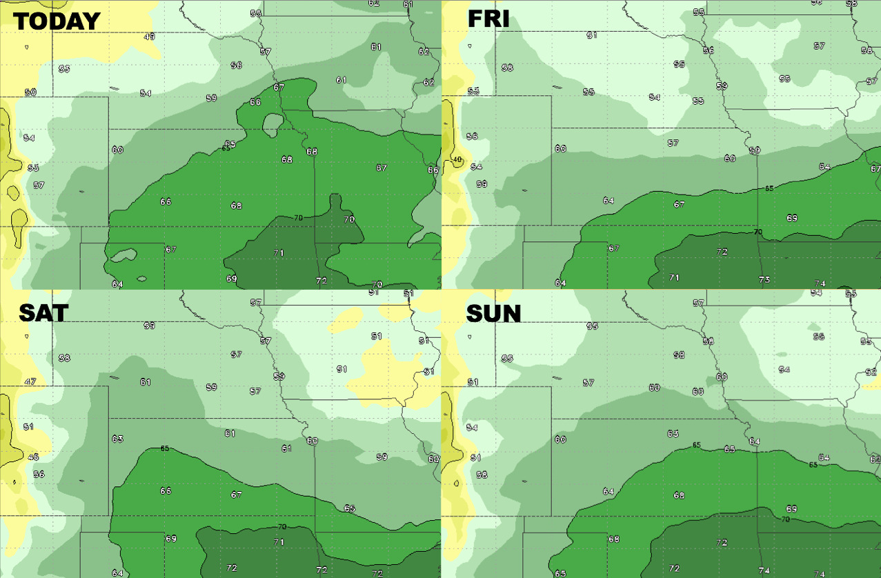
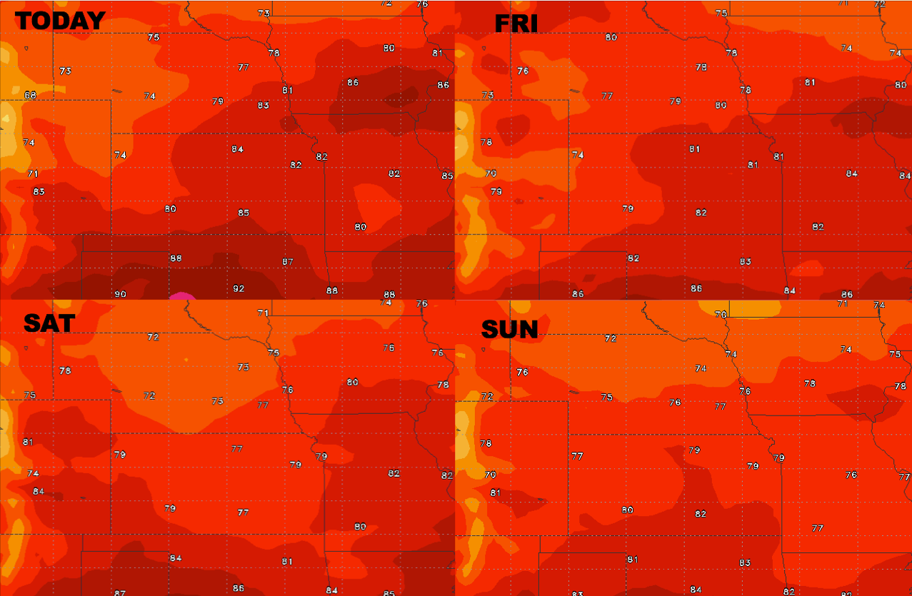
High temperature guidance over the next 4 days:
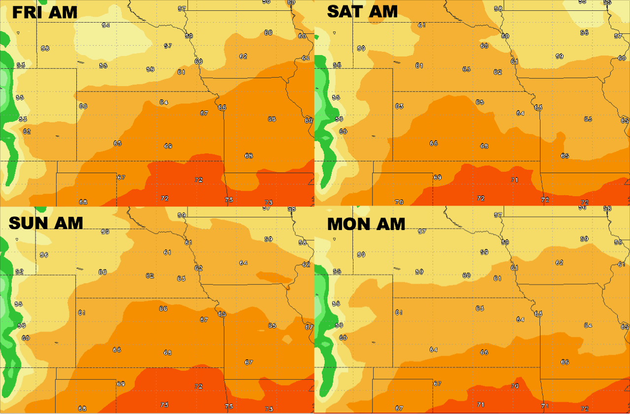
Overnight low temperature guidance next 4 mornings into early next week:
Here’s your dew points forecast as well as we head into the weekend: