Key Points – Friday, September 29, 2017:
Synopsis: Good Friday morning! Waking up to another quiet and pleasant start to the day for much of the area. Scattered shower and storm chances are in the forecast for portions of the area this weekend as a strong storm system works across the upper Plains into southern Canada. Not expecting a washout of a weekend. A frontal boundary looks to get “stuck” across the region into the middle of next week, with multiple rounds of storms tracking along that. This will lead to heavy rain and flooding concerns where this “boundary” sets up. Details in today’s video. Have a blessed day, and let us know if you have any questions!
Today’s video (5 min):
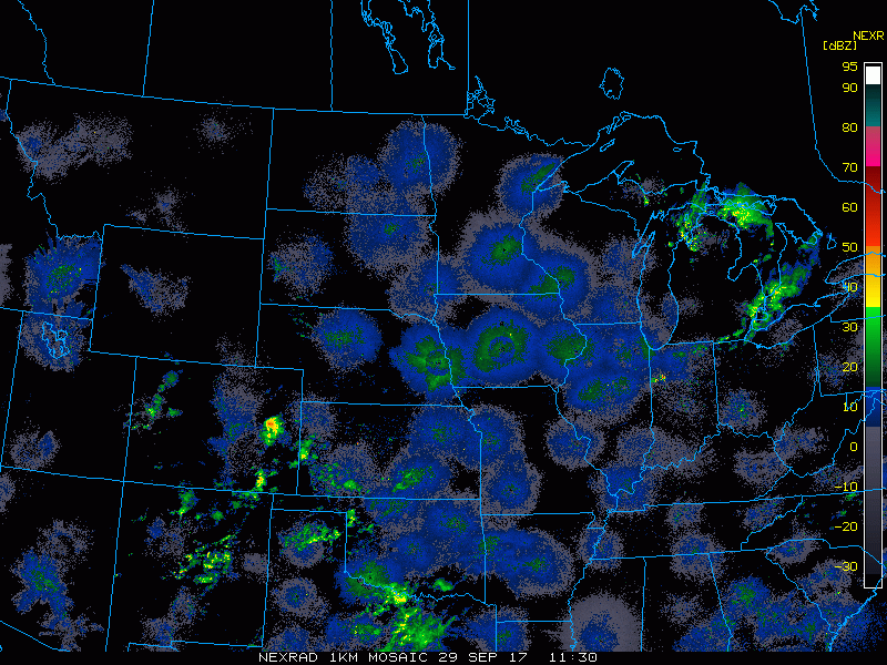
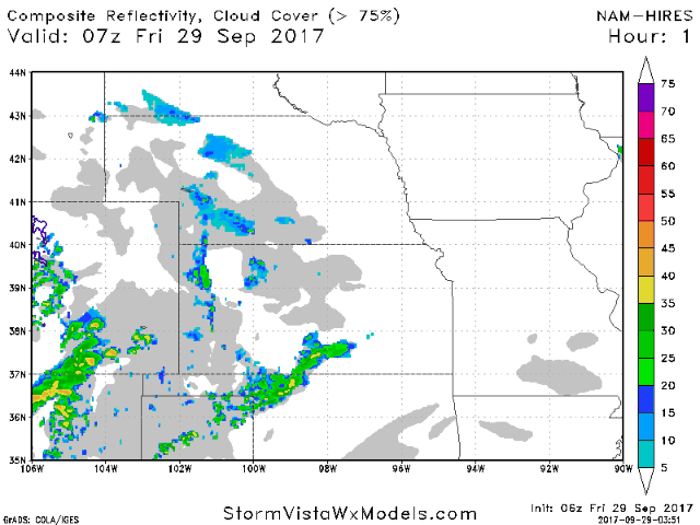
Current radar shows a few light showers working into southwest Kansas this morning.
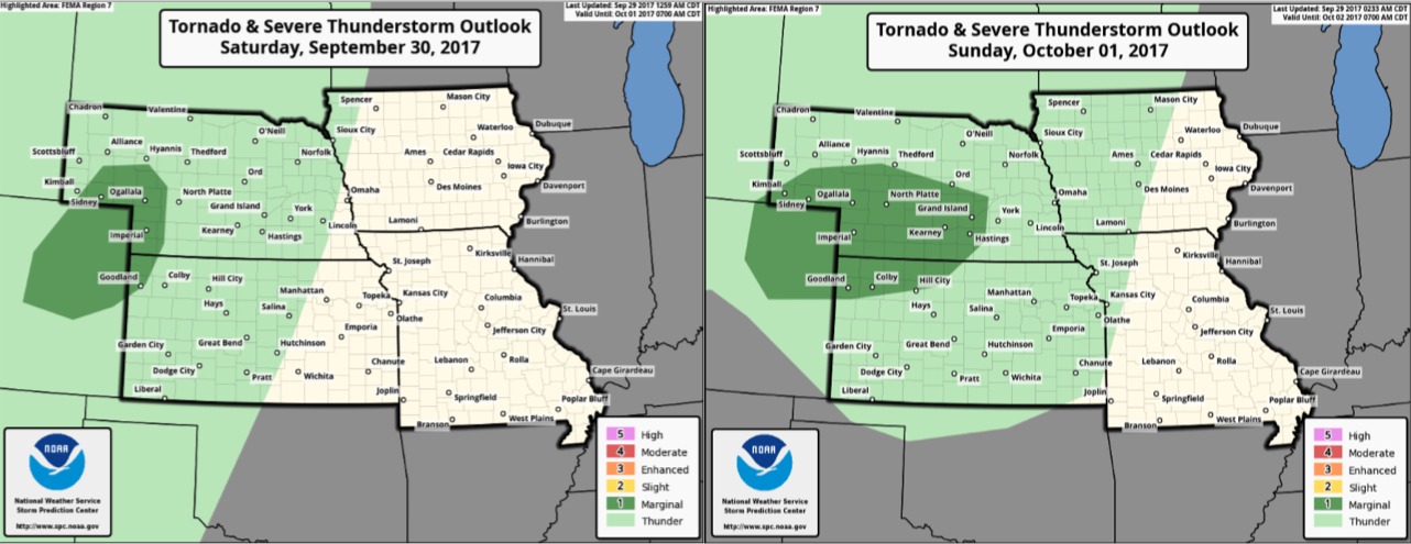
Marginal threat for a few stronger storms with wind/hail in the far western Plains late Saturday, then a marginal threat across Nebraska and northern Kansas Sunday evening/night.
Scattered showers are expected to develop across Nebraska and Kansas as we head into tonight and during the day Saturday. Additional storms develop across the western Plains Saturday evening, and some of these could be strong to severe. Heading into Sunday, scattered showers/storms most numerous in eastern Nebraska and western Iowa.
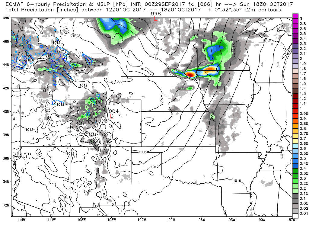
Expecting an increase in storms across Nebraska and Kansas Sunday evening and night as a secondary low pressure moves east along a stalling frontal boundary. This is just the beginning of a very active period as numerous rounds of storms track across the area through the middle of the week. Check out this animation of 6-hour precipitation from Sunday afternoon through Wednesday morning.
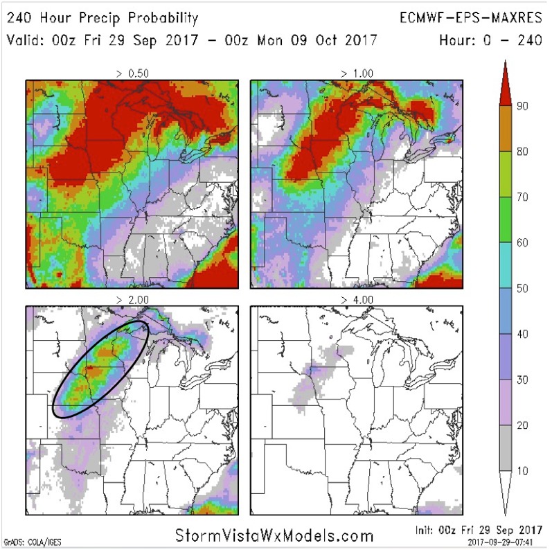
Here is a panel showing rainfall total probabilities over the next 10 days (starting with the probability of greater than 0.5″ in the upper left to the probability of greater than 4″ rain amounts in the lower right panel). This gives us a good idea of where the heaviest rains look to fall next week, closing in on northern Kansas, central/eastern Nebraska, and western Iowa.
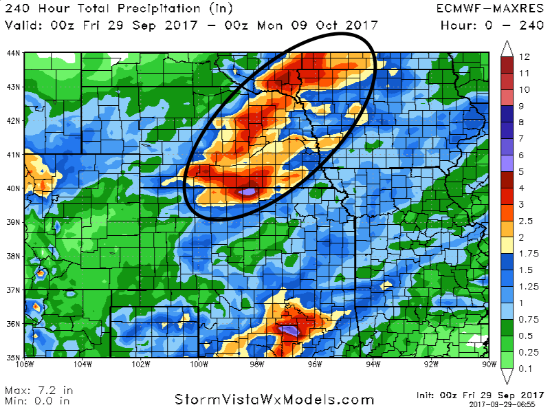
Here are the 10-day rainfall numbers off the European model. The highest uncertainty is how much rainfall the southeast parts of the region receives, as it will be contingent upon how quickly a ridge of high pressure breaks down. The black circled area highlights where the heaviest rain concerns look to set-up, with 2-4″+.
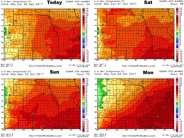
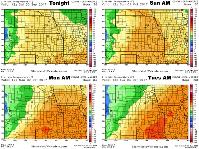
High temperatures over the next 4 days:
Low temperature guidance over the next 4 days:
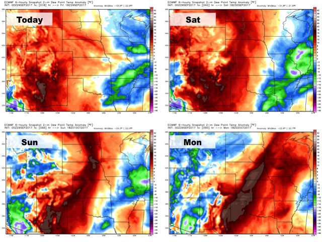
Dew points from normal: Drier air to the east through the first half of the weekend with higher moisture west. Above normal humidity levels spread across the region early next week.
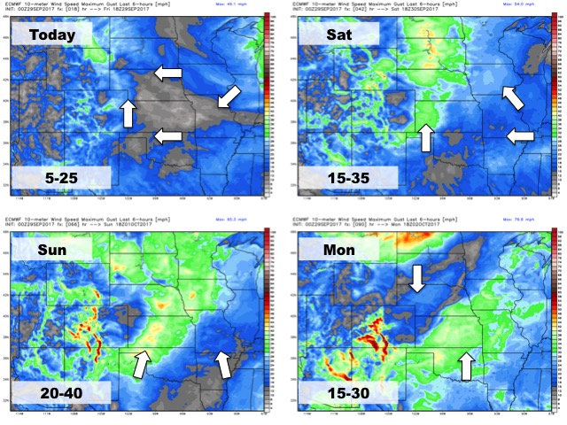
Wind forecast over the next 4 days: