Key Points – Wednesday, August 9, 2017:
Synopsis: Good Wednesday morning! Scattered rainfall noted across parts of Nebraska and Kansas over the past 24 hours, expecting more storm threats pushing east going forward into this evening (~40% coverage). Some scattered areas of heavy dew and patchy dense fog over the next 3 mornings as well, key thing to note is most of this burns off as the sun rises mid-morning. Getting later into the work-week, we target additional storms, some being strong/heavy, along a cold front pushing east…and then another round Friday into Saturday along a wave of energy (~50-60% coverage). It’s a busy forecast as we head into the weekend, all the details in the video…if you have any questions please let us know; have a blessed day!
Today’s video (8 min):
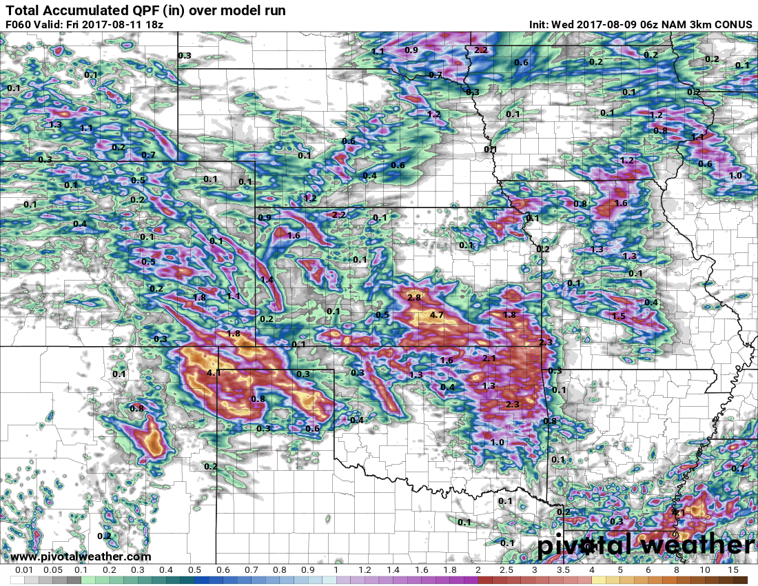
Rainfall guidance over the next 60 hours…the model below isn’t perfect in terms of where we are targeting energy…it’s still the “have and have-nots” pattern where not everyone cashes in, but those that do could see 0.5-1.5″ (with isolated higher amounts possible in the strong storms).
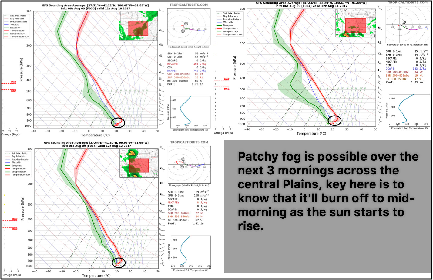
Still seeing some patchy fog/heavy dew possible over the next 3 mornings:
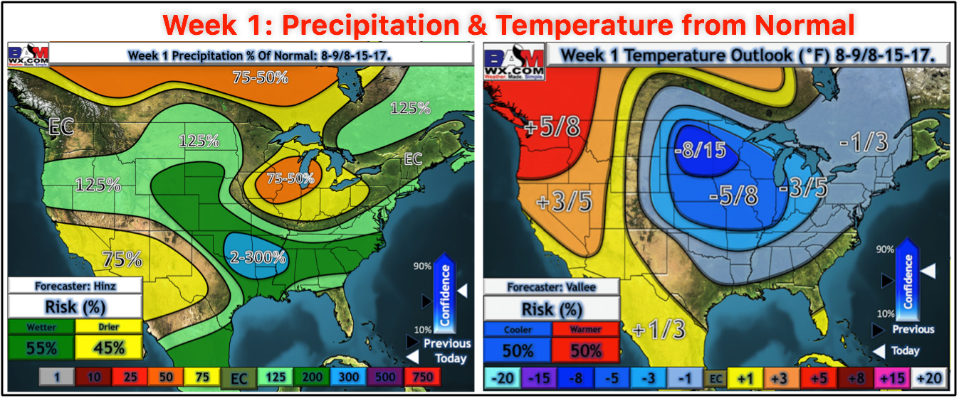
Week 1 precipitation and temperature guidance from normal…same story different day, the cooler anomalies continue with the focus of the above normal rainfall west and south.
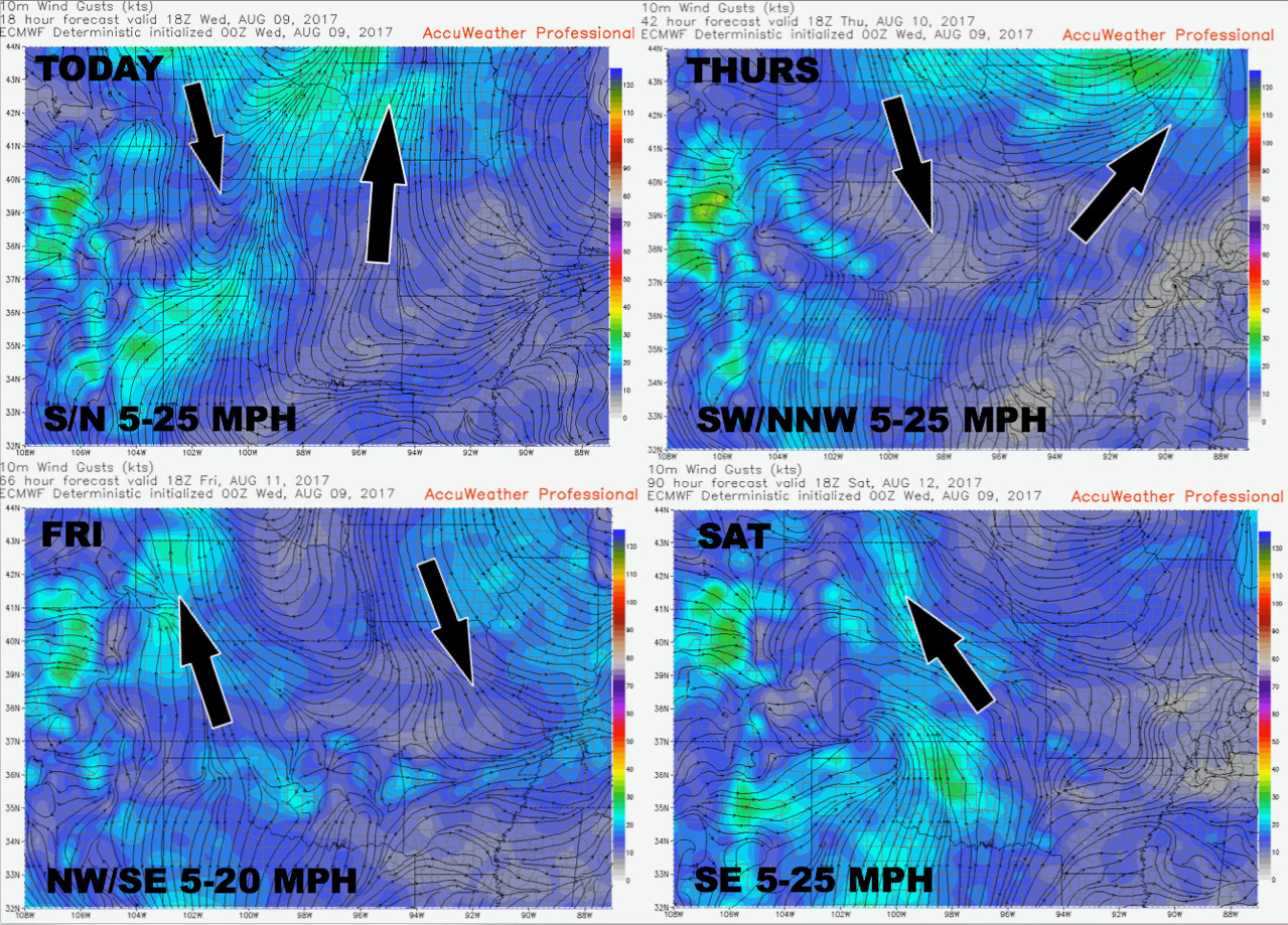
Wind forecast guidance over the next 4 days:
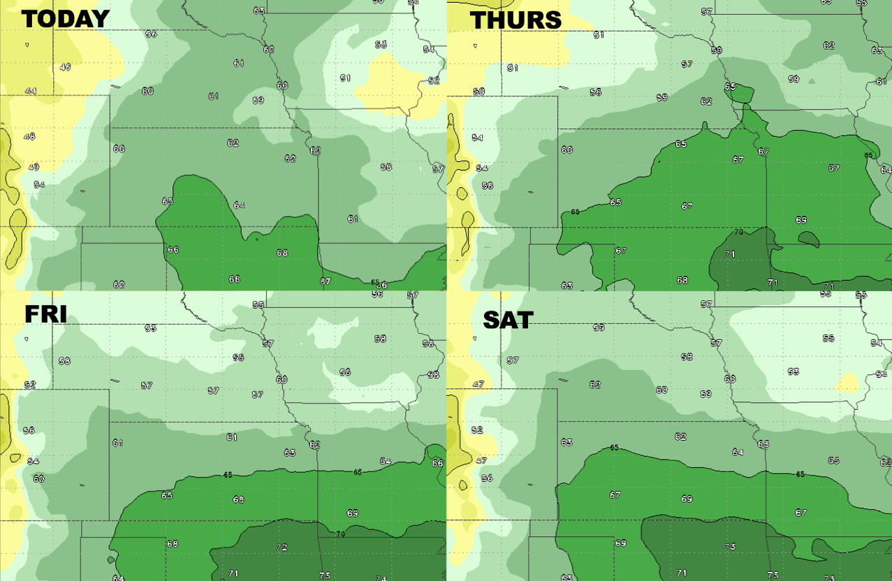
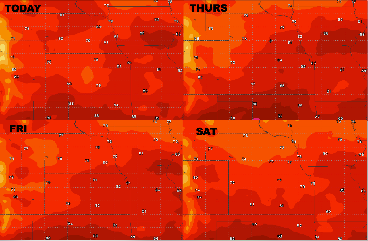
High temperature guidance into the weekend:
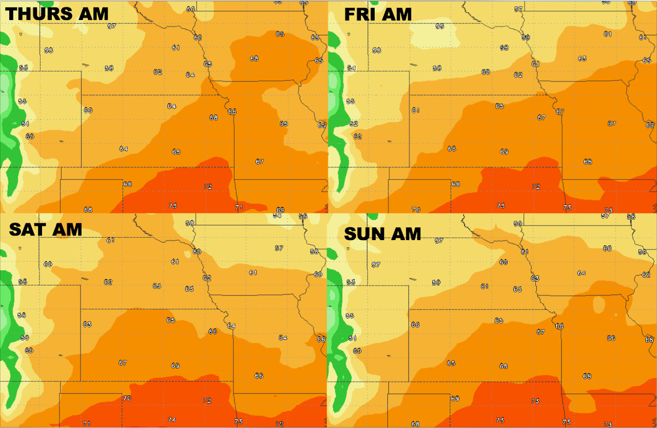
Here’s your overnight low forecast temperature guidance:
Dew points as well are below over the next 4 days: