Key Points – Wednesday, August 16, 2017:
Synopsis: Good Wednesday morning! Waking up to another morning of heavy rainfall across Nebraska, watching for additional showers and storms, some being strong to heavy with excessive rainfall work east along a cold front through Thursday morning. Most of the weather on Thursday is calm, next chance for storms to work in from west to east on late Thursday into Friday morning…can’t rule out a few strong storms will additional chances for excessive rainfall especially to the south and east. We discuss the pattern through the weekend in today’s video as well…if you have any questions please let us know. Have a blessed day!
Today’s video (8 min):
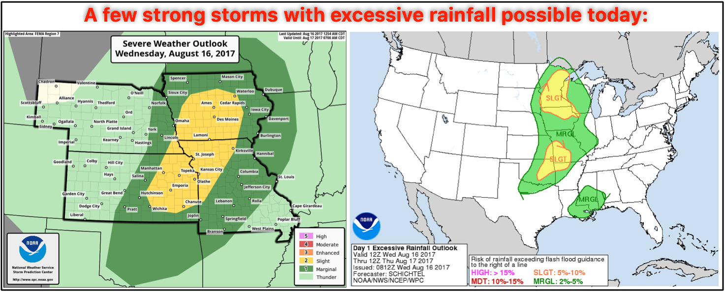
Watching for the potential for strong storms along the cold front as it strengthens east later today into tonight…some localized heavy rainfall is on the table here as well as discussed in the video; oftentimes when atmospheric moisture content (PWATs) are elevated above 2″ we see it as a good potential for heavy storms. Damaging winds are the main threat, but isolated large hail and a brief spin-up can’t be ruled out.
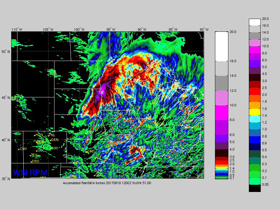
Rainfall guidance over the next 2 days is below…localized 1-3″ amounts are call here, it’ll be fairly scattered, not everyone cashes in across the central Plains. Some localized 4″+ totals aren’t off the table here as well, similar to what we saw across Nebraska overnight.
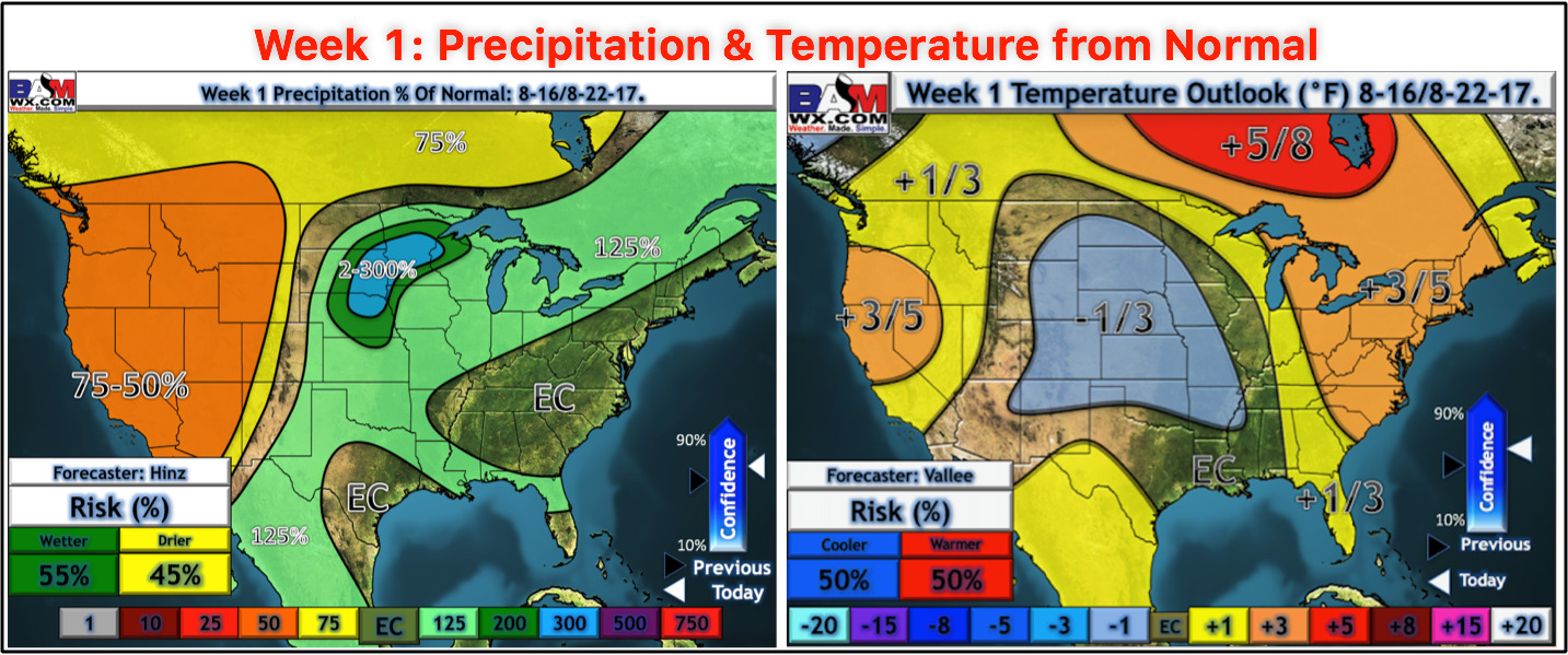
Updated week 1 precipitation and temperatures from normal this morning:
Wind forecast guidance over the next 4 days:

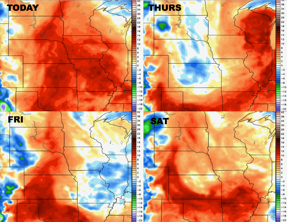
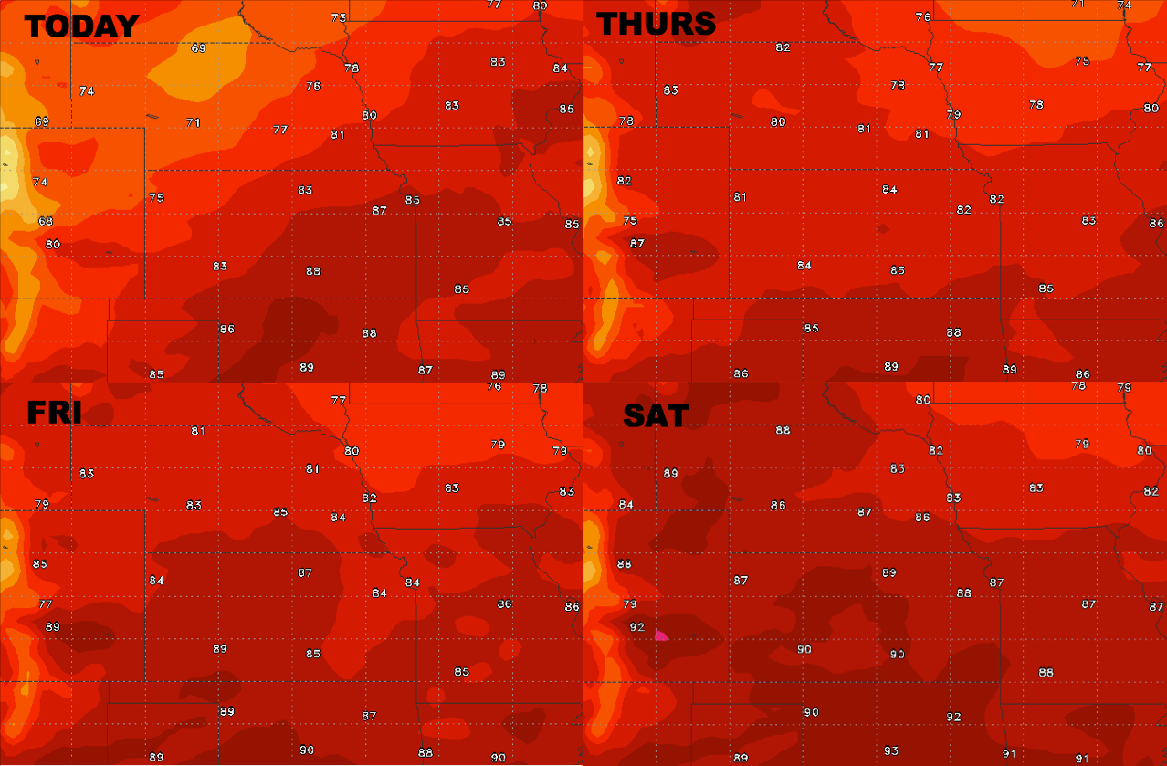
High temperature guidance as we head into the weekend:
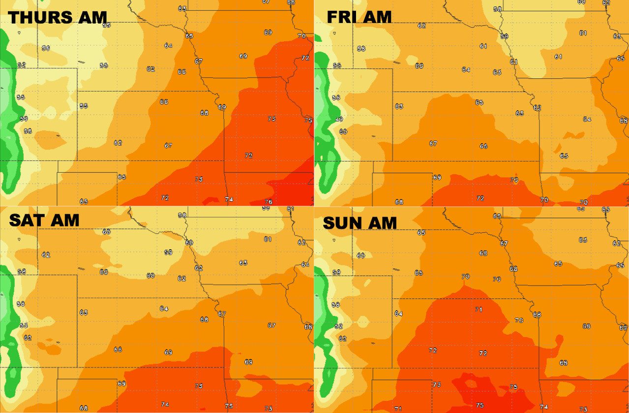
Overnight low temperature guidance over the next 4 mornings:
Dew points from normal into the weekend: