Key Points – Monday, August 14, 2017:
Synopsis: Good Monday morning! Unsettled weather pattern for the next few days with showers and storms chances, particularly as we go into Tuesday and Wednesday. Strong to severe storm threats will be in place as well, along with localized heavy rain potential. Detailed analysis in the video below. Be sure to let us know if you have any questions, have a blessed day!
Today’s video (9 min):
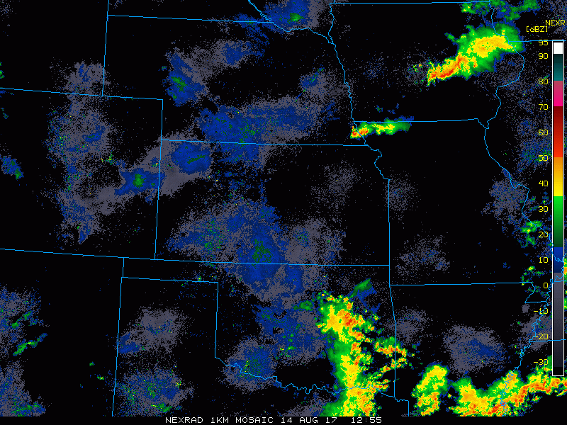
Current radar shows a few storms working across Iowa into northwest Missouri.
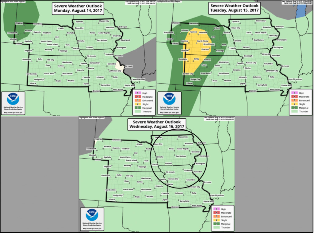
Here are the severe storm outlooks heading into mid-week. Watching for a more widespread strong/severe storm threat across Nebraska into Kansas on Tuesday. Damaging winds/hail the main concerns. We may also see another risk issued for Wednesday, mostly likely in the area circled.
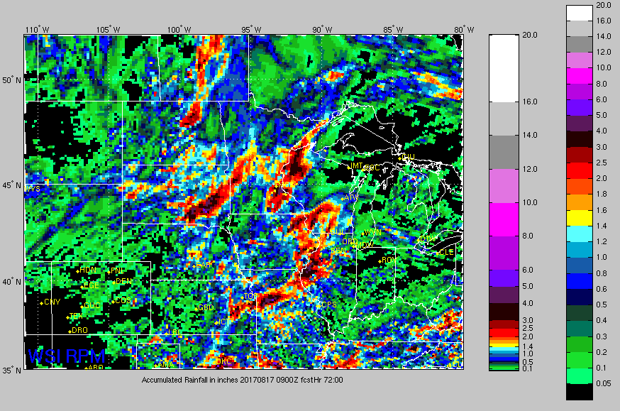
Good signal for decent rainfall coverage through mid-week, with locally heavy rains possible. Here is the rainfall guidance out to 72 hours.
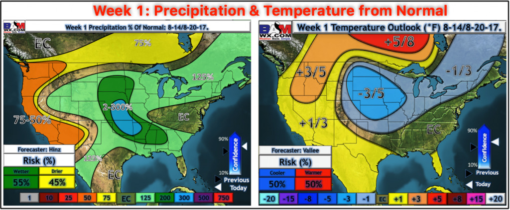
Here is the week 1 temperature and precipitation from normal outlook.
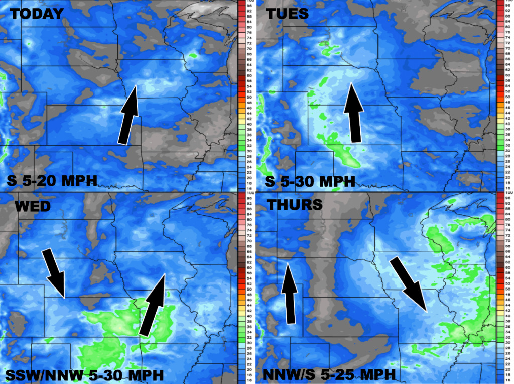
Here is the wind forecast over the next 4 days.
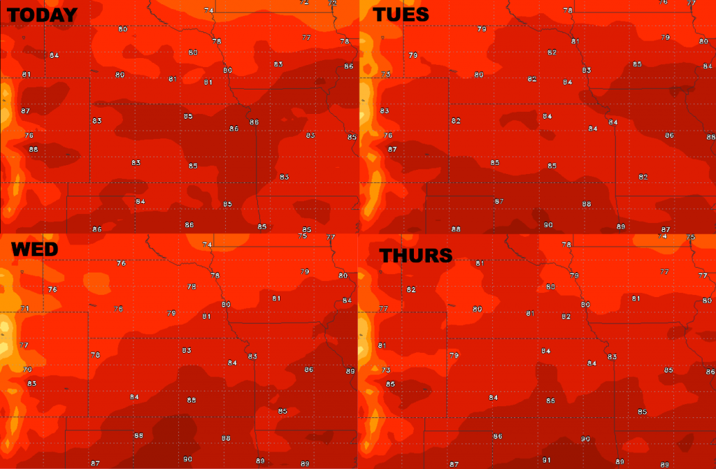
High temperature guidance is shown below.
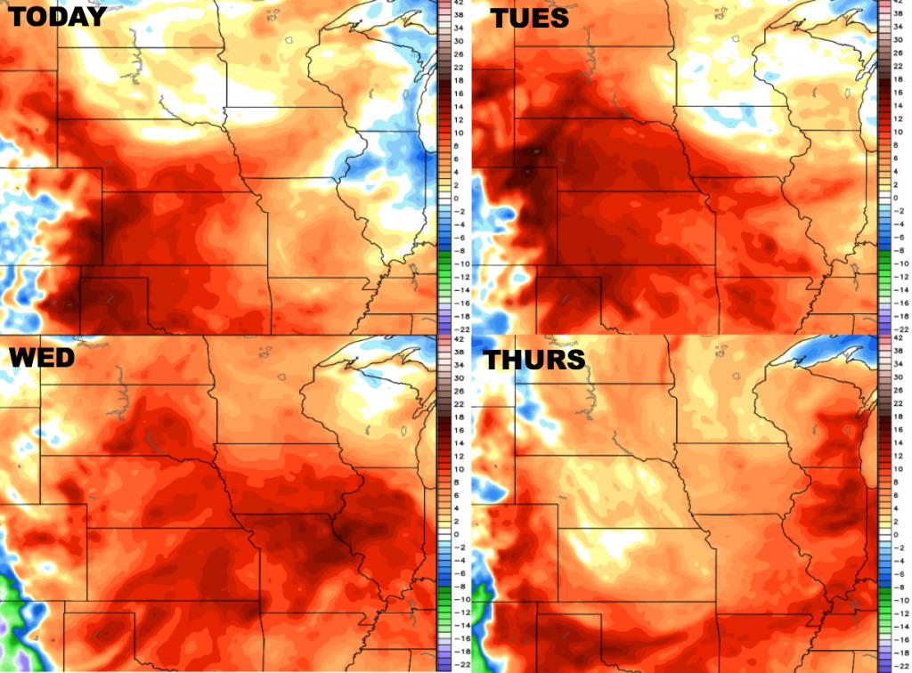
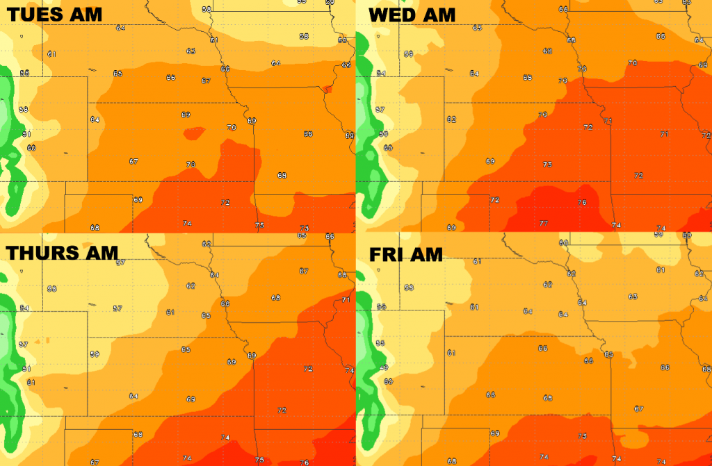
Low temperatures stay elevated this week thanks to higher moisture levels.
Dew points from normal….overall it’s a humid week ahead with a bit of a drop in moisture levels Thursday behind a cold front.