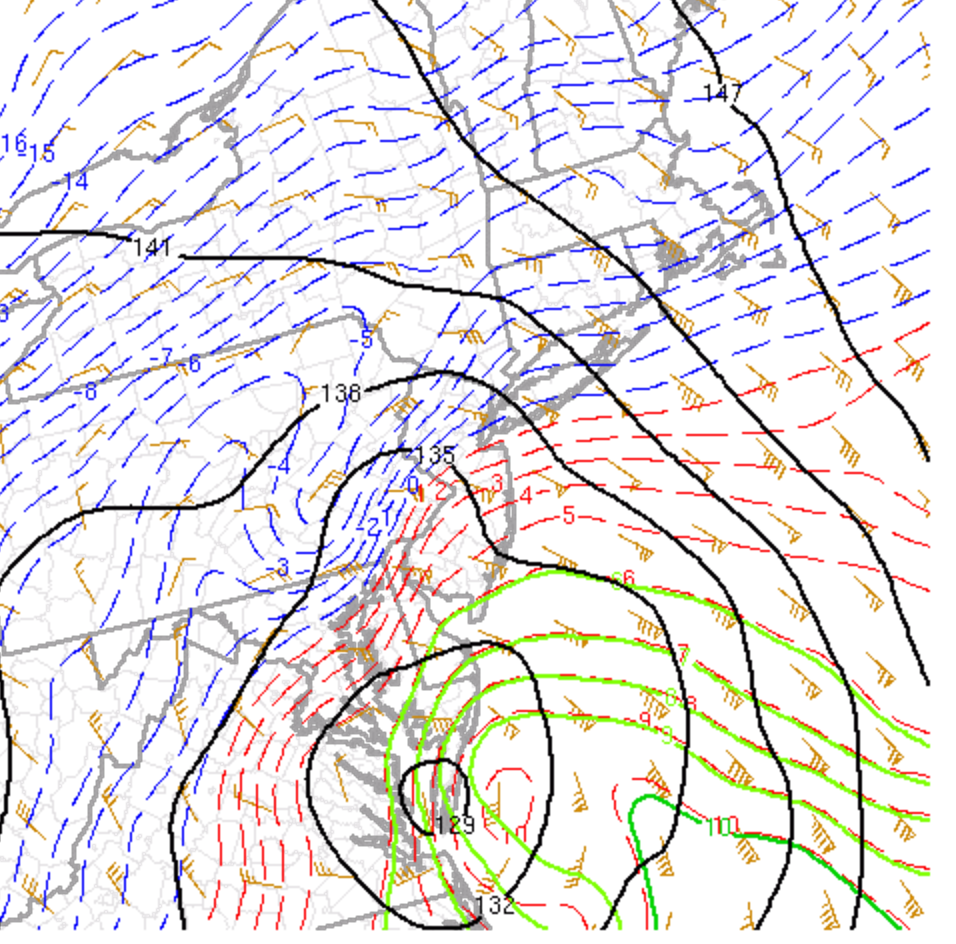
Good morning. As discussed, the exact track of this system would dictate snowfall amounts and precipitation type. Latest SPC analysis at 850mb (~5,000ft) shows the strong warming, leading to sleet along the coast.
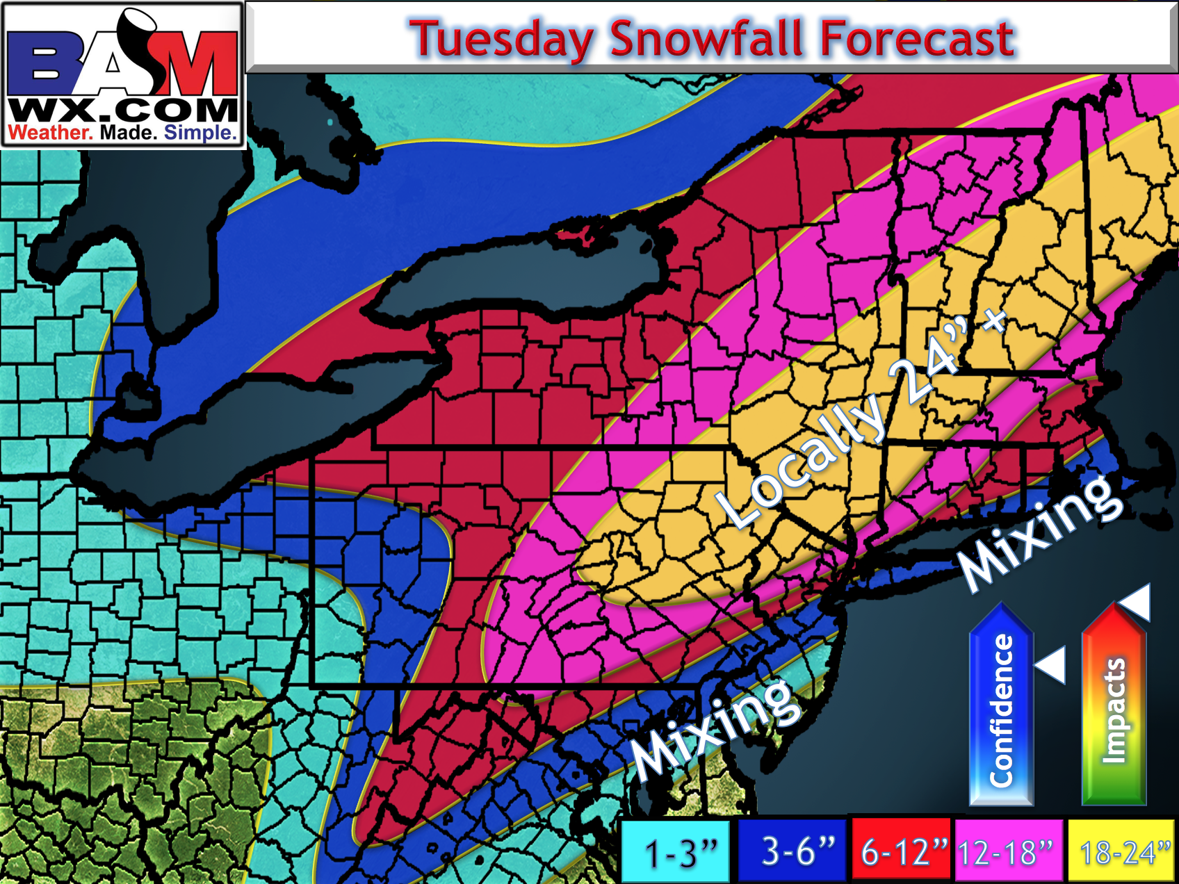
This was a risk we discussed the last few days with mixing likely. With the recent trends, here is an updated snowfall map. In southern New England and across the coastal Mid-Atlantic, lean closer to the lower side of the range.
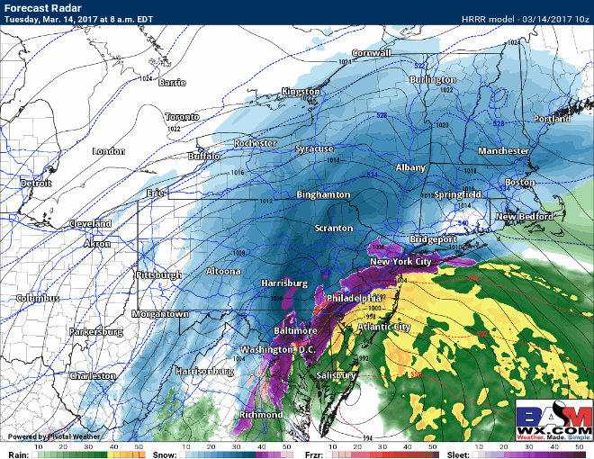
Snow will slowly transition to sleet and rain in southern New England (south and east of I-84) this morning, while areas across western New Jersey and SE PA go back to snow as colder air wraps into the storm.
I’ll have additional updates throughout the morning as needed.