#AGwx #Plant17 #MNwx #SDwx #NDwx #WIwx Snow For Some Today, Warmer Times By Next Weekend. Details Here! E.
Key Points: May 1, 2017
Synopsis: Good Monday morning! We are tracking snow across Minnesota and the eastern Dakotas this morning with rain and a few storms further east across Wisconsin and southeastern Minnesota. This is thanks to a dynamic storm that unfortunately brought severe flooding to many across the Ag Belt. Another system will bring a few showers west Tuesday, then dive southeast of the region Wednesday into Thursday. While most misses to our south and east, a few showers and some clouds are expected through Thursday. Drier and warmer times will return for the end of the week and into the weekend, especially the farther west you go across the region.
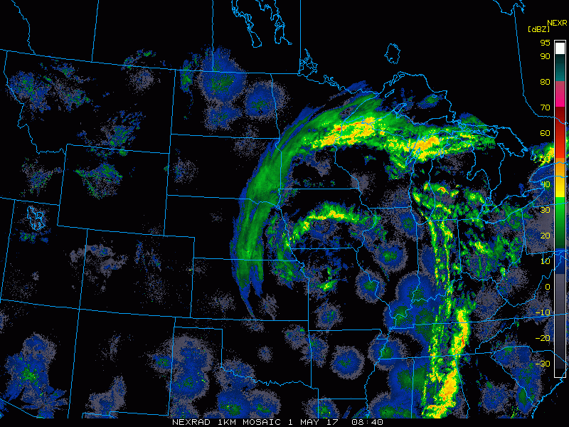
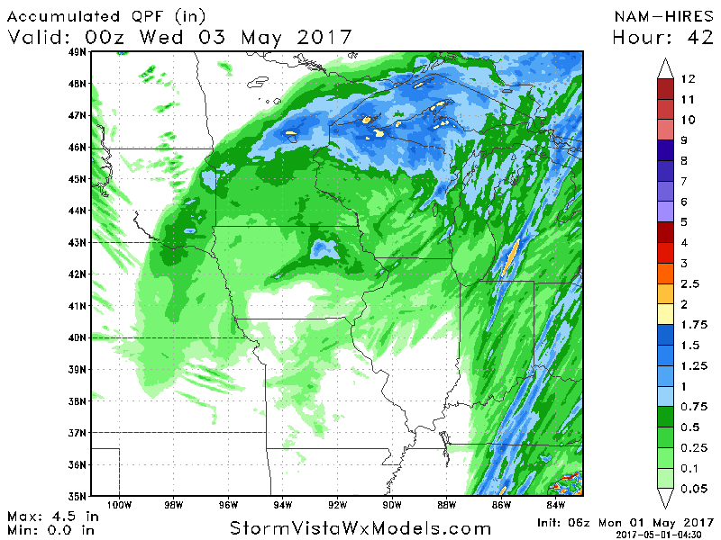
- Current radar this morning shows snow across parts of the region with showers east.
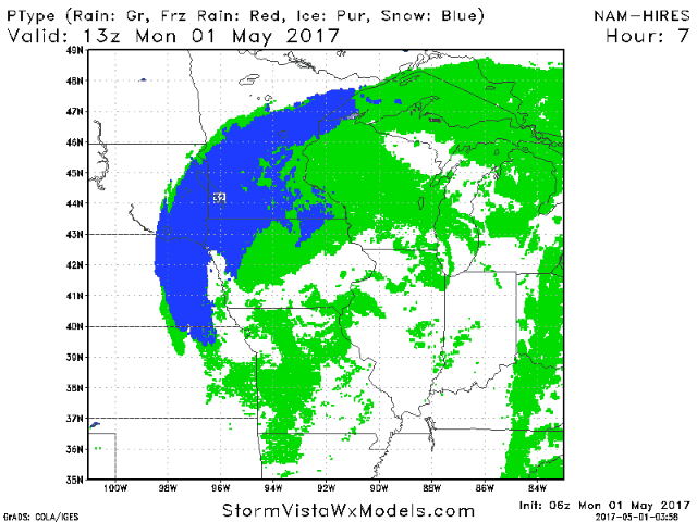
- Throughout the day today, rain and snow will continue as an area of low pressure slowly moves through the region. Blue indicates snow, green indicates rain.
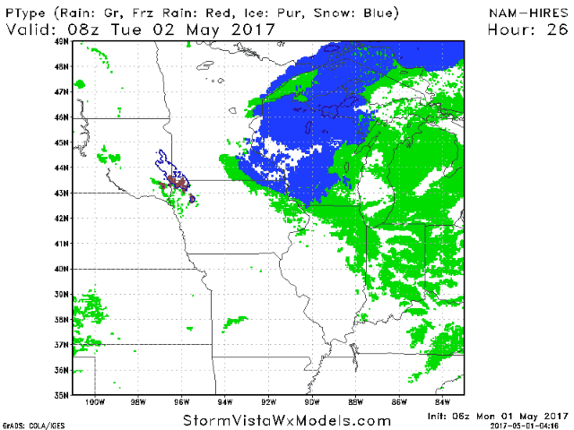
- Some snow showers likely last even into Tuesday across Wisconsin with some afternoon showers across the Dakotas.
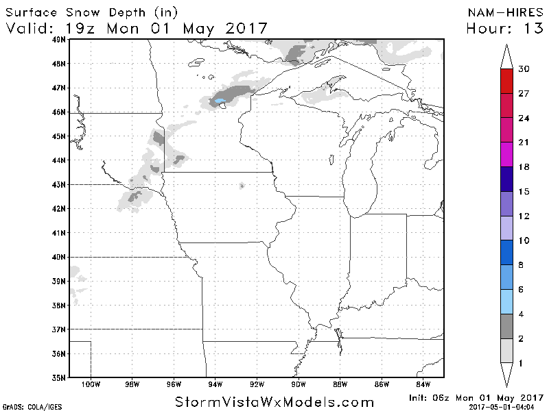
- While snow will be falling, surface temperatures above freezing and a May sun angle will keep accumulations to a minimum. Here’s a good estimate of what to expect. 1-3″ with locally more, especially on grassy surfaces.
- Liquid falling from the sky (some in the form of snow) through the day Tuesday will be upwards of 1 inch in northern Minnesota and Wisconsin. Elsewhere much less is expected.
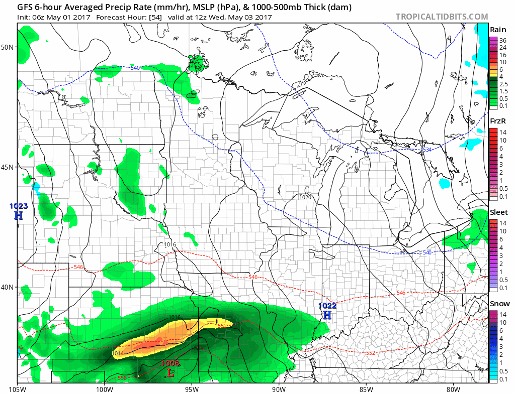
- Our next system brings a few showers Wednesday and Thursday with heaviest rainfall staying southeast of the region.
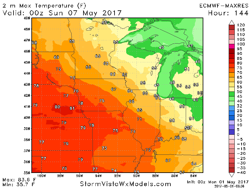
- Drier times and warmer temperatures return by next weekend especially west. Here’s a look at the European for high temperatures Saturday. Very warm west!
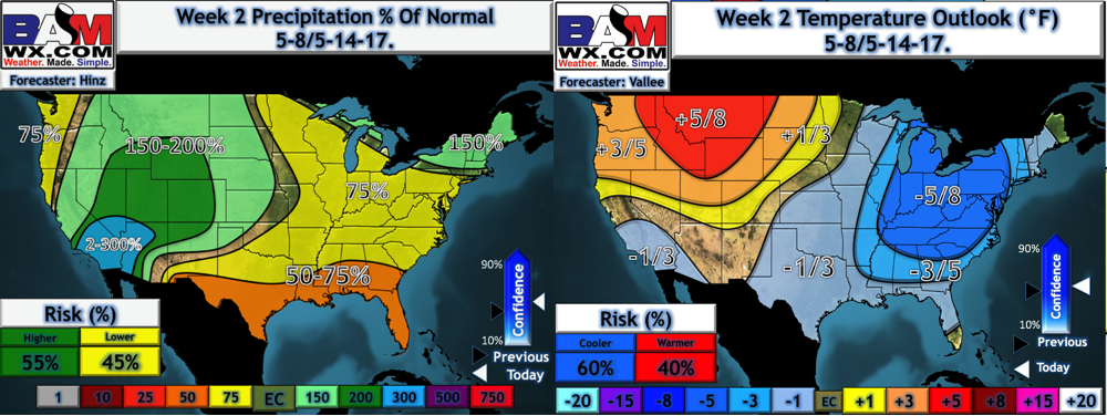
- Week 2 temperatures continue this “warmer west” theme with drier times east.
Confidence and Risks:
- Above average confidence in some snow today into tomorrow north and east.
- Average confidence for the track of the midweek system. Any shifts northwest would introduce steadier rain into southeastern portions of the forecast area.
- Increasing confidence for warmer times, especially west as we approach next weekend. This will continue into next week as well.
Today’s Video (6 minutes):