#AGwx #Plant17 #MNwx #SDwx #NDwx #WIwx Frosty For Some Tonight, Warmer Times Expected Into The Weekend. Details Here! E.
Key Points: May 2, 2017
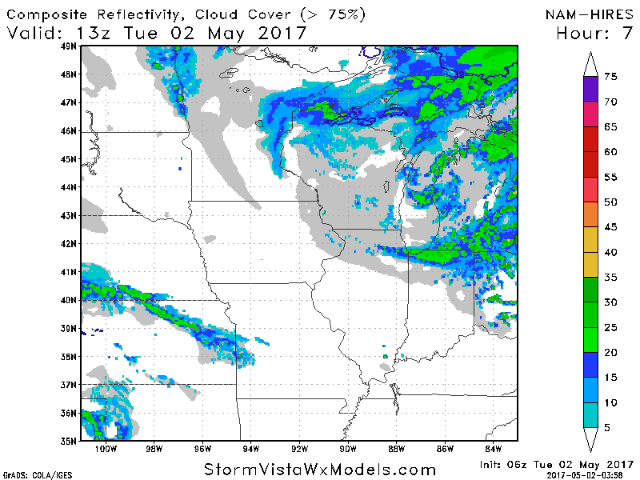
Synopsis: Good morning! We are tracking a few spotty rain and snow showers across Minnesota and Wisconsin, otherwise it is a rather quiet morning out there. A few showers will occur today in the Dakotas as a weak system slides east. These will expand eastward through tomorrow, but rainfall will be light. We are watching a heavy rainfall maker that looks to slide southeast of the region Wednesday into Thursday, but it has trended northwest in recent runs. If this continues, some in southeastern Wisconsin may see some rainfall from this system. Beyond this, drier and warmer times are expected this weekend into early next week, especially west. Eastern areas likely remain near to below normal in the temperature department. Have a great day!
- Current radar shows those scattered showers in eastern areas.
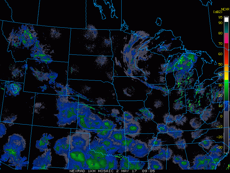
- A few spotty showers east this morning, then this afternoon west look to hang around through today.
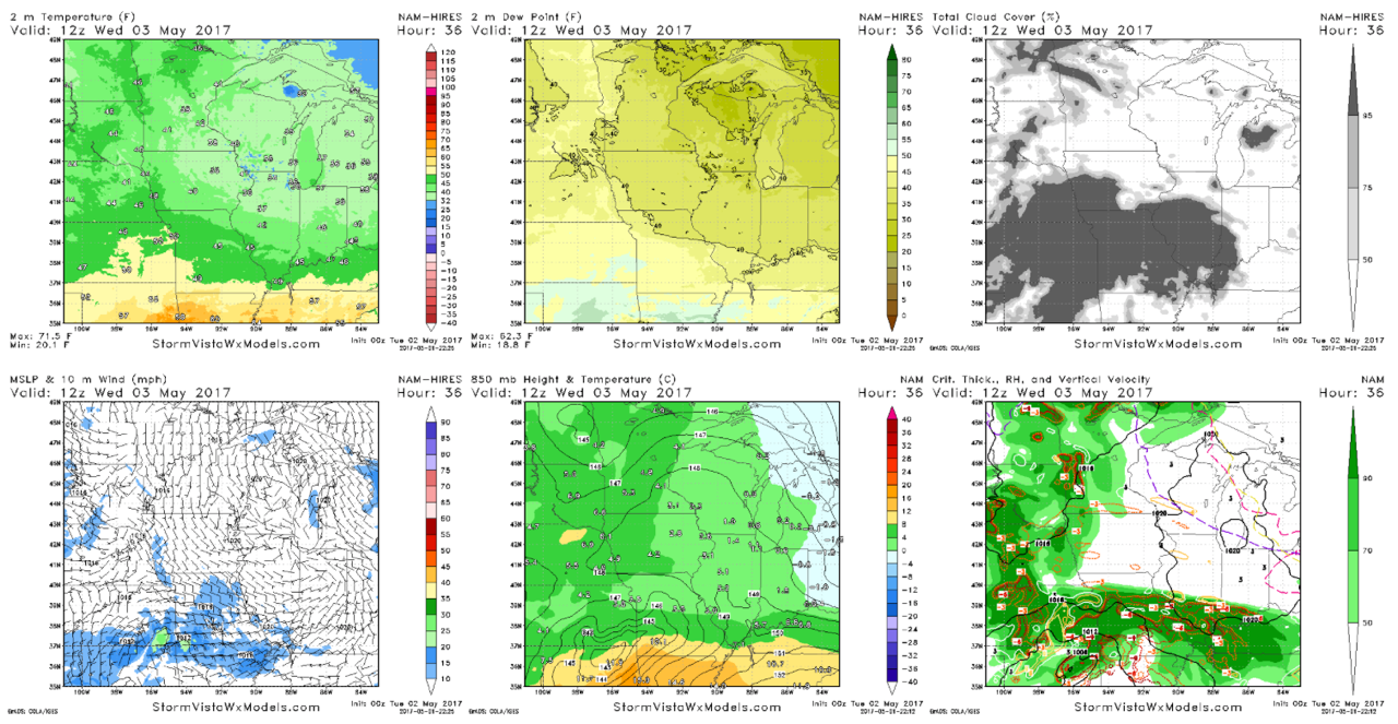
- Frost advisories are out for tonight across Wisconsin as temperatures dip close to freezing thanks to clear skies and light winds.
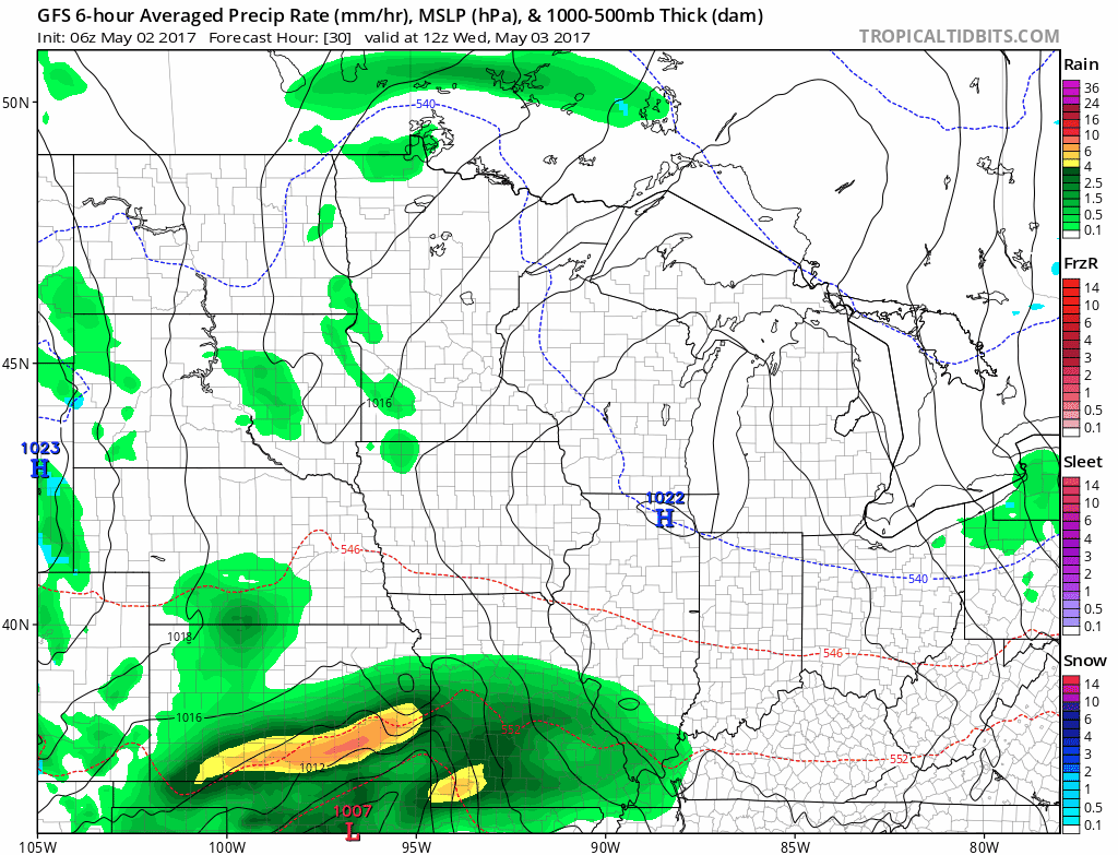
- Our next system approaches tomorrow with some light showers and perhaps a thunderstorm. We also will watch the northwestern extent of a heavier system to our southeast.
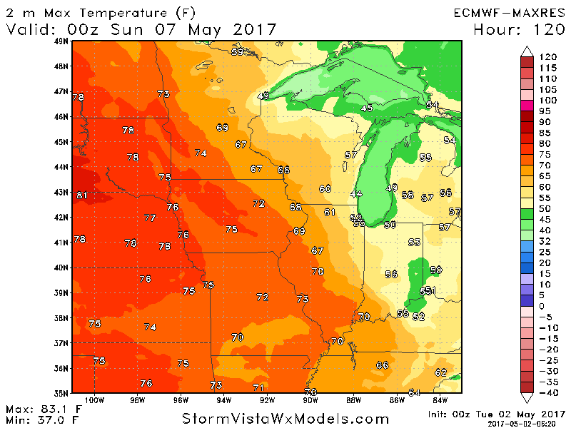
- Beyond this, we warm things up especially west late this week into the weekend. Temperatures by Saturday look to get into the 70s and 80s west and 60s east.
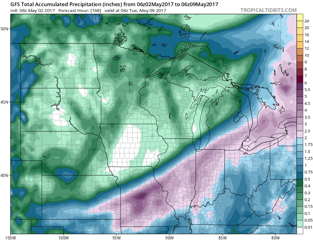
- Total rainfall over the next 7 days looks minimal for most, but notice how close those heavier rains are just to our south and east.
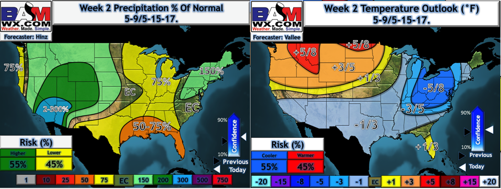
- This pattern looks to continue into week 2 with warmer than normal conditions across the Dakotas and cooler conditions farther east. This should help get the planting process underway!
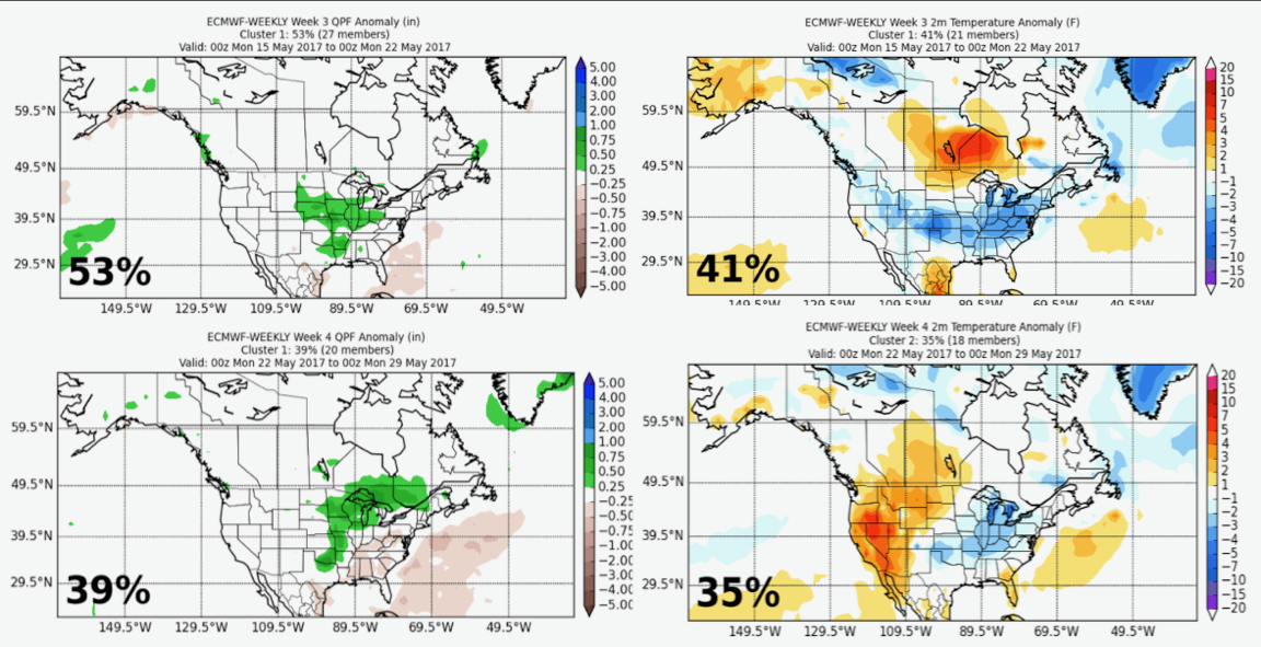
- Looking into weeks 3 and 4, the new European weeklies look active across the region, with a similar temperature regime to week 2 – colder east, warmer west.
Risks and Confidence:
- Above average confidence in drier conditions today compared to past days especially east.
- Above average confidence in a few showers and storms tomorrow.
- Average confidence in the northwestern extent of rainfall Wednesday night through Friday with the system to our southeast. Any small shifts will impact rainfall in southern Wisconsin.
- Increasing confidence in a drier week 2 pattern with warmer conditions west.
- Average confidence in weeks 3 and 4 becoming more active.
Today’s Video (6 minutes):