#ILwx #INwx #OHwx Thurs Short-term:
Synopsis: Good Thursday afternoon, here’s the latest update in regards to the continued heavy rains, the additional shower chance early Saturday, the hard frost potential late weekend into early next week and the latest on the pattern turning active again in the medium-to-long-range.
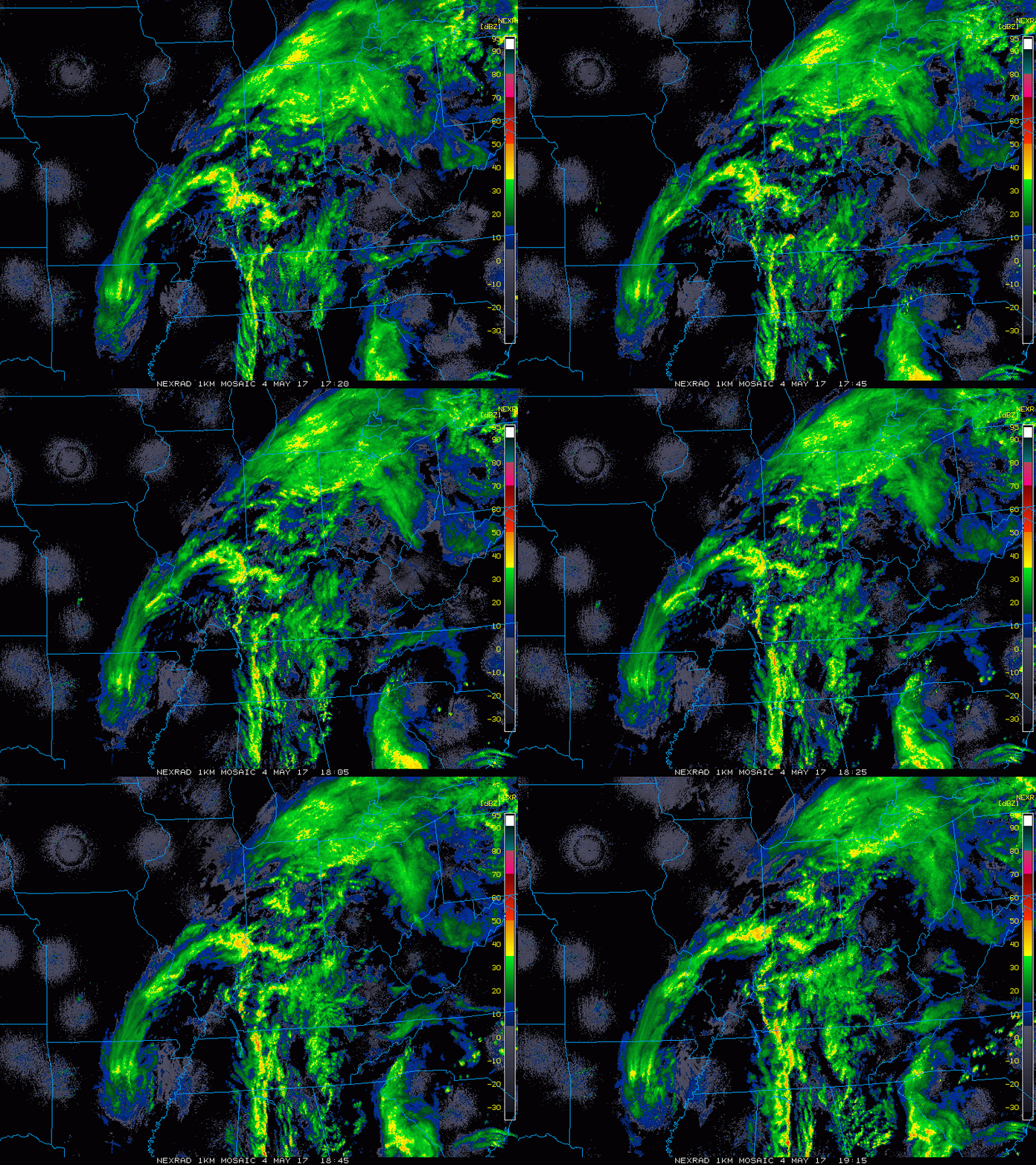
Current Radar:
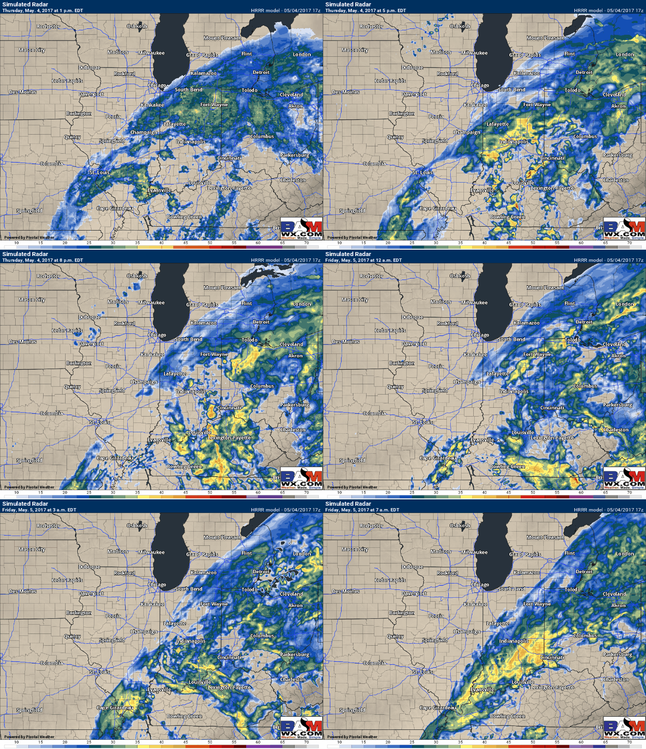
Simulated Radar through 7am tomorrow…very wet across Indiana, southern Michigan and western Ohio…Illinois folks will mainly stay dry except folks to the far south and east.
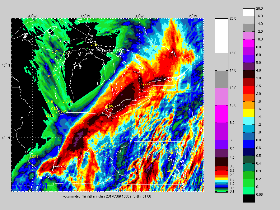
Total rainfall next 2 days…some very heavy rainfall still yet to fall:
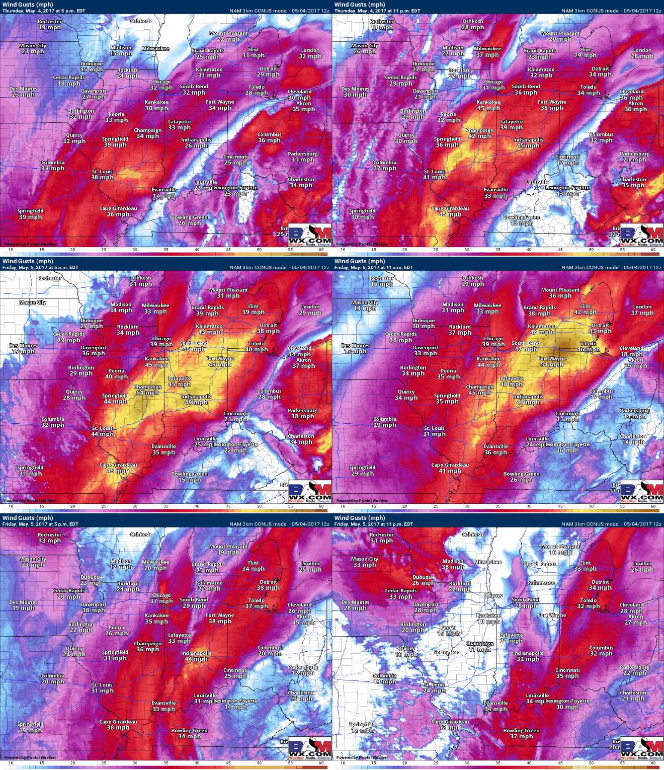
Windy through Friday:
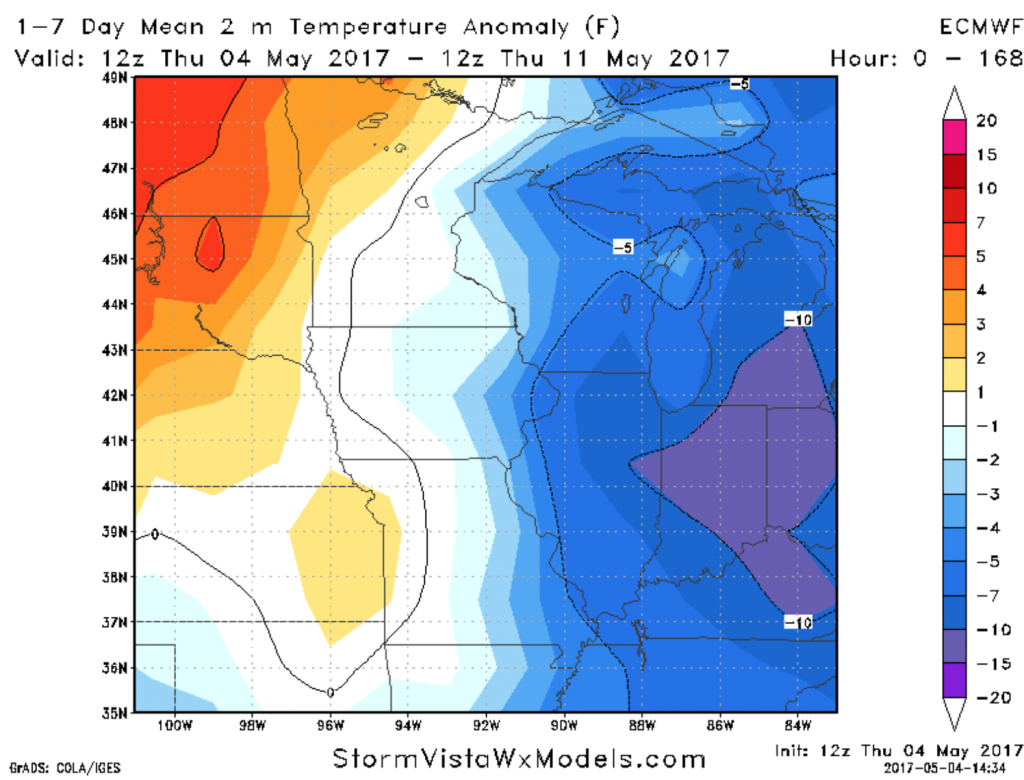
Data still very cold over the next week across the Midwest…hard frost threats remains Sunday through Tuesday mornings for folks to the north.
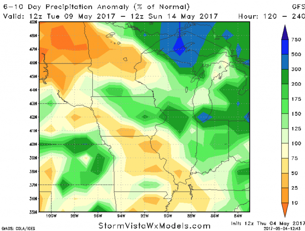
Data continues to turn wet in the 6-10 day timeframe starting next week, with showers and storms riding around the ridge that will be placed to our south. Models have a very hard time picking up on this type of pattern which is why didn’t bite on an extended dry window.
Confidence and Risk:
- High confidence heavy showers continue to move across Indiana, southern Michigan and western Ohio locations through Friday.
- Average risk for continued flash flooding in these same areas through Friday.
- High confidence we are chilly through early next week.
- Average risk for a hard frost Sunday through Tuesday mornings.
Today’s video (6 min):
