Key Points – Wednesday, May 3, 2017:
Synopsis: Good Wednesday morning! Heavy showers move east across eastern Kansas into Missouri this morning with very heavy rainfall already working in…these will be focused across eastern Missouri on Thursday and early Friday before moving further east into the Midwest; further west across Nebraska, Iowa and Kansas will stay more dry. Warmer and drier weather works in this weekend into early next week which we anticipate will help continue to improve field conditions.
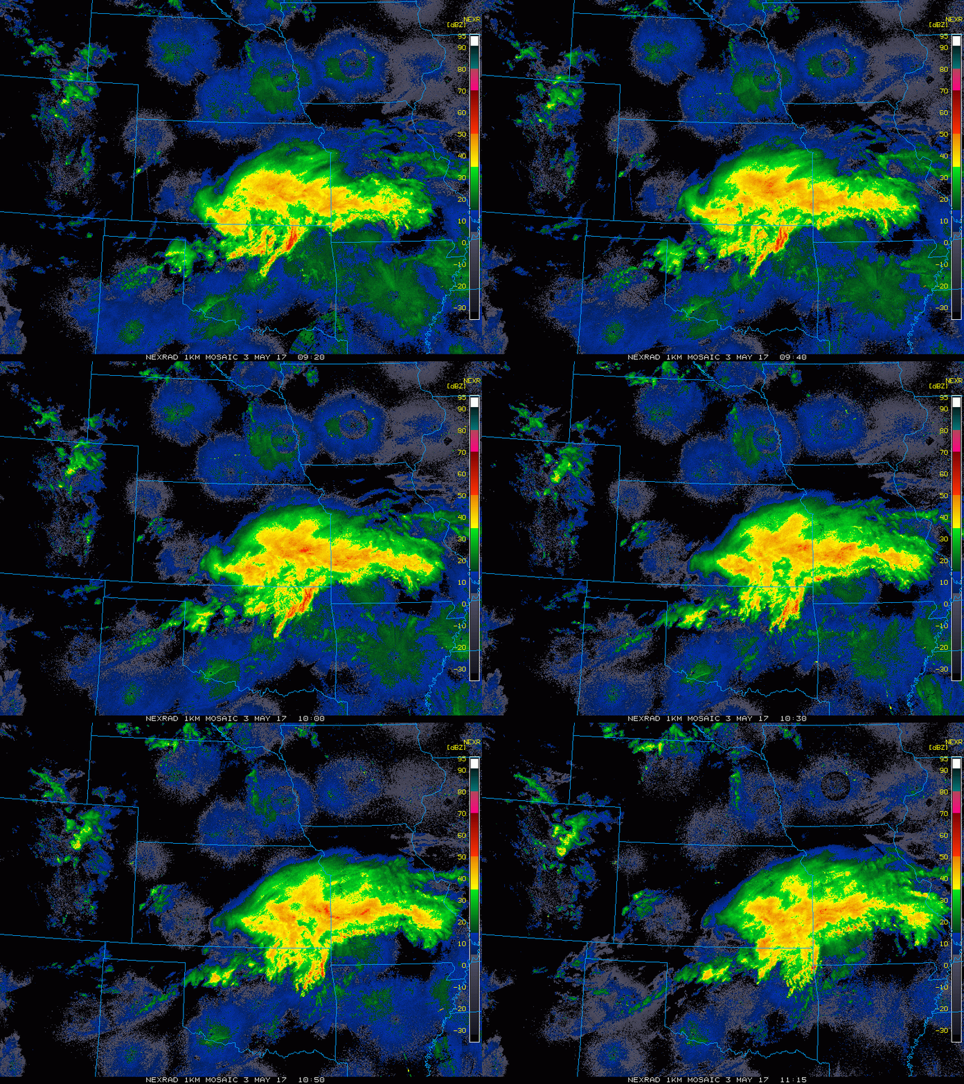
Current Radar:
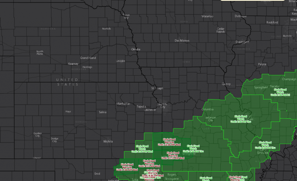
Flash flood watches and warnings hoisted across the central Plains:
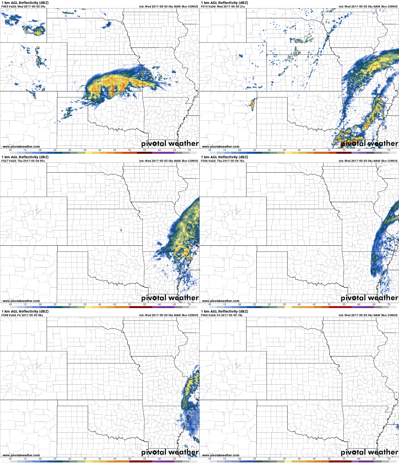
Simulated radar through Thursday and early Friday primarily focused across eastern Kansas into Missouri, but can’t rule out a few thunderstorms across eastern Nebraska into central Kansas later today as well along a boundary.
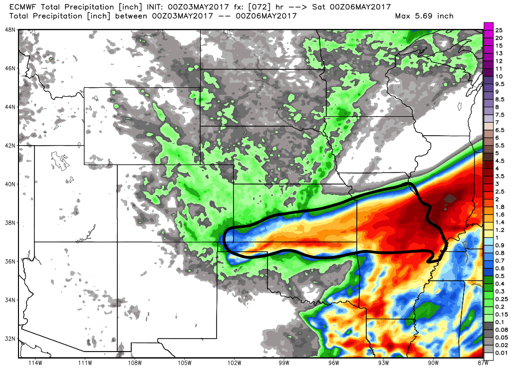
Thoughts on total rainfall…very sharp cut-off to the north…some locations across northern Missouri to Iowa may not even see a drop of rain from this system. Areas further south across the southern half of Kansas likely seeing 1-3″ with localized higher amounts possible across eastern Missouri.
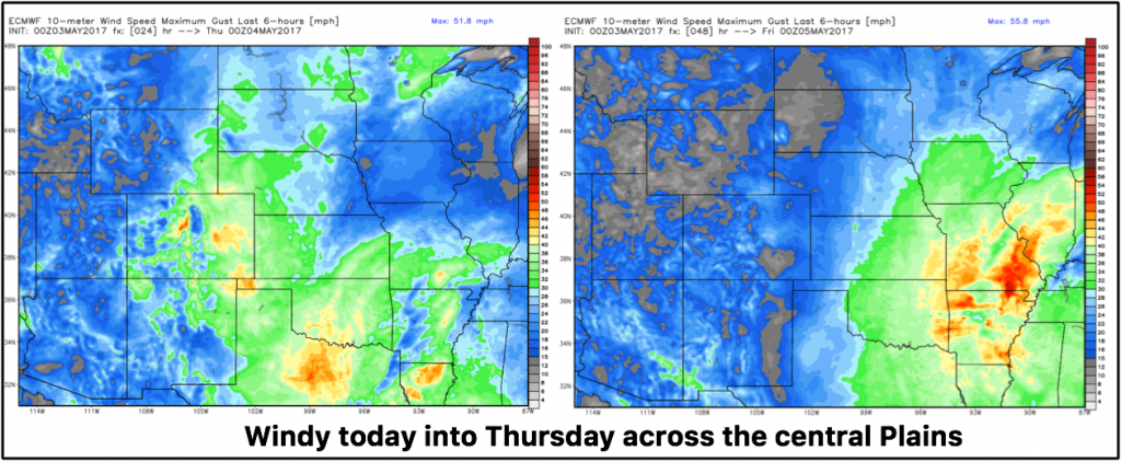
Windy today as well today and on the day on Thursday:
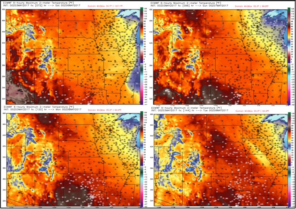
A very nice weekend with a warm up is in store across the central Plains (slightly cooler across Iowa Saturday/Sunday)…not much in the way of widespread rainfall in the forecast until mid-next week which should help conditions to improve.
Confidence and Risk:
- Above average confidence for heavy rains across eastern Kansas into Missouri today through Thursday.
- Average risk for some flash flooding as well.
- Average risk for gusty winds across the central plains greater than 30mph also possible through Thursday.
- Above average confidence we warm up through the weekend into next week that will help field conditions to improve.
Today’s video (time):
