#AGwx #NDwx #SDwx #WIwx #MNwx More Severe Weather Possible Today, Cooler Times Coming As Well. E.
Key Points: May 16, 2017
Synopsis: Good Tuesday morning! A very active pattern continues with showers and thunderstorms across the region this morning. Showers and thunderstorms will continue through the day today with a threat of some severe weather across southeastern South Dakota, southern Minnesota, and western Wisconsin. Active times will continue Wednesday through Friday especially across the south and east as a frontal boundary slowly moves through the region. This will introduce cooler temperatures as well by the end of the week and into the weekend. In week 2, temperatures look to remain cooler than normal with active times continuing, especially south and east. Have a great Tuesday!
- Current radar shows the active regime ongoing across the region.
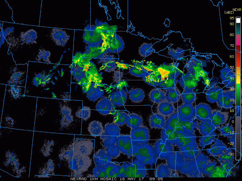
- Through today, showers and storms look to continue and will push south and east through the region.

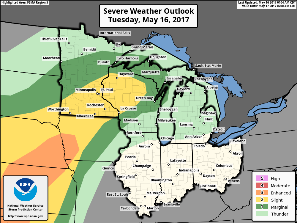
- The SPC has highlighted part of the region for severe weather this afternoon and evening once again.
- More showers and storms will lift into the region overnight and bring another threat for strong storms tomorrow into tomorrow night.

- Additional rain and storms will occur late Friday night into Saturday as cooler air settles into the region.
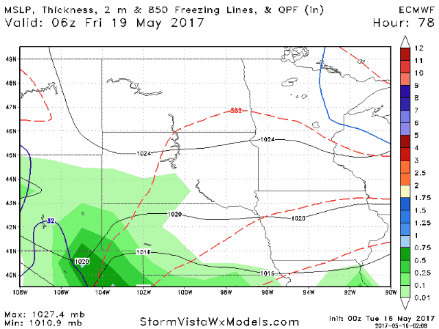
- Total rainfall through Sunday will be impressive across southeastern portions of the area. Once again, North Dakota looks to see the least amount of rain out of the entire region.

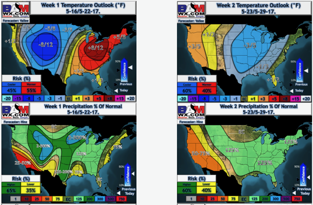
- Cool and active conditions look to continue into week 2 across the region. Here’s a look at our temperature and precipitation forecasts.
Confidence and Risks:
- Above average confidence in thunderstorms this afternoon, some severe, in the areas discussed above.
- Above average confidence in an active pattern continuing this week, but exact rainfall is uncertain and will be storm dependent. Heaviest rains do look to occur in the south and east portions of the region.
- Above average confidence in cooler times developing toward the end of this week into week 2.
Today’s Video (6 minutes):