Key Points – Wednesday, May 3, 2017:
Synopsis: Good Thursday morning! Today we discuss the heavy rain and flooding threats moving in later tonight into Thursday and Friday as another powerful low pressure system moves into Midwest, we stay pretty gusty on Thursday into Friday as well. Another big story is the potential for a hard frost, even a freeze late weekend into early next week that we are very concerned about for any crops or vegetation that was recently planted. Plenty of inclement weather over the next week, make sure to watch the entire video. Have a blessed day!
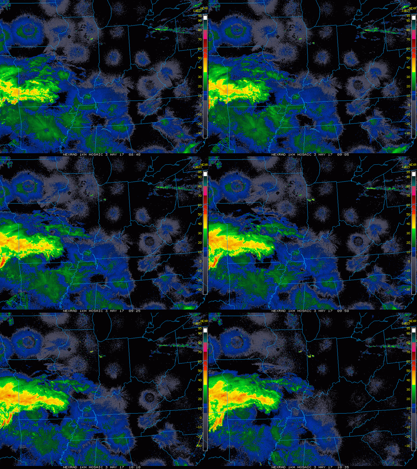
Current Radar:
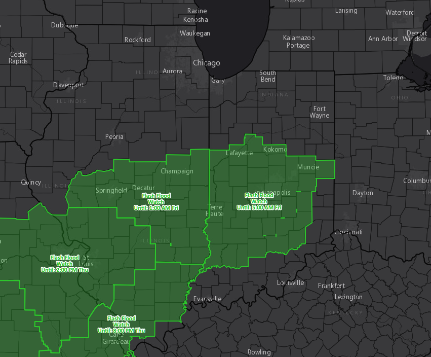
Flash Flood watches hoisted…wouldn’t be shocked to see these slightly expanded to include more northern Indiana locations:
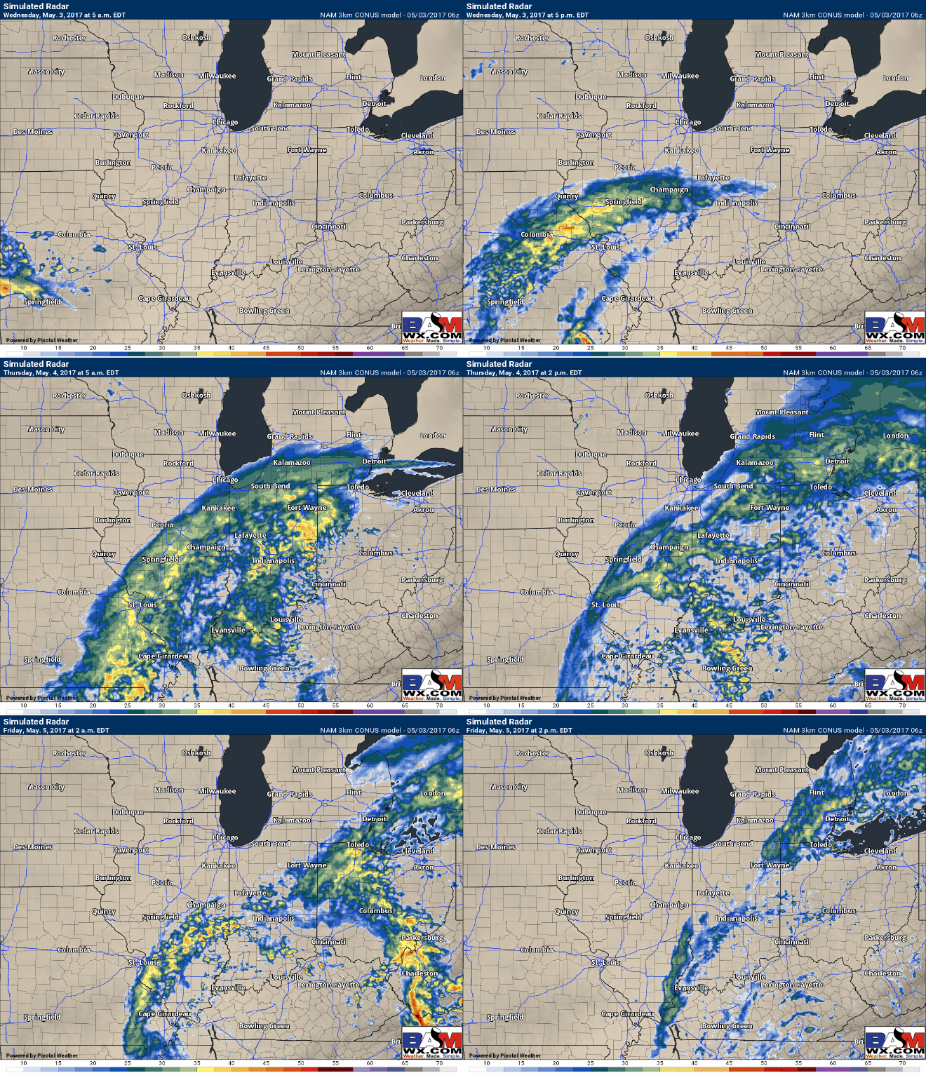
Showers today ~lunchtime across southwest Indiana slowly expanding north and east throughout the afternoon and evening. Waking up Thursday to widespread heavier rains that will continue through the entire day. More rain will be present waking up Friday morning on the backside of the low pressure that will keep us fairly wet…not a lot of dry time expected over the next 72 hours.
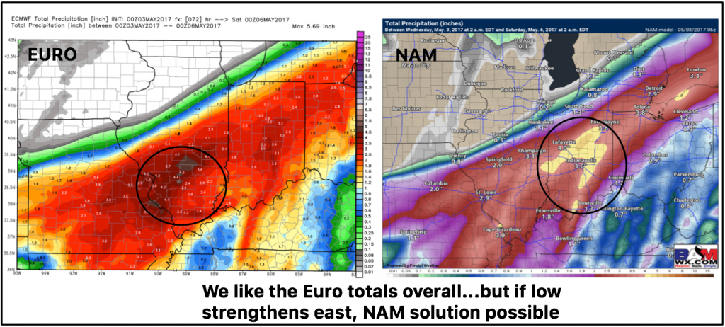
Rainfall Totals…widespread 2″ with 3-4″+ localized amounts higher possible. With this being said, if the low pressure strengthens further east as the NAM below suggests, the heaviest rains could set up across Indiana which we need to watch closely.
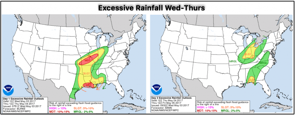
Excessive rainfall risks and flash flooding late tonight through the day on Thursday…can’t rule out the first half of Friday as well:
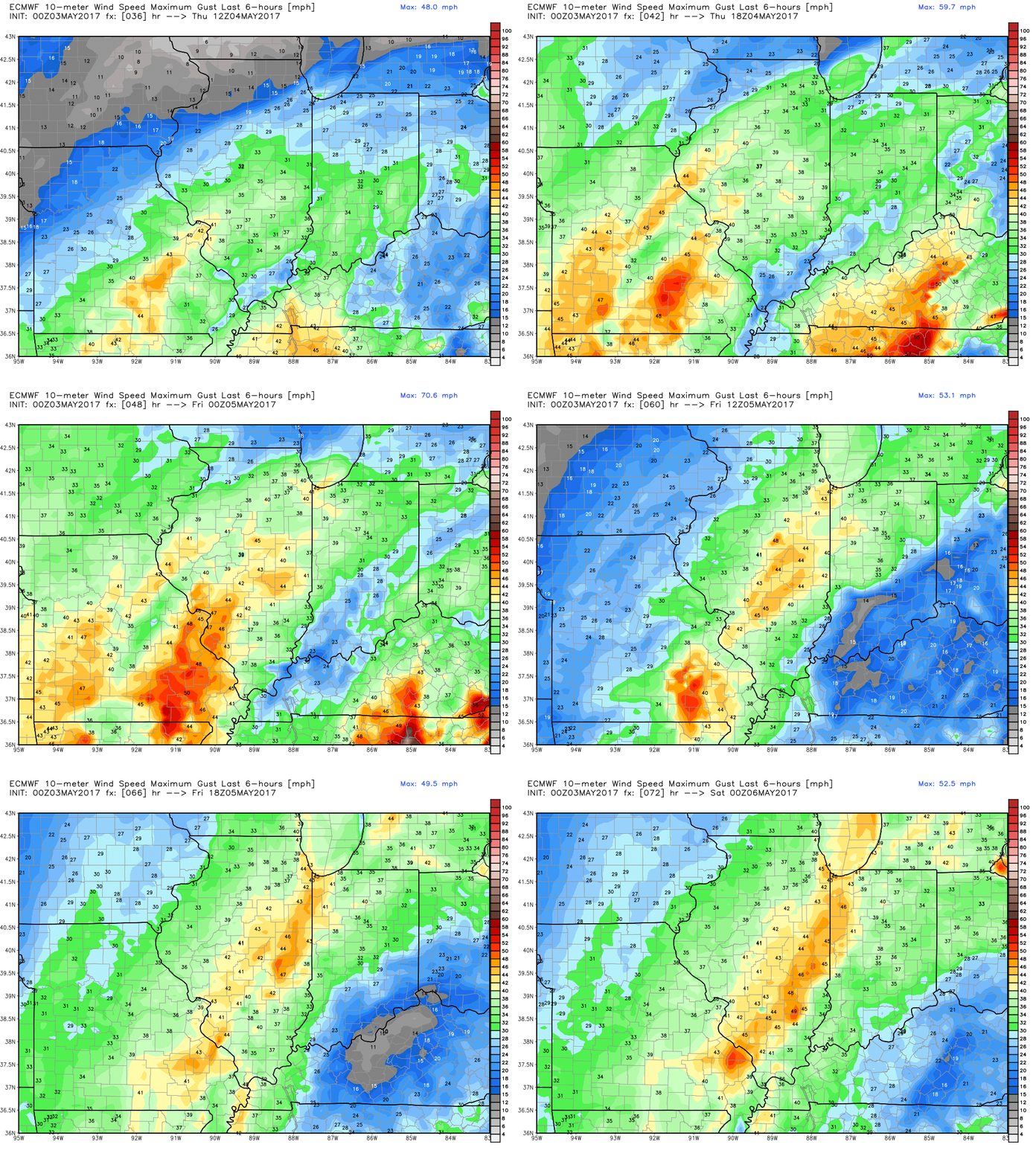
Windy Thursday into Friday out of the northeast to north gusting at times over 30+mph:
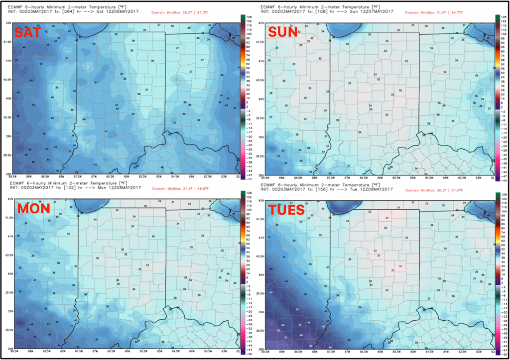
Very chilly mornings coming this weekend into early next week…worried about hard frost and even a freeze Sunday morning into Monday and Tuesday mornings.
Confidence and Risk:
- Average confidence of scattered showers today through this afternoon working in across southwest Indiana.
- Above average confidence of heavy rain working in on the day Thursday and exiting east later on Friday.
- Average risk for some flash flooding with this system as well.
- Average risk for a hard frost late weekend into early next week.
- Average risk for gusty winds Thursday into Friday over 30mph.
Today’s video (7 min):
