#AGwx #ILwx #plant17 Flooding Rains Coming to Already Saturated Areas Through Friday. Frost This Weekend? Details Here! E.
Key Points: May 3, 2017
Synopsis: Good Wednesday morning! We are tracking rains already moving into southern Illinois this morning ahead our next big system. This will bring more flooding rains to southern and central Illinois tonight through early Friday. There will be a very sharp northern edge of the precipitation shield, allowing northwestern Illinois to see hardly any rain. Any small shifts in storm track will have a huge impact on rainfall amounts in north-central Illinois. Beyond Friday, a window of dry time is becoming likely this weekend into next week, with only a few showers possible early next week on the leading edge of some warmer air. Have a wonderful day!
- Current radar this morning shows rain slowly inching northward and eastward.
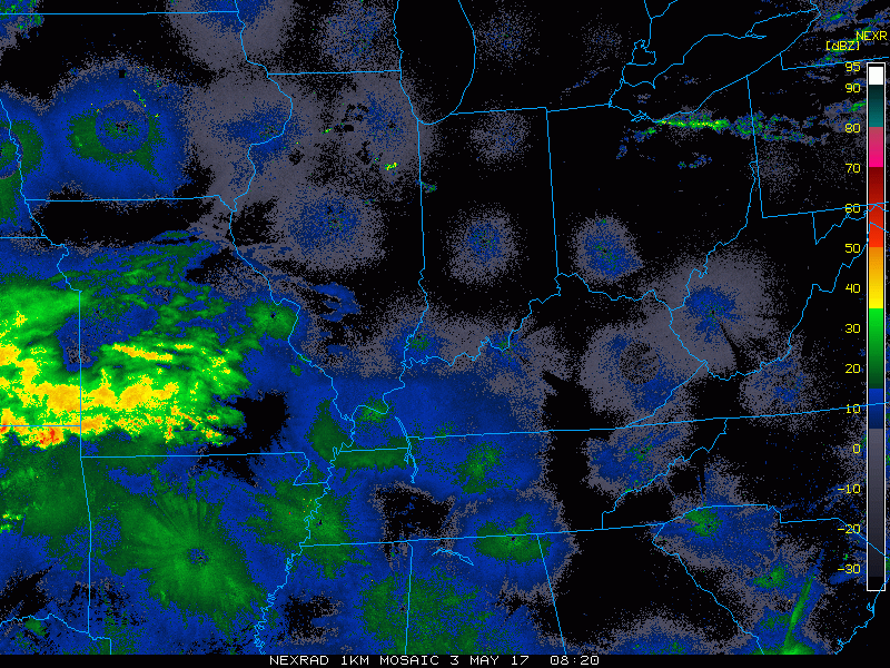
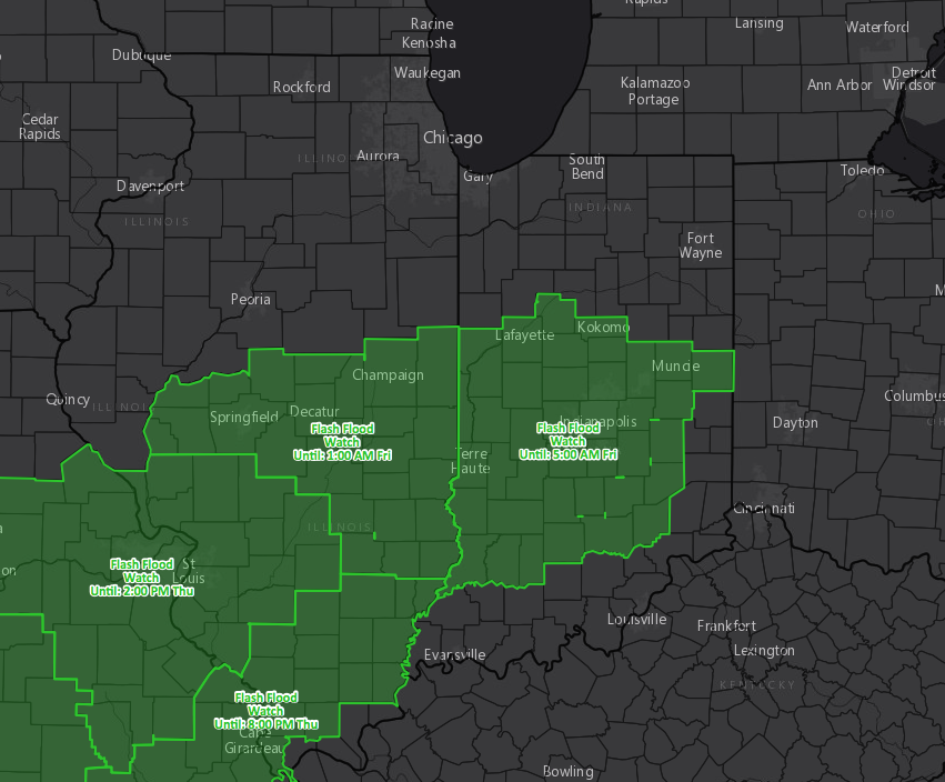
- As this rain falls on already saturated soils, flash flood watches have been hoisted for southern and central Illinois.
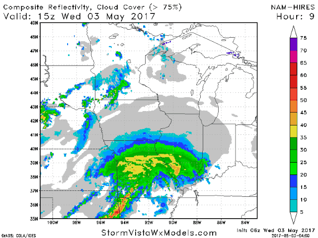
- Rains will spread eastward this afternoon and overnight tonight, focusing on southern Illinois for heaviest amounts.
- Rains will continue all day Thursday into Thursday night, before slowly pushing east early Friday. Some places in southeastern Illinois will see rains through morning before improving conditions.
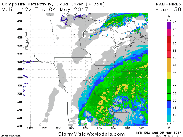
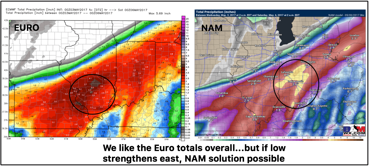
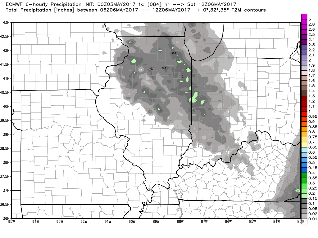
- There is still some uncertainty with respect to where heaviest amounts occur and where the northwest edge will be. Note how quickly you go from no rain to over 2 inches!
- Beyond this system, a weak disturbance may bring spotty showers Friday night, but otherwise it appears to be a largely dry, but cool weekend.
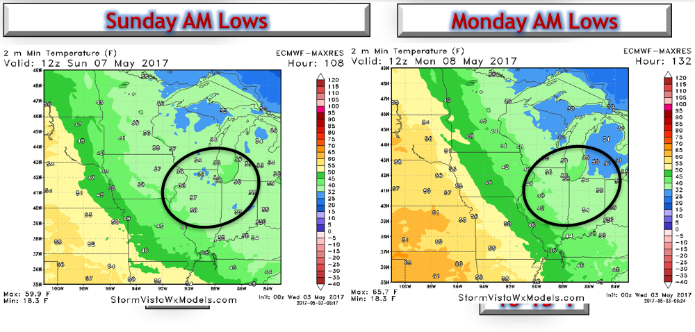
- Frost and freezes with also be a threat Sunday and Monday mornings as cool air hangs around.
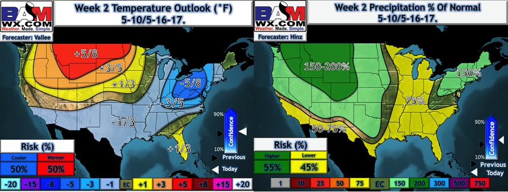
- Temperatures will slowly warm next week along with some drier times. This is great news to dry out some of the fields that will likely be under water after this week’s rains, but the bad news will be temperatures remaining below normal.
Confidence and Risks:
- Above average confidence on heavy, flooding rains in southern Illinois. Exact track of this system will determine rainfall in central and northern areas and subtle shifts will make a huge difference. Stay tuned!
- Above average confidence in a frost threat Sunday and Monday morning in northern and eastern Illinois.
- Increasing confidence on drier times developing in week 2 across the region, which is great for currently flooded or saturated fields.
Today’s Video (7 minutes):