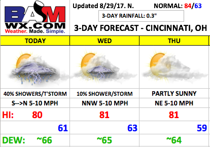
Good Tuesday morning! A few scattered showers are moving across the area this morning, and we will continue to see hit and miss showers/storms through the day. Rainfall coverage will decrease as we go into the evening. Overall, a decent forecast setting up mid-week mainly dry conditions.
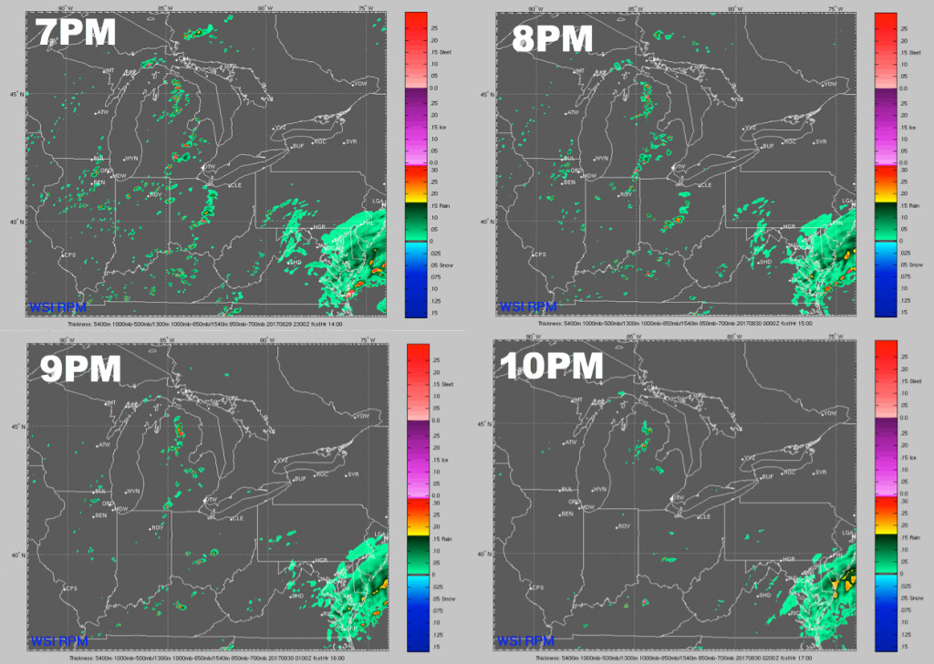
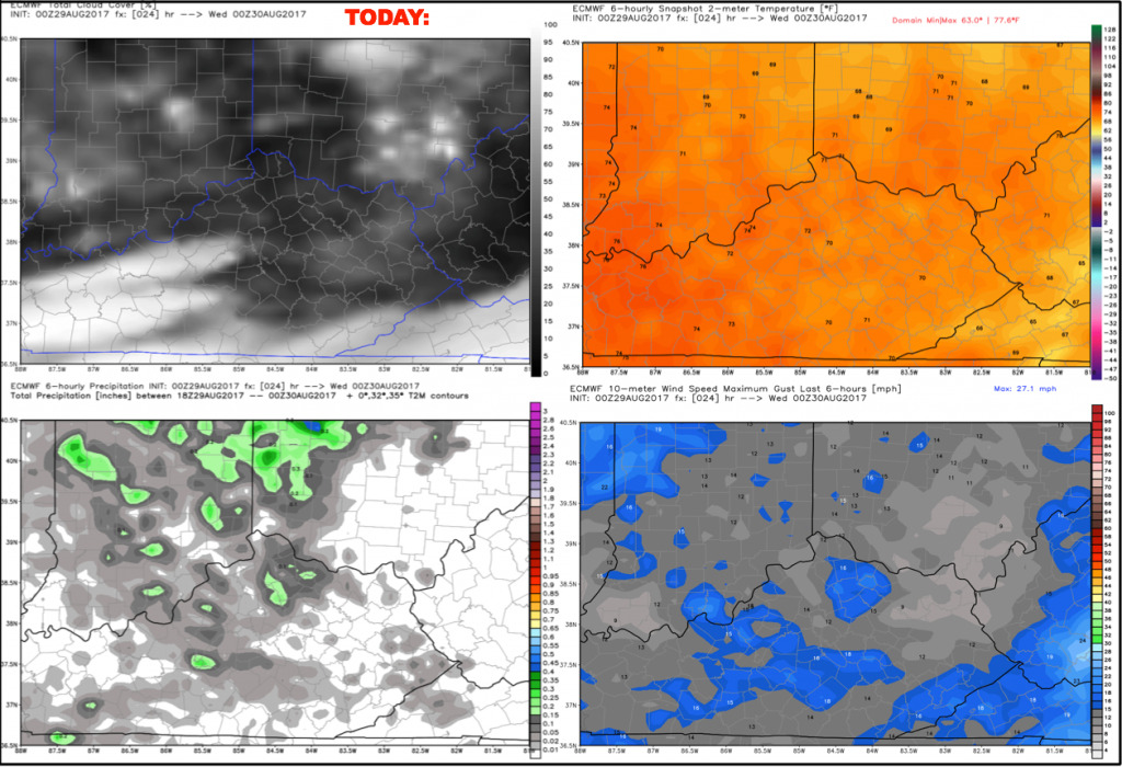
Shower and storm activity today will be very hit and miss with ~40% coverage. The good news is that these should become more isolated in nature as we reach the first pitch and beyond. Here is a panel of the hi-res RPM model showing the storms becoming very spotty in nature through the game. Cannot rule out a weather delay especially early in the game, but overall think we will be in decent shape.
Temperatures should be around the middle 70s at first pitch, falling to near 70/upper 60s closer to 10pm. Winds will be light out of the north during the game, likely 5 mph or less.
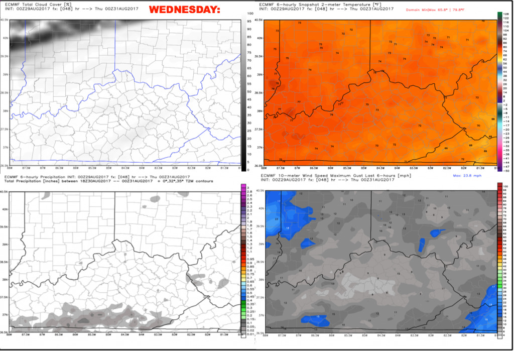
Wednesday continues to look like a decent day with partly to mostly cloudy skies. We cannot rule out isolated showers or a storm popping up during the afternoon, but the game should be dry. Winds will be light out of the north-northwest 5-10 mph, with high temperatures in the low 80s. Dewpoints remain elevated a bit with a slight muggy feel.
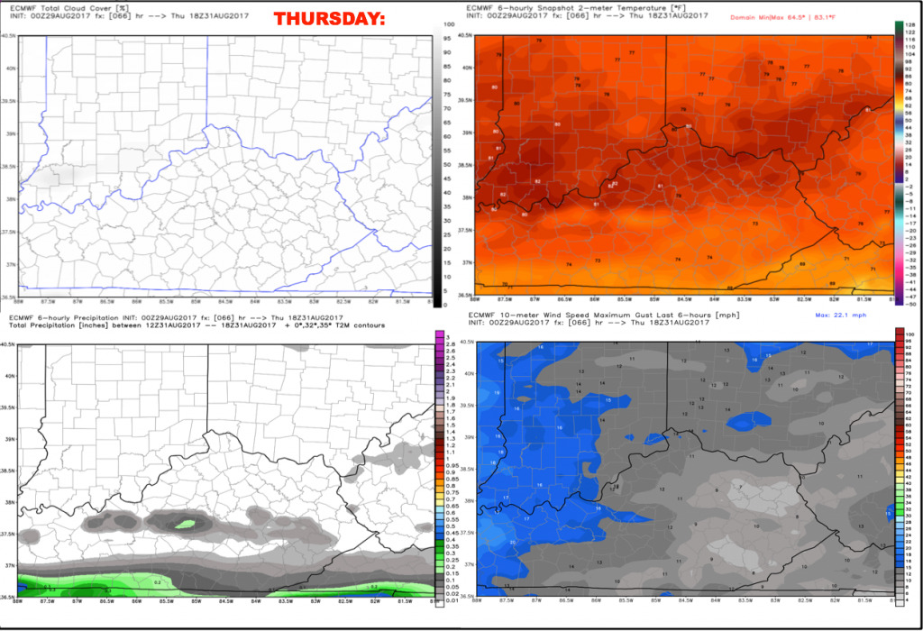
We will keep Thursday dry with partly to mostly cloudy skies. A cold front will be approaching from the north, along with the remnants of Harvey lurking across southern Kentucky. Cincinnati should stay in between these features with dry conditions. Temperatures will reach the lower 80s during the afternoon, feeling slightly humid with dew points in the middle 60s. Winds will be out of the northeast 5-10 mph.
Have a great day, and let us know if you have any questions!