Good Friday morning!
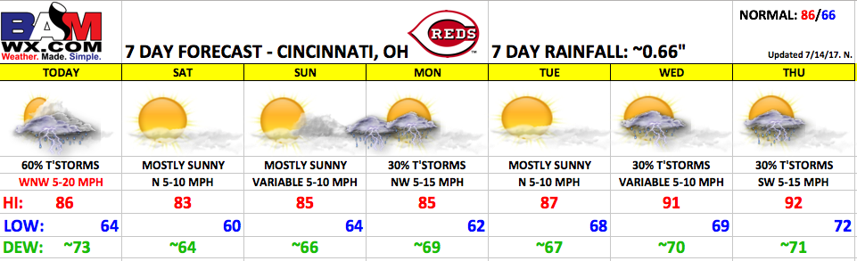
A frontal boundary will gradually push south into the area today with scattered t’storm chances decreasing later this afternoon and ending tonight. The front is looking to pass right around game-time, which is great news for tonight’s game. The front will move far enough south to keep it dry for much of the weekend. Another front will move in by late Sunday into Monday with the next t’storm risk. Temperatures will be on the increase heading into the middle of next week.
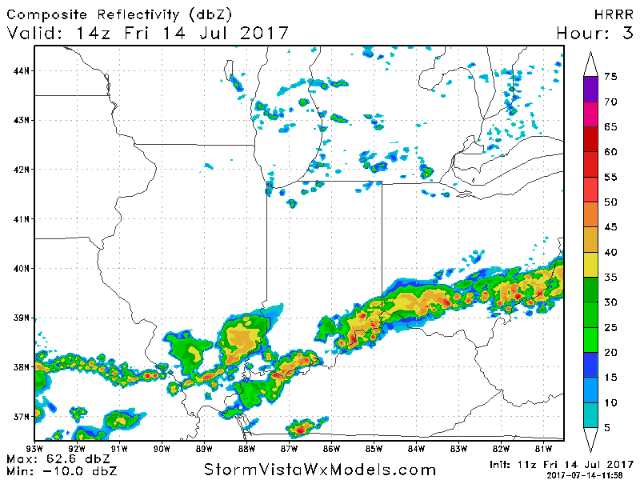
Here is an animation of future radar from the HRRR model from 10 AM today to 1am Saturday. Notice the rain chances peak this morning into early afternoon, then the best chances shift southeast of Cincinnati by late afternoon and early evening. Overall the game should be dry, with just a small lingering storm chance at the beginning of the game. Winds will be mainly out of the west, shifting to the northwest during the game at 5-20 mph.
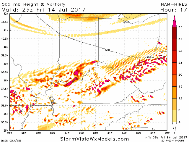
Here is a look at upper-level energy animation this evening. As we reach the start of the game, the main focus of energy will shift south of Cincinnati, meaning storm chances will continue to decrease. The animation of vorticity below goes from 7pm today to 1am Saturday. Think of the areas of vorticity on the map where rain would be anticipated.
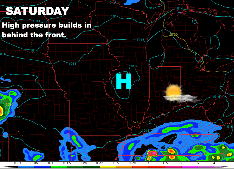
Saturday looks dry with surface high pressure building in behind the front. Winds will be very light out of the north at 5-10 mph. Great weather for Saturday evening’s game!
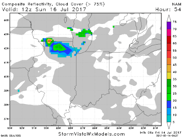
Another front will drop in from the north late Sunday, but the current timing holds the storms off until after sunset. Winds will be light once again on Sunday with a few more clouds during the afternoon. We will keep an eye on the speed of the front, but at this time is appears the Sunday afternoon game should be dry. Below is an animation of the NAM model on Sunday from 8am Sunday to 1pm Monday. Gray represents clouds and the blue/green represents rain.
Temperatures are expected to turn rather hot by the middle of the next week along with high humidity. For now we are including 30% storm chances for Wednesday and Thursday, with models still showing some differences during this time-frame.
Have a great Friday, and let us know if you have any questions!