Good Tuesday morning, below you will find an updated forecast for the educational events on Thursday and Friday later this week. Have a blessed day!
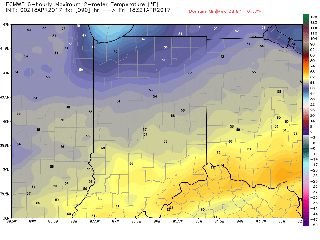
Synopsis: Good Tuesday morning! Today’s educational program will see mostly sunny skies and very pleasant conditions with highs expected in the mid to upper 70s and winds out of the southeast at 5-20 mph. Thursday we continue to watch for the threat for gusty storms as a cold front approaches from the northwest, temps will be warm here again in the mid-70s before the front moves through and knocks down the warmth. Friday will see partly sunny skies and chillier temps with highs expected in the mid-t0-upper-50s.
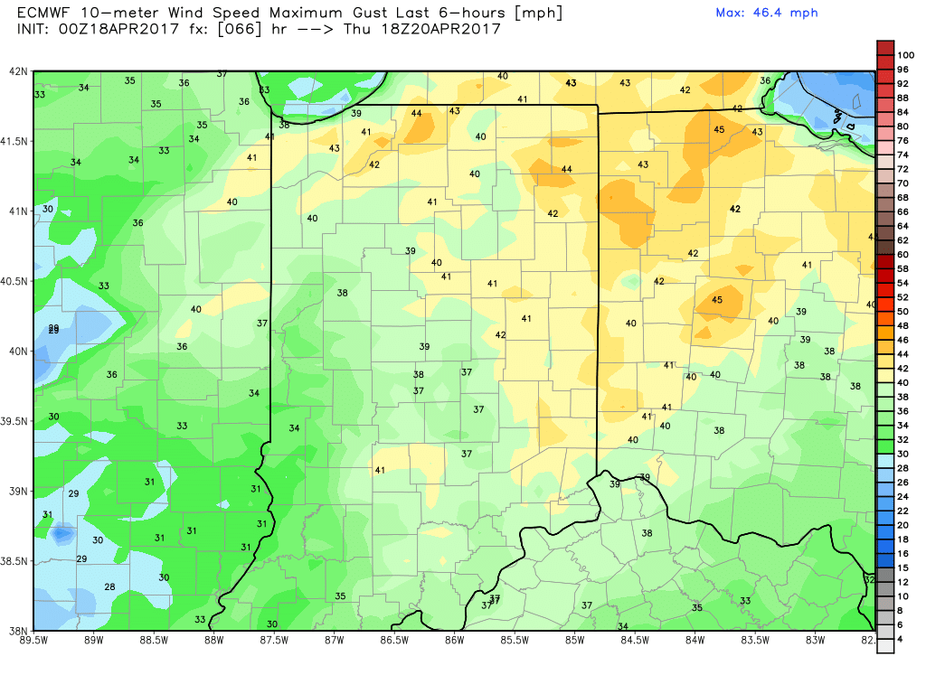
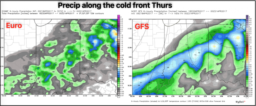
Thursday: Here we will see a high temperature of 76º out ahead of the cold front and winds out of the southwest at 15mph gusting upwards of 35-40mph at times. Via the latest NAM-WRF data, we are expecting a line of showers and storms to move northwest to southeast into the Indy metro area right between 11am-2pm Thursday. At this time, cannot totally rule out a strong storm along the cold front given the amount of energy available and dew points above 60ºF. In regards to total precipitation we are expecting ~0.25″ but cannot rule out up to 0.5″ via the latest GFS run. Cannot rule a weather-related hazard Thursday.
Timeframe for stoms to approach ahead of the Cold Front Thurs (middle image is CAPE or energy available for t’storms, image on the right is dew points…anytime they are over 60º we watch for strong storms possible).
Gusty winds possible upwards of 35-40mph at times out of the southwest.
Total rainfall via the European and GFS models. Right now we have more confidence in the European solution with ~0.25″ of rain possible, but cannot totally rule out the GFS solution if we get more instability (CAPE or energy) on Thursday up to 0.50″ as the storms pass.
Friday: Expecting partly sunny skies throughout the event, highs in the mid-50s with a north wind at 5-10mph gusting up to 20 mph at times. No weather-related hazards are expected here.
If you have any questions please let us know!
-Kirk


