Good Thursday morning, below you will find an updated forecast for the educational events today and tomorrow. Have a blessed day!
Synopsis: We continue the risk for showers and storms today, some potentially becoming stronger later this afternoon into tonight that may catch the back-end of your event today. Partly sunny skies with increasing clouds throughout the day expected on Friday, cooler conditions expected as well behind the cold front.
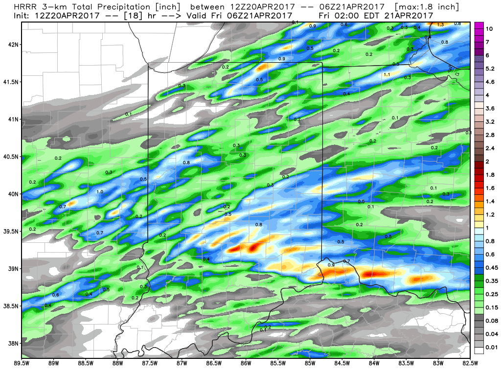
Thursday: We’ve started out today dry and warm, and it will be quite warm as we continue throughout the event today as well with a forecasted high being near 81º. Winds will also be out of the Southwest at 10-15mph getting into later this morning, potentially gusting upwards of 30mph+ this afternoon. We could see some spotty showers between 12pm-2pm, otherwise the main line of storms (some potentially strong) along the cold front moves through between 2-3pm from west to east lingering we think through about 8-9pm before getting out of here. Total rainfall has been consistent between 0.25-0.50″ with isolated higher amounts possible if a stronger storm were to develop.
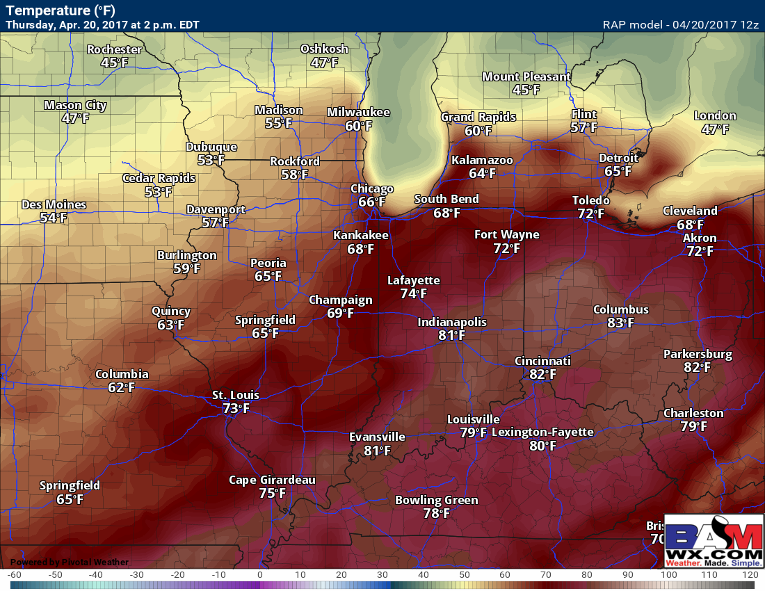
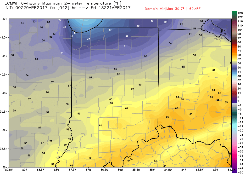
High temperature expected near 81º as seen below by the latest RAP model.
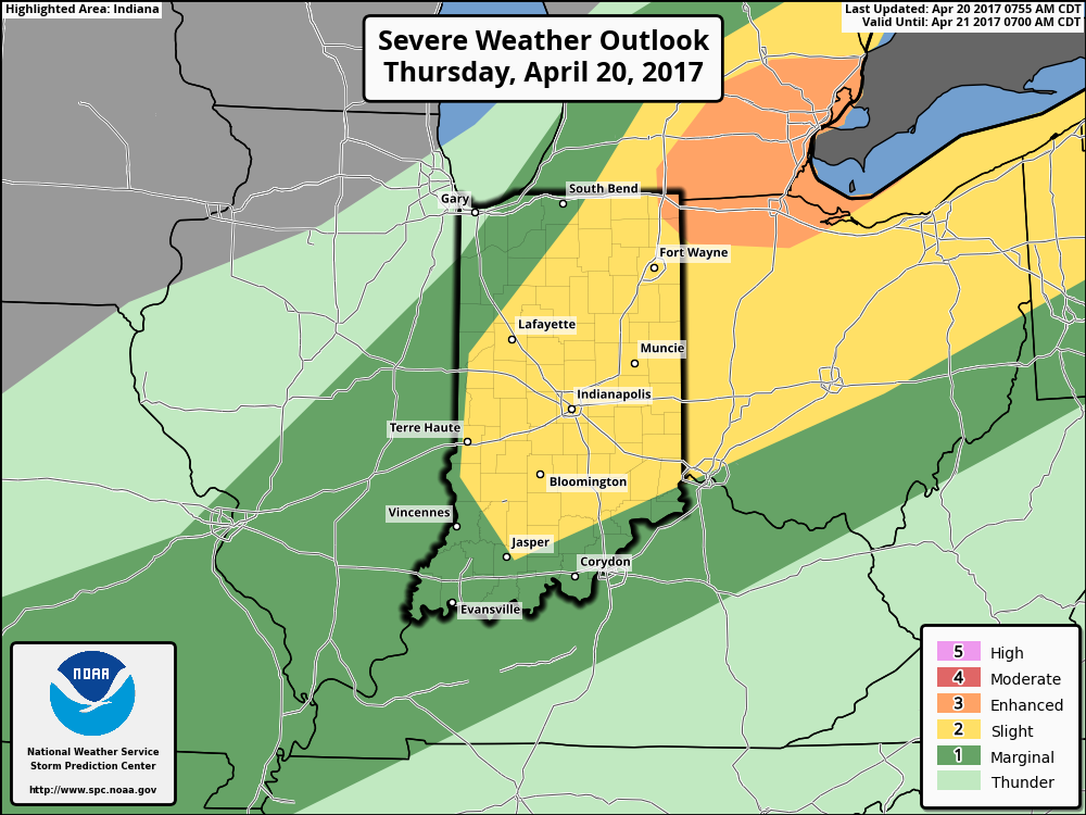
Current risk area for strong storms this afternoon still encompasses Indy, with the main threats being damaging winds, isolated large hail, with a low risk for an isolated tornado.
As mentioned above the main timeframe for storms to start rolling through is 2-9pm tonight, although a few pop up showers will be possible out ahead between 12-2pm today. A strong storm cannot be ruled out, although most of the heavy stuff looks to come after the event is over with beyond 3pm.
Total rainfall is expected to be between 0.25-0.50″ with a chance for isolated higher amounts if we get a stronger storm to move through.
Friday: We will be much cooler here as the cold front passes Thursday, with a high near 60º with a northwest wind ~5-10mph gusting at times up to 20mph and partly sunny skies. There is a chance for rain later Friday evening lifting from the south, however we expect these to stay away from the Indy metro area for the time of this event.
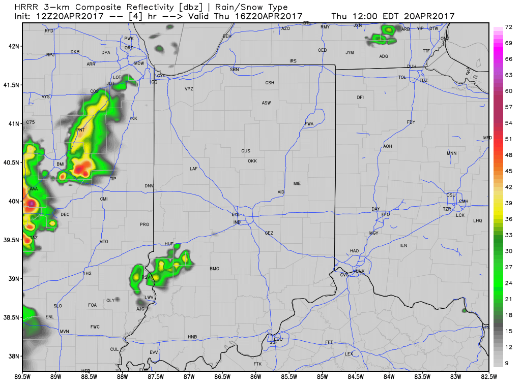
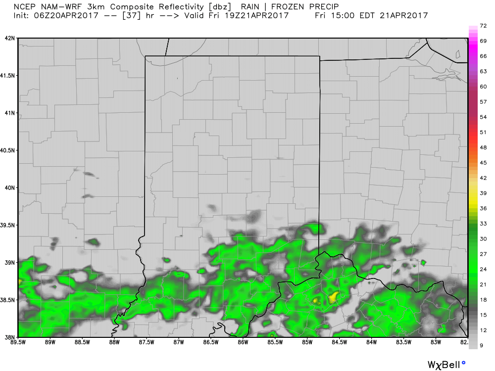
Here’s a snapshot of simulated radar at 3pm from the 3km NAM showing the rain should stay south through the end of the event. However, we will be monitoring this closely in case things speed up slightly.
If you have any questions please let us know!
-Kirk