11:05 PM ET Update
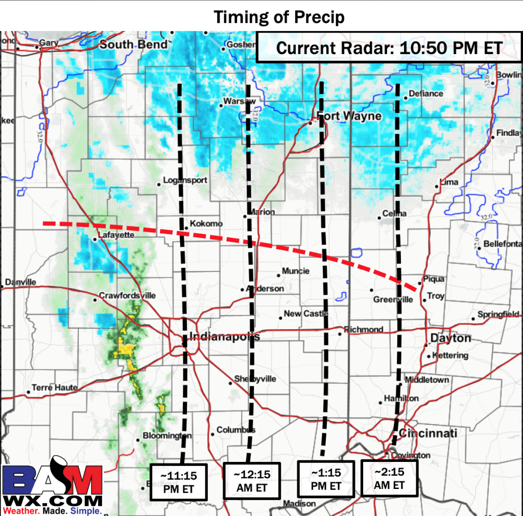
BOTTOM LINE: A line of rain and snow showers will impact your area over the next 4 to 5 hours. The line is moving east at about 35 mph. Areas north of the red dashed line will be at greater risk for brief surface impacts of trace to 0.2 inch accumulation with this activity as temperatures are closer to freezing, while areas south of the black dashed line presently are not expecting surface impacts over the short term (next 2 – 3 hours)
What we will need to continue to monitor however is areas at risk for refreeze heading towards the mid-morning hours of Monday (5-7 AM). This will pertain to areas south of the red line as well, as light precipitation that falls presently will run the risk of freezing as temperatures behind this line of precipitation will dip to 30 – 32 F. Your application is handling timing with this line of mixed precipitation well.
As always, do not hesitate to reach out if you have any questions.
