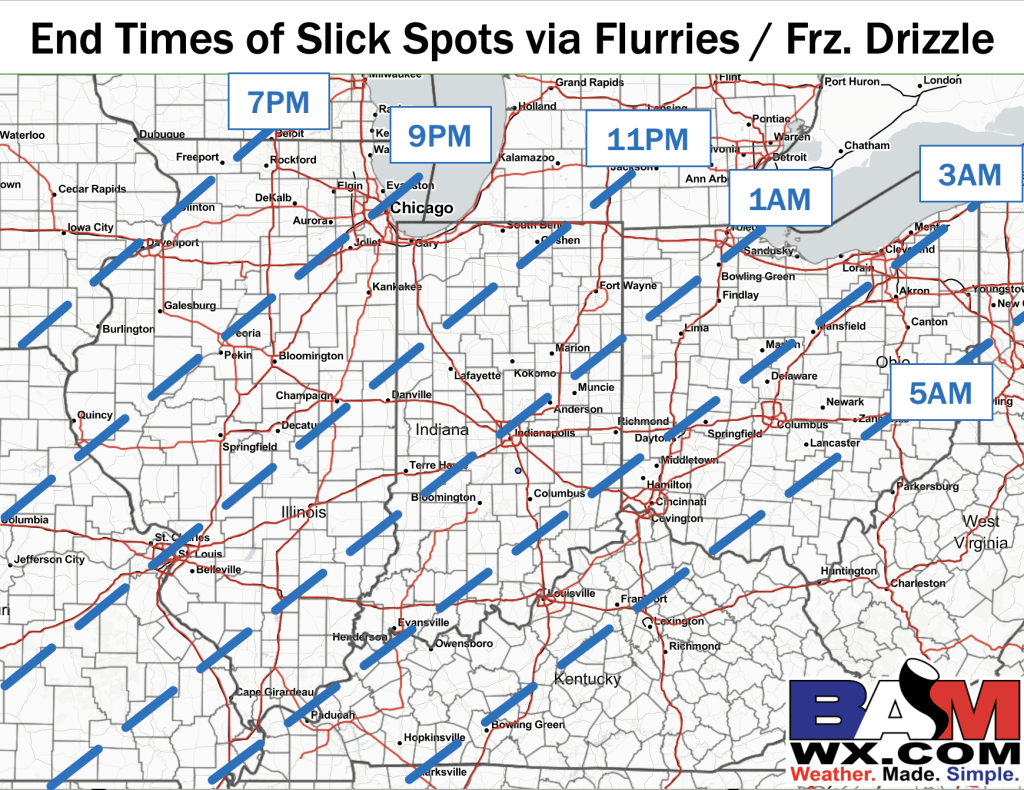
2:30 PM ET Slick Spot End Timing Graphic (All in ET):
Above is the timing of when energy aloft departs the area tonight and when the risk for additional slick spots would diminish. Out through these times however, areas of flurries/ light snow showers as well pockets of drizzle with temps below freezing will keep slick spot potential in the forecast (no measurable freezing drizzle expected).
While this threat is not widespread nor something that everyone will see, there is no one location that is 100% safe from an additional coating of snow/ slick spot between now and the times listed in the image.
The overall threat for accumulating snow looks rather low end with any additional accumulation of snow likely sitting below 0.25″.
As touched on in the AM video, freezing fog across parts of the area will be something to monitor in the overnight timeframe (future updates will be sent out on this threat). Please let us know if you have any questions!
