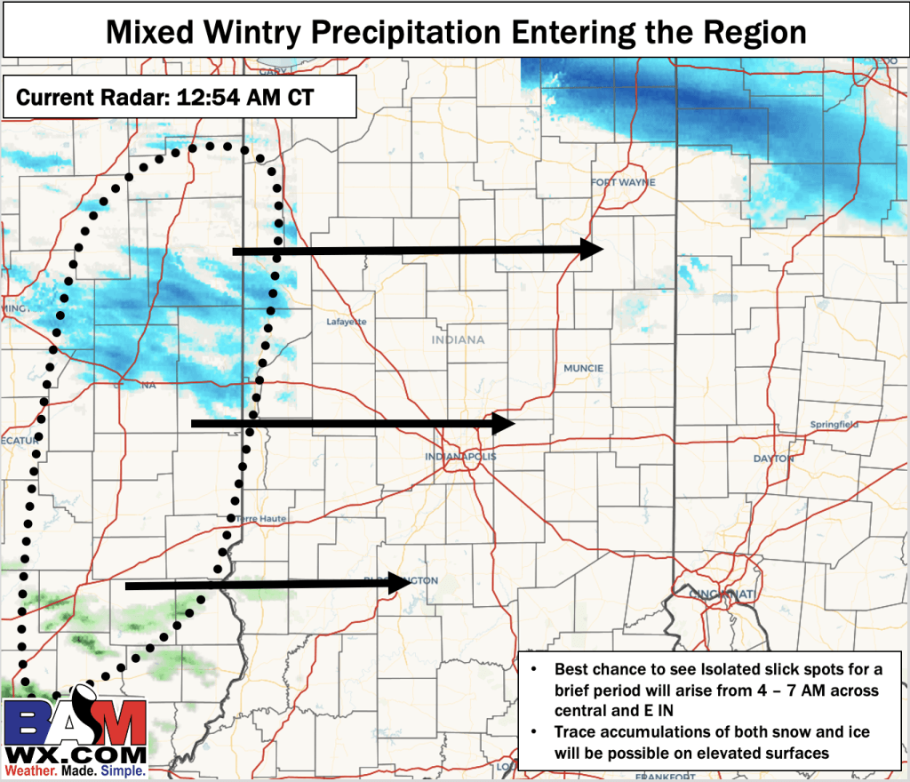
Light mixed wintry precipitation will be possible for your area during the mid-morning hours with the best chance to see this activity from 4 – 7 AM. Current radar coverage is too widespread in extent of precipitation and plentiful low level dry air will help to inhibit precipitation reaching the surface for a few hours. Thus, towards the mid-morning hours a mixture of rain and freezing drizzle will be possible with trace Ice and up to 0.2 inches of snow from the sky. Due to pavement temperatures and air temperatures being marginal during this window, we are not favoring impacts to be widespread, but a few isolated slick areas cannot be 100% ruled out. The best chances to see an isolated slick area will be north of the I-70 corridor (4-7 AM). Your application is doing a decent job at picking up on precipitation chances and accumulations.
Please reach out if you have any questions!
-Will