Video:
Good Thursday everyone!
We have an impending arctic air mass that will enter the area early next week. However, before that we have a few disturbances that could put down some light snow especially in Northern Missouri.
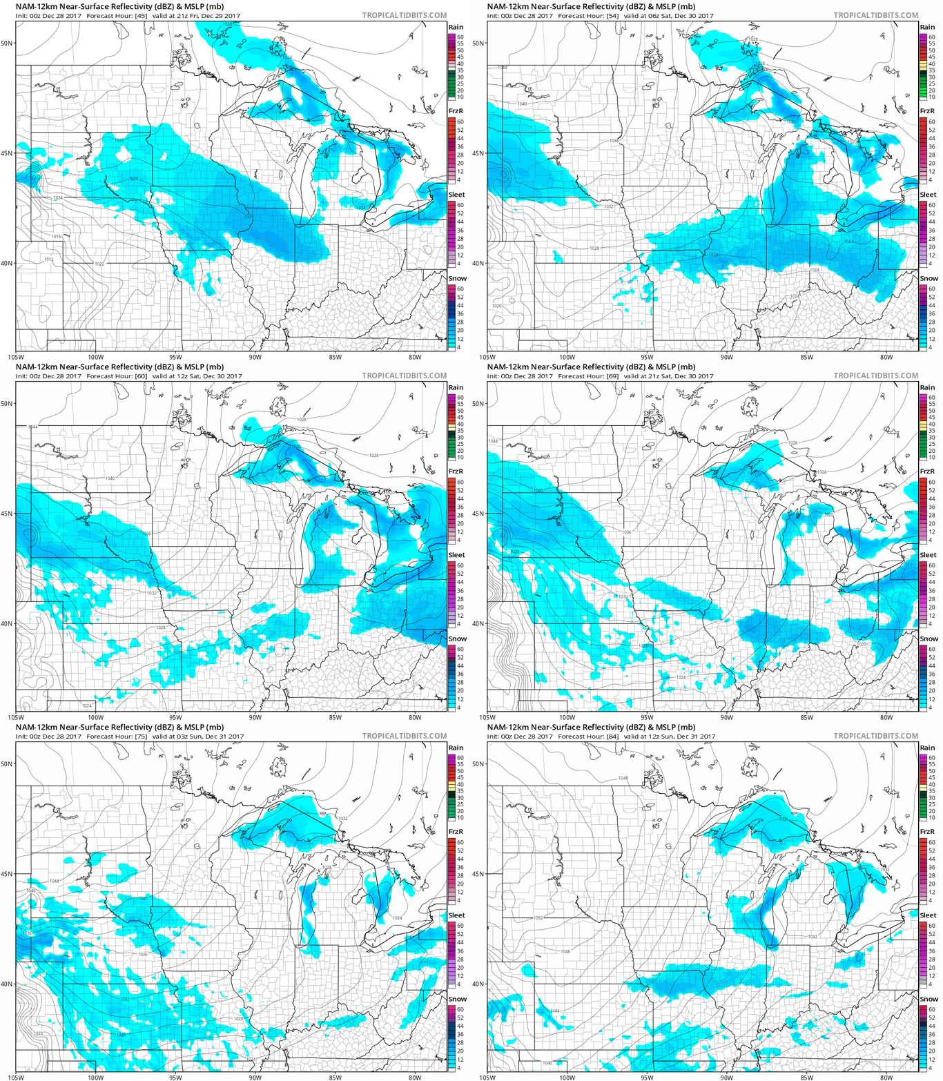
If you take a look at the simulated radar over the next couple days, we do have a couple of chances of accumulating snowfall in the forecast. The first chance will be Friday night. This looks to mainly affect the extreme northern portion of Missouri. A stout piece of energy will dive into the Central Plains late Saturday into early Sunday, but will be suppressed and weakened by a strong arctic high pressure system. However, it could lay down some light snow accumulating snow especially in Northern Kansas and Northern Missouri.

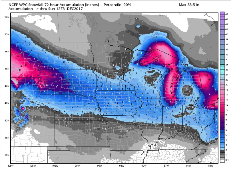
Overall, accumulations will be light, but 1-2 inches could fall by Sunday in Northern Missouri with up to an inch in Kansas.

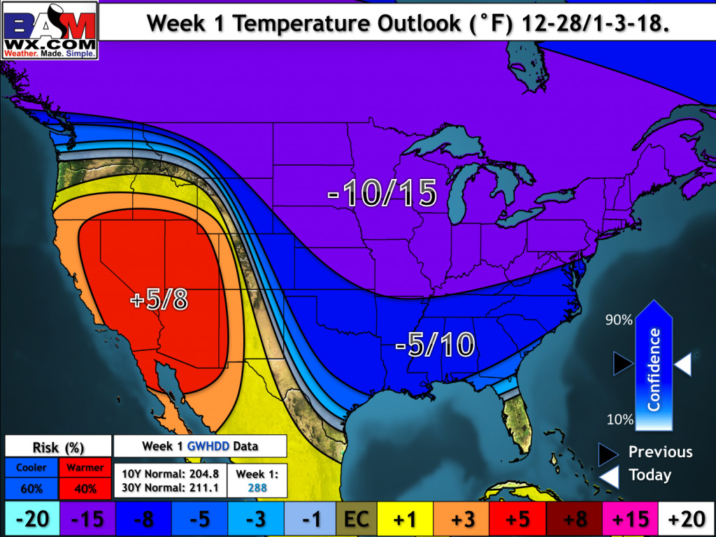
Behind these disturbances, brutally cold temperatures will flood the region for next week. Northern portions of Kansas and Missouri will likely see low temperatures dip below zero Sunday and Monday morning. Overall, temperatures will average around 10 to 15 degrees below normal the next week.
