Today’s video (7 min):
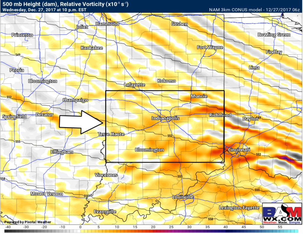
Can’t rule out a wave ~7-11pmEST tonight along the I-70 corridor for some flurries to snow showers despite models picking up on anything on simulated radar:
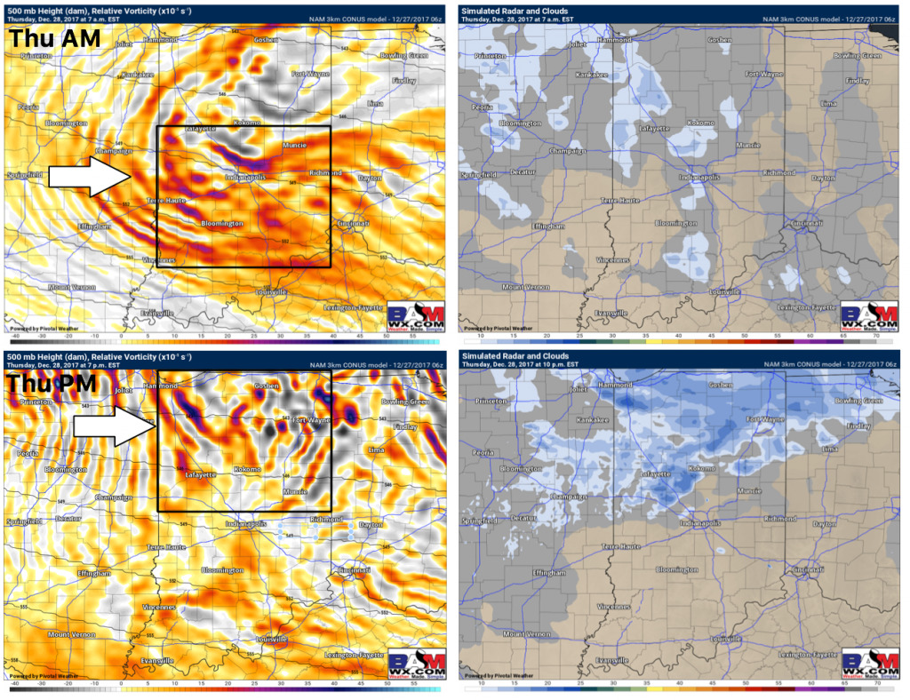
Very cold day on tap today with more sunshine building in across the state…targeting 2 waves of energy to push east bringing our next chances for snowfall Thursday morning around rush hour (moves in 4-7am from west to east…could linger into early afternoon with spotty snow across the I-70 corridor) as well as Thursday evening across north-central parts of the state into Friday morning. Data is handling this very poorly with simulated radar, we time out the specifics in the video:
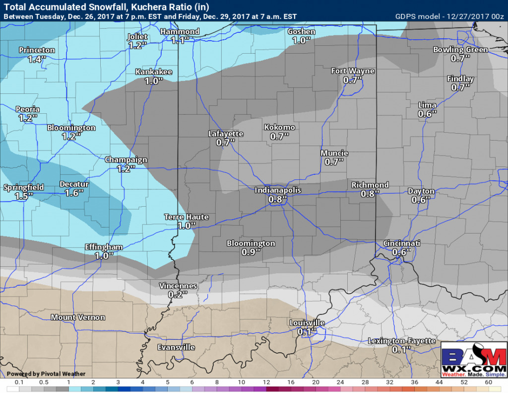
Through Friday morning ideas for snowfall accumulation using the Canadian model we think up to 1″ is possible of total accumulation given multiple waves moving east over the next 48 hours:
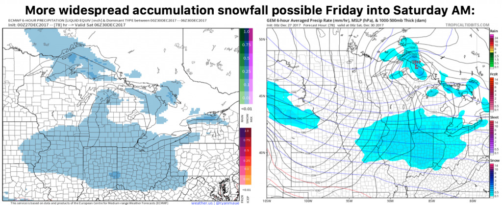
Still eyeing a more widespread snowfall threat on Friday afternoon into Saturday morning…data is gaining more confidence in terms of timing and accumulation but it’s looking more like a widespread swath of snowfall here:
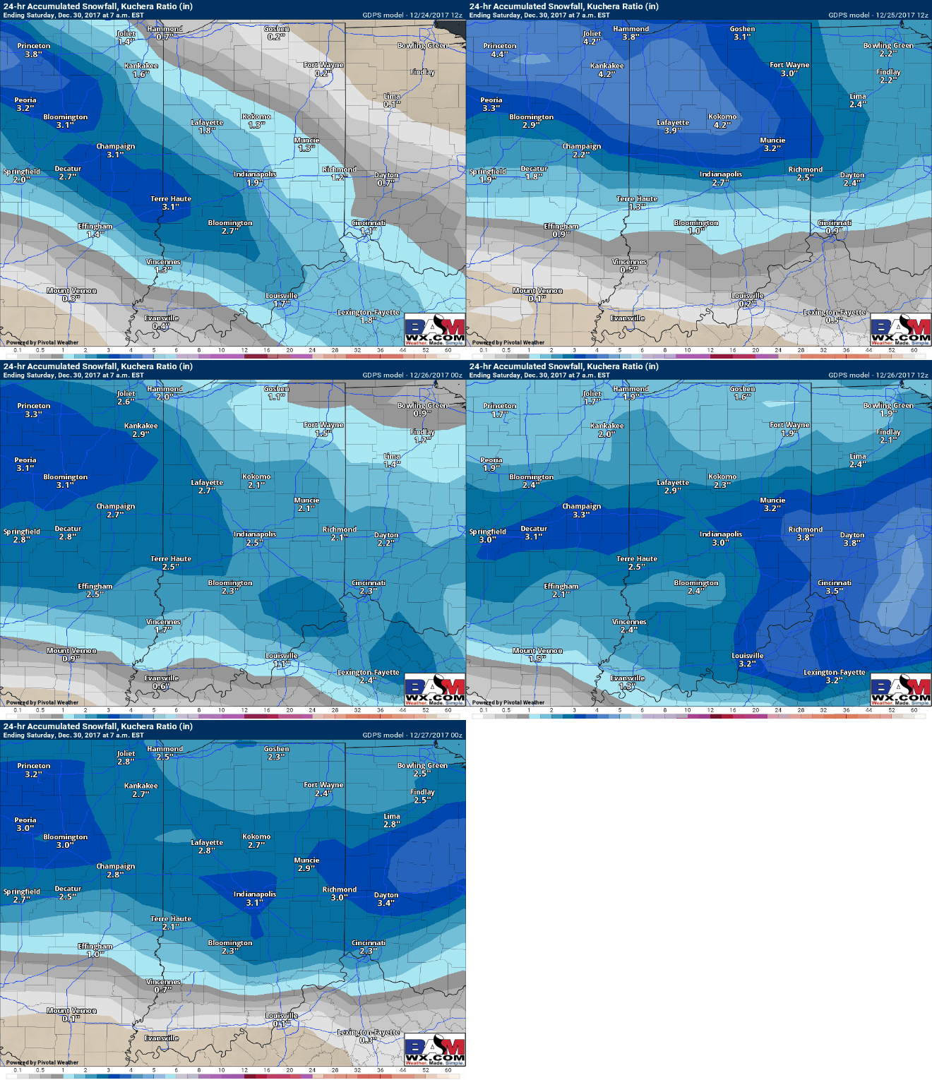
Here’s the last 5 Canadian runs regarding the accumulating snowfall Friday into Saturday showing a consistent 2-4″ (still need to fine-tune exactly how much and where):
