Video:
Heavy snow bands have formed in Western and Northwestern Nebraska. The hi-resolution NAM model seems to have a good handle on the system with the exception of a heavy band occurring in North Central Nebraska. This area has the potential overachieve the NAM’s forecast.
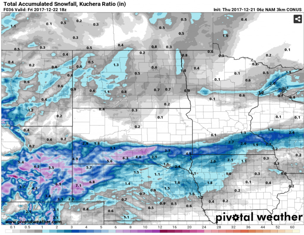
The system will begin to weaken as it moves to the east resulting in lower snowfall totals in Eastern Nebraska and Northwest Iowa, but a couple of inches cannot be ruled out. Light rain will occur in Southeast Nebraska and Iowa with spotty freezing drizzle possible. Precipitation will exit the Eastern Iowa tomorrow afternoon. (Timing: 9AM Thursday – 3PM Friday)
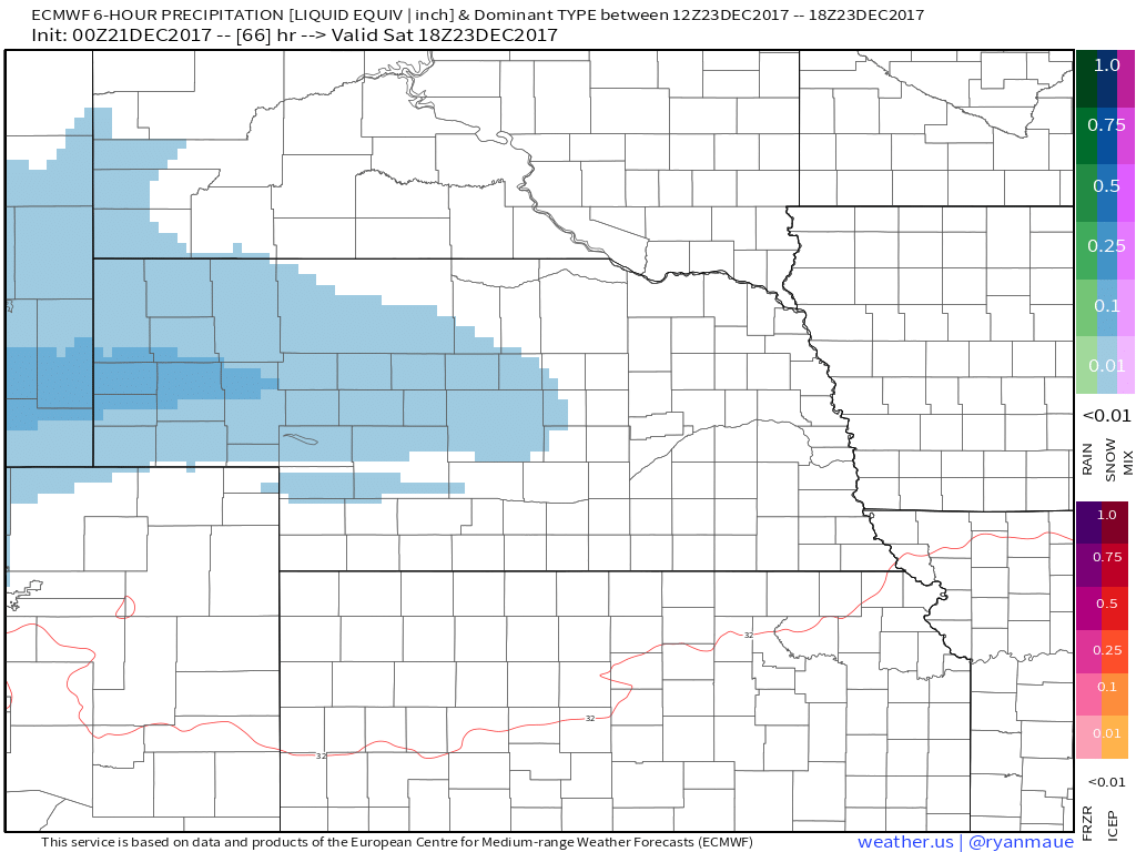
The next snow chance for western Nebraska arrives early Saturday. The energy with this system is weaker than today’s, however, cold temperatures throughout the atmosphere will lead to high snow-to-liquid ratios and the potential for a decent snow accumulation through Christmas Eve morning
.
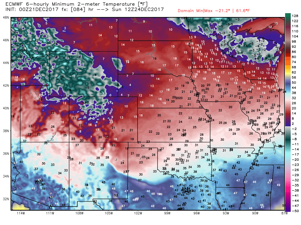
Very cold air will usher in behind these systems. Temperatures on Christmas Eve morning will be bitter with the coldest temperatures in the areas with a snowpack.
We will continue to update on the snowfall and cold threats throughout the week.