Today’s video (7 min):
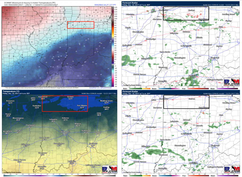
Light showers/drizzle push east later this evening into Friday along a warm front…overall temps stay above freezing for the majority of the state, however, can’t rule out patchy freezing drizzle across the northern row of counties early Friday morning if temps can get near 32ºF (lower confidence on this solution, more in this afternoon’s update):
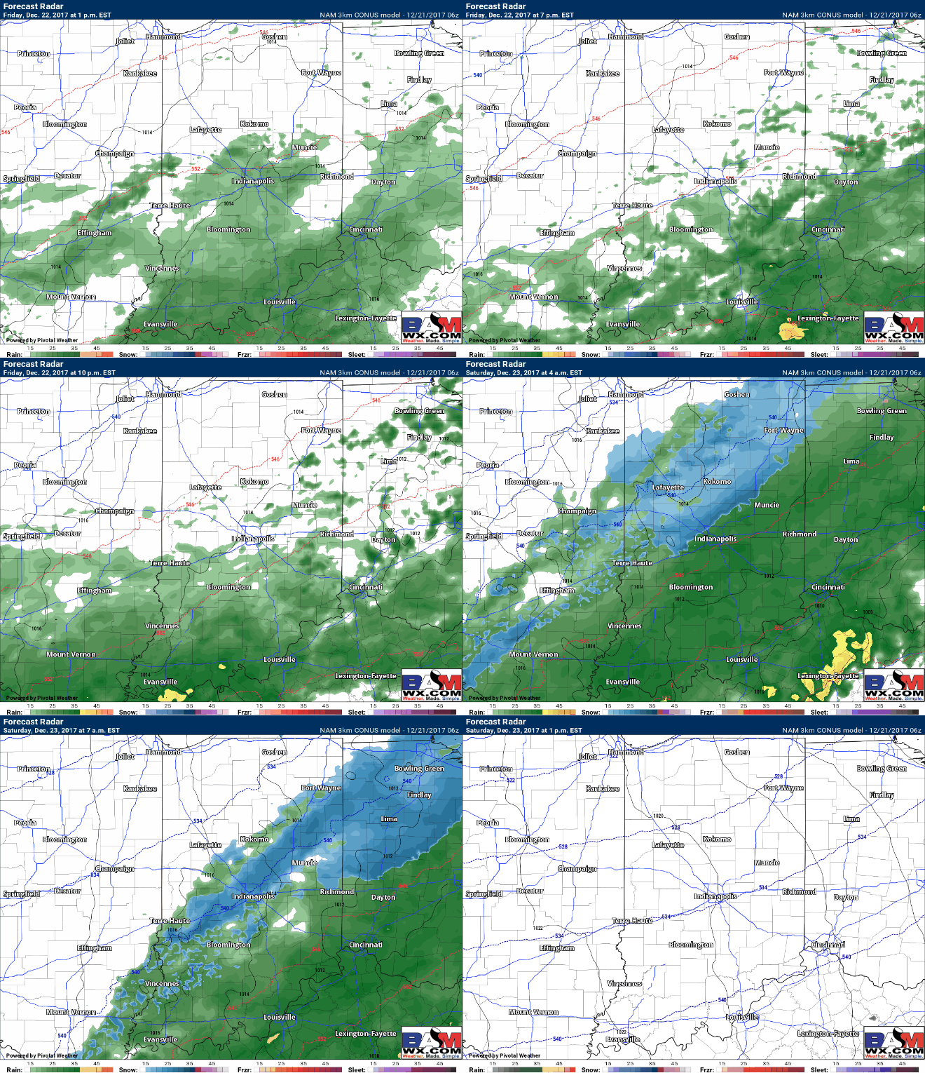
As the low pressure system works in closer to the Ohio Valley we begin to increase the rainfall coverage as well Friday afternoon into Saturday morning…expecting things to transition to a mix and to snow on the backside as temps fall to freezing and below (northwestern IN locations look to stay drier here) after midnight Saturday morning). We also need to monitor for slick surfaces later Saturday into the overnight. Southern IN locations could see some moderate to heavy rainfall at times with this system.
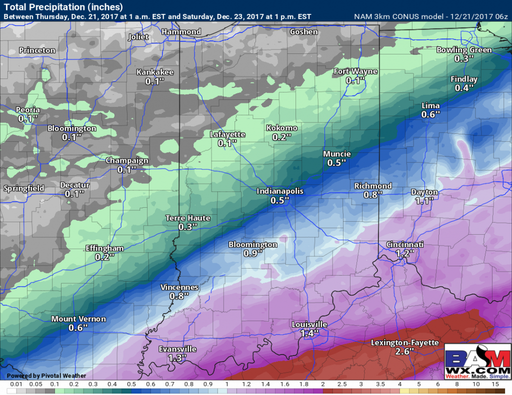
Total precipitation accumulation next 60 hours…moderate to heavy rainfall of 1.0″+ possible across southern IN locations:
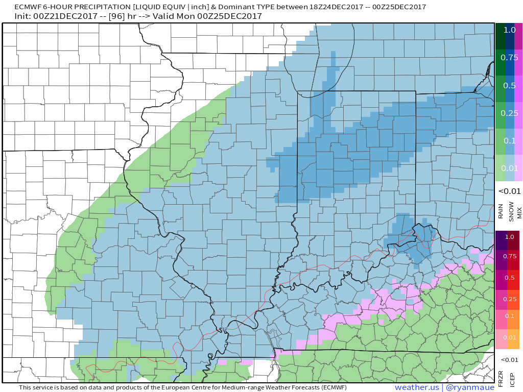
Finding consistency in the data this morning with accumulating (fluffy) snow on Christmas Eve as a piece of energy sweeps east into the Ohio Valley…temps will be dropping into the 20s so it’ll be an all snow event…more details in the video on the potential and risks for this:


