Today’s video (7 min):
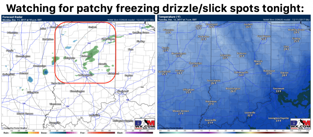
We are monitoring for some patchy freezing drizzle and slick spots this evening as temps crash from the 40s this afternoon into the upper 20s Tuesday morning.
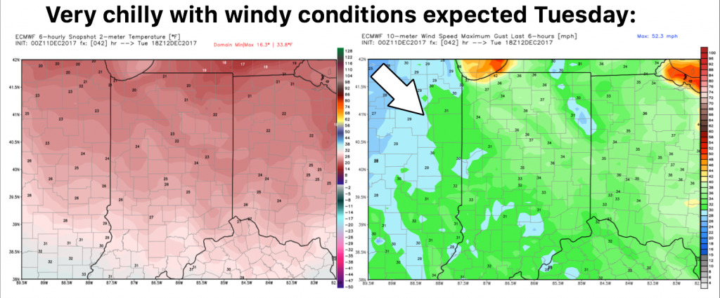
Very chilly and windy day Tuesday:
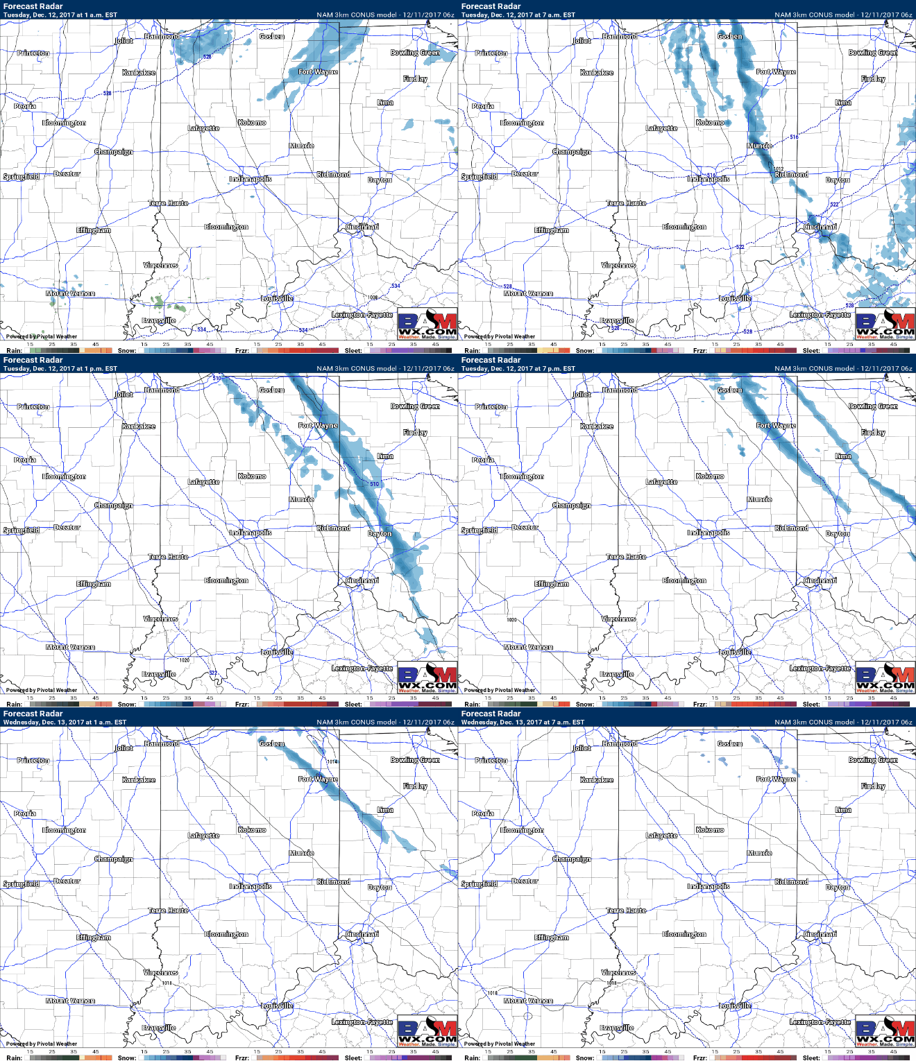
Targeting a lot of lake effect snow potential on Tuesday into early Wednesday morning, mainly across the northern and eastern parts of the state…folks to the north at times seeing 1-2″ / hr snowfall rates and near-whiteout conditions. We think the lake effect feeder bands could make it all the way down to Muncie, Richmond to Cincinnati.
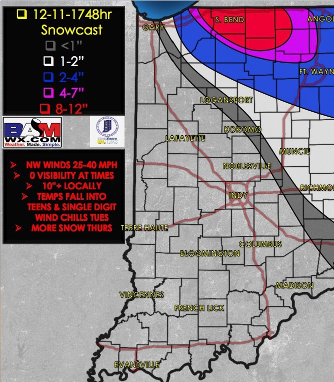
Latest thoughts on snowfall accumulation through Wednesday morning…an additional 8-12″ possible across northern Indiana locations where the heaviest band sets-up shop:


