Key Points – Friday, October 6, 2017:
Synopsis: Good Friday morning! Another day of rain today I-70 north (at times heavy), and plenty of it, as a stationary front continues to stall out across the midwest. As we go through the afternoon into the evening tomorrow we need watch things very closely as storms, some potentially being strong to severe, move east out ahead of the cold front. Generally 0.5-1″ will be possible but localized pockets of 2-3″ are not out of the question through Sunday morning. Most of Sunday we are expecting dry conditions, we continue to be suspect of Tropical Storm (soon to be Hurricane) Nate rainfall impacts especially across the eastern half of the state into Monday. In the video we break down the next 4 week temperature and precipitation long-range outlooks as well. If you have any questions please let us know, have a blessed weekend! -Kirk
Today’s video (5 min):
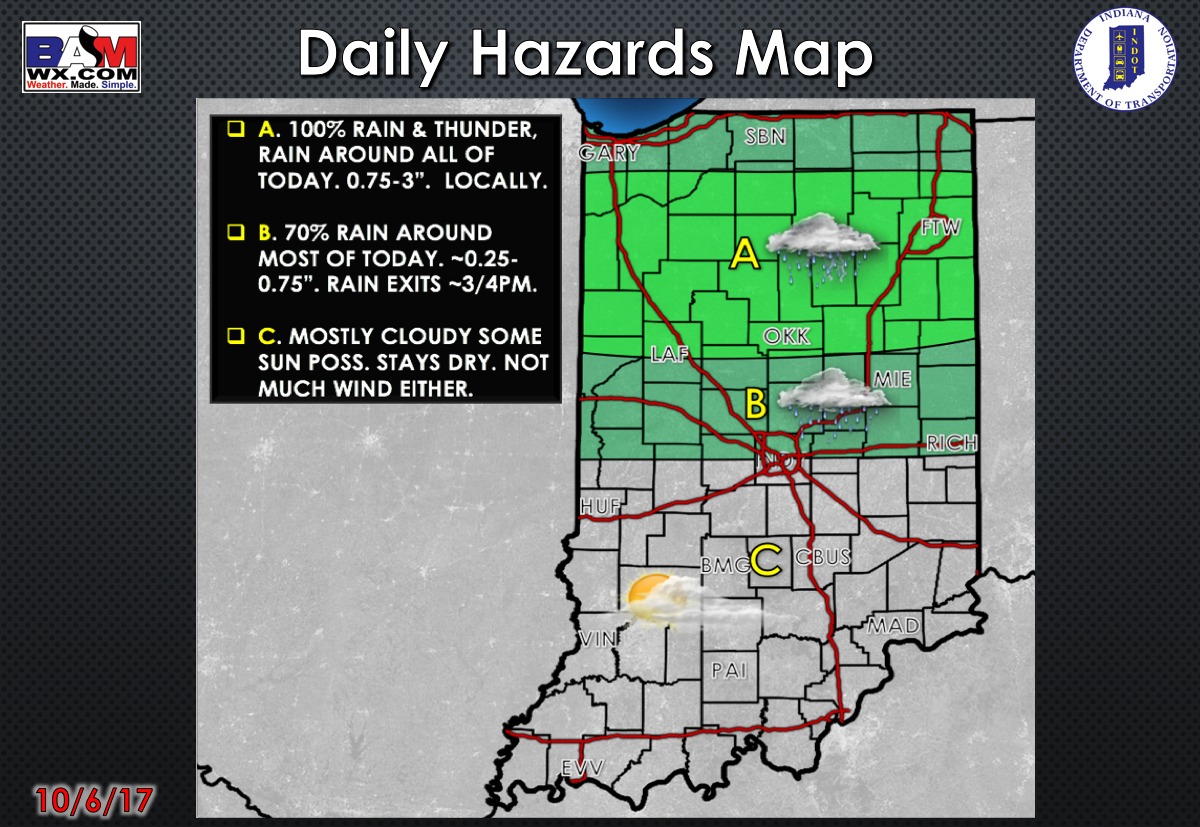
Today’s weather hazard quick sheet:
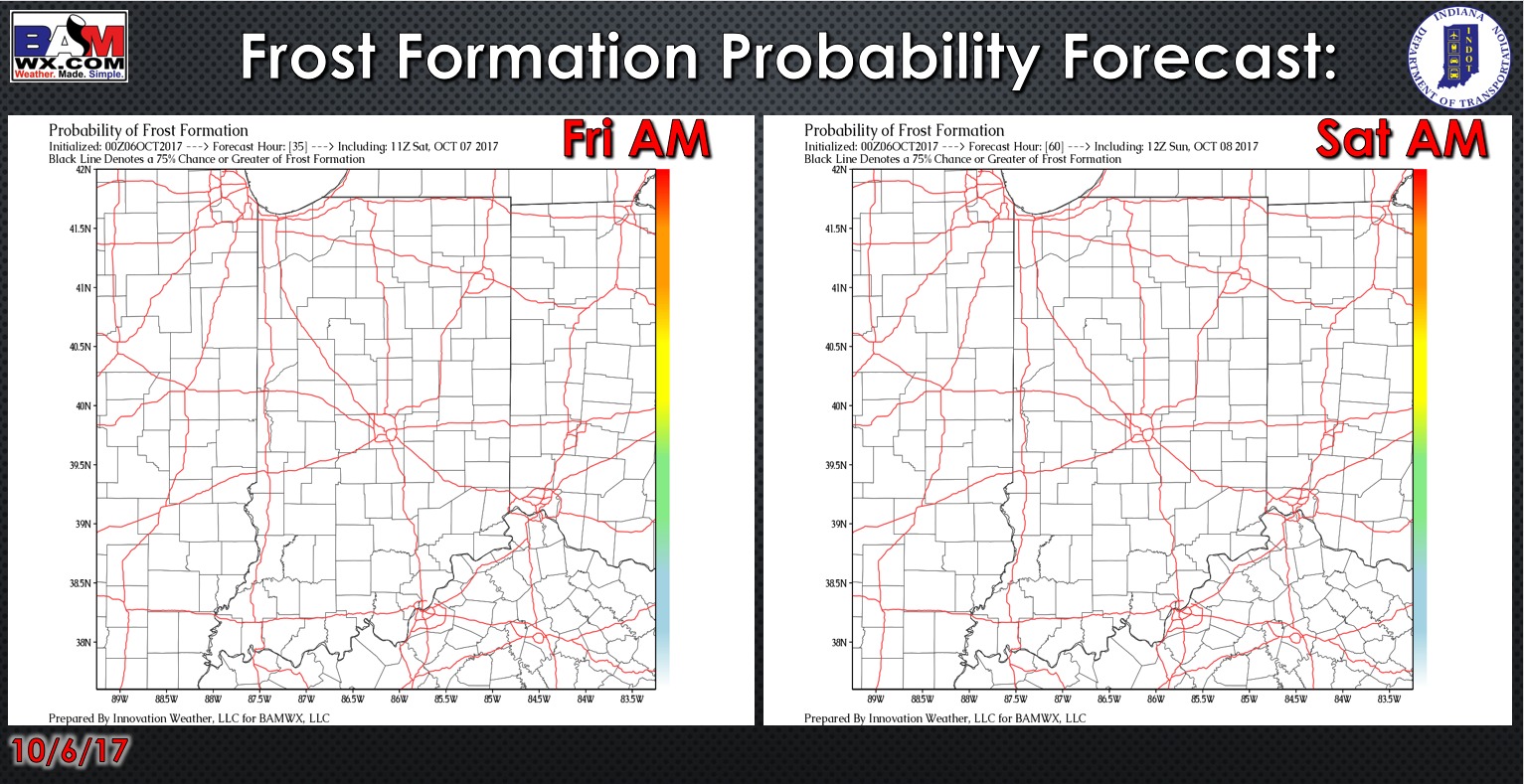
Exclusive BAMwx frost probability formation forecast over the next 2 mornings is below…no frost is expected:
Storm coverage over the next 2 days…showers continue to work west to east this morning across the northern half of the state, lingering to light showers into this afternoon. We are watching very closely Saturday evening for a line of storms ahead of the cold front…some of these may be strong to severe.
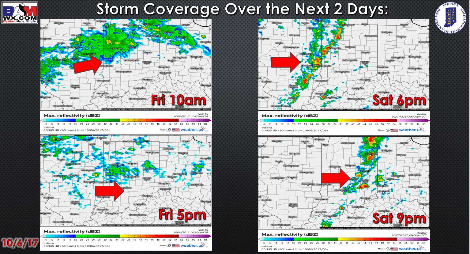
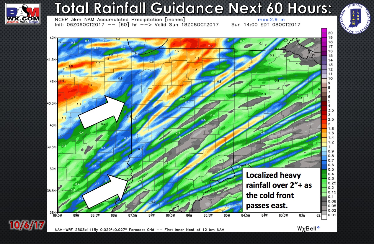
Total rainfall guidance over the next 60 hours…we are expecting bands of 1-2″ into Saturday, especially with any storms that may be strong to severe. Otherwise, 0.25-1″ generally will possible as showers and storms move across the forecast area.
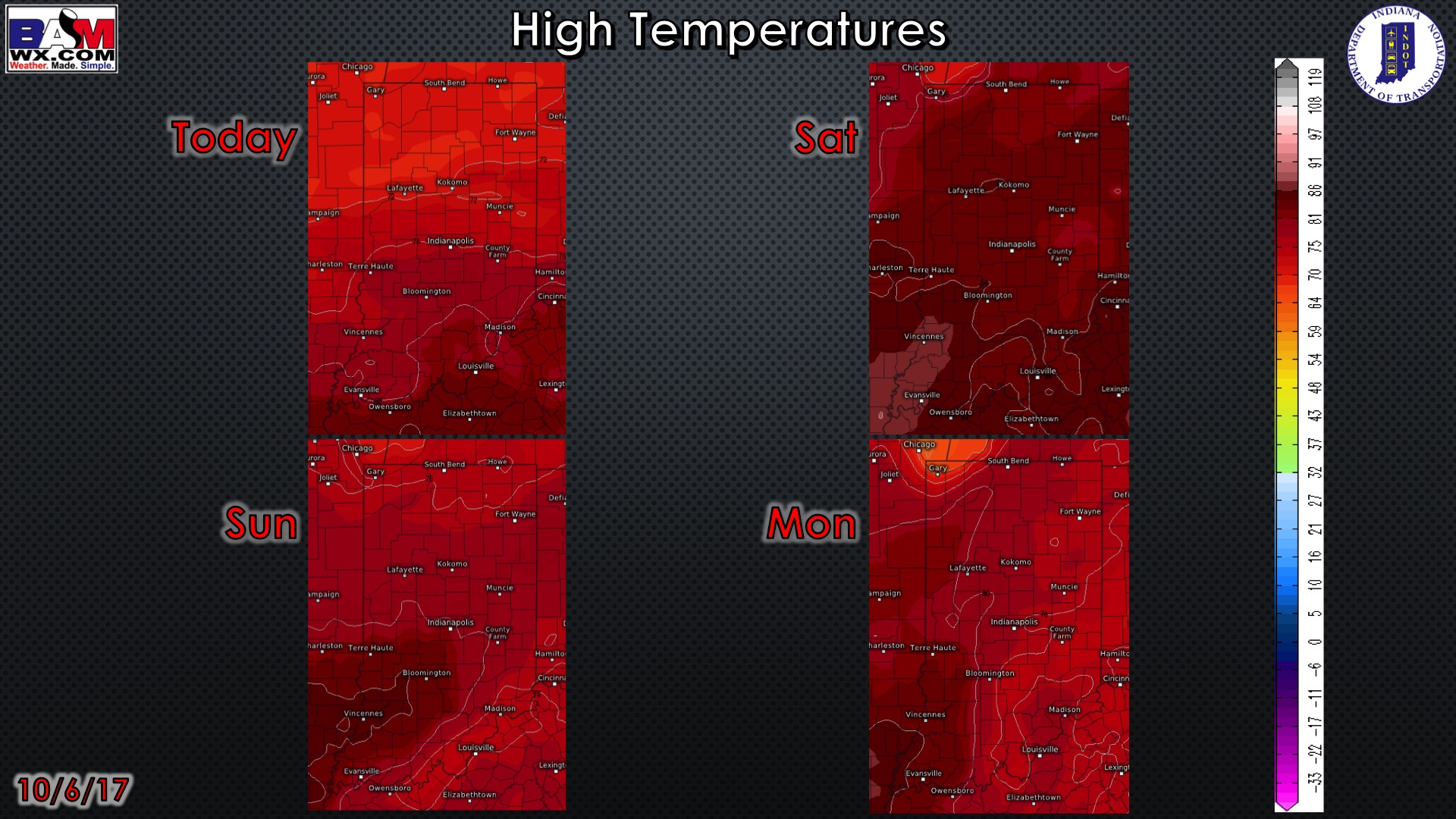
High temperature guidance over the next 4 days:
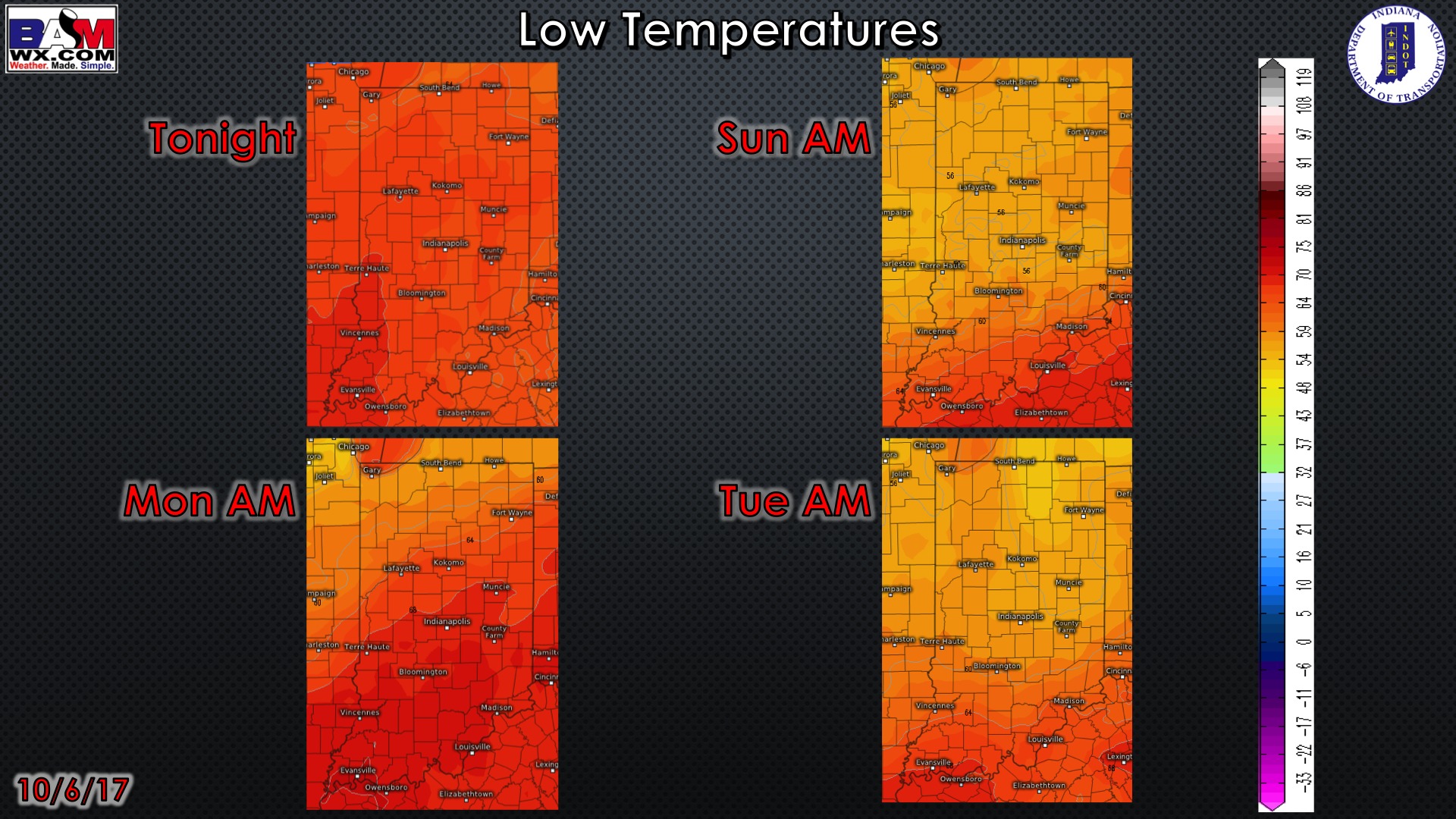
Overnight low temperature guidance over the next 4 mornings:
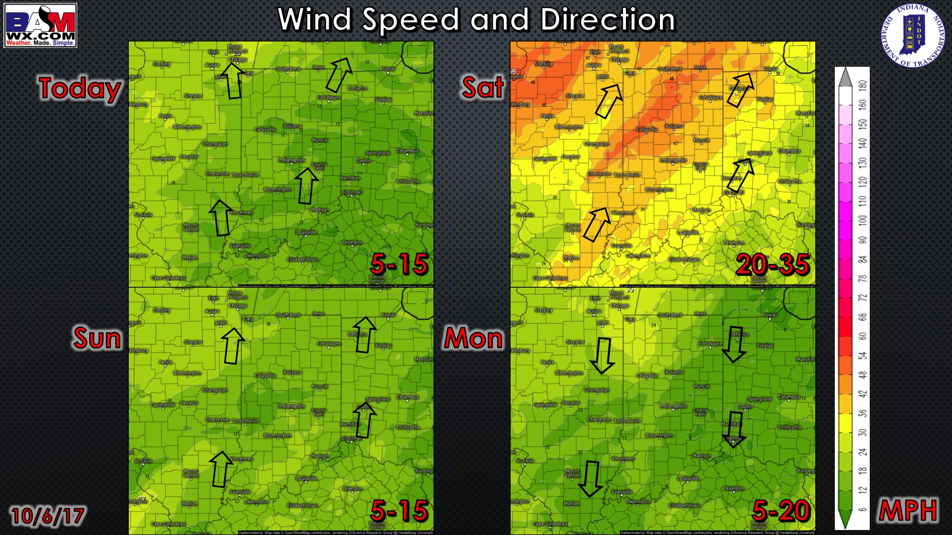
Wind gusts forecast guidance over the next 4 days:
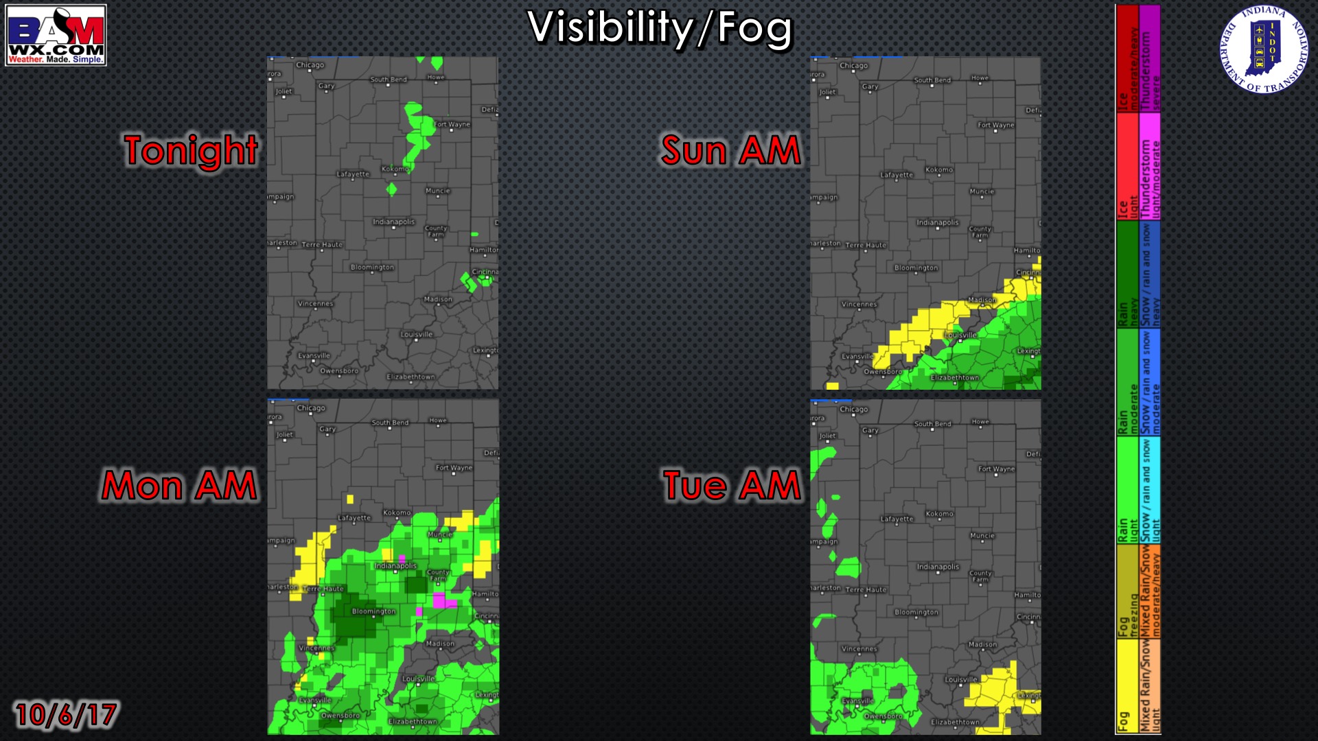
Visibility guidance over the next 2 mornings (the darker red the color shade, the more reduced the visibility…great tool for finding drizzle/fog):
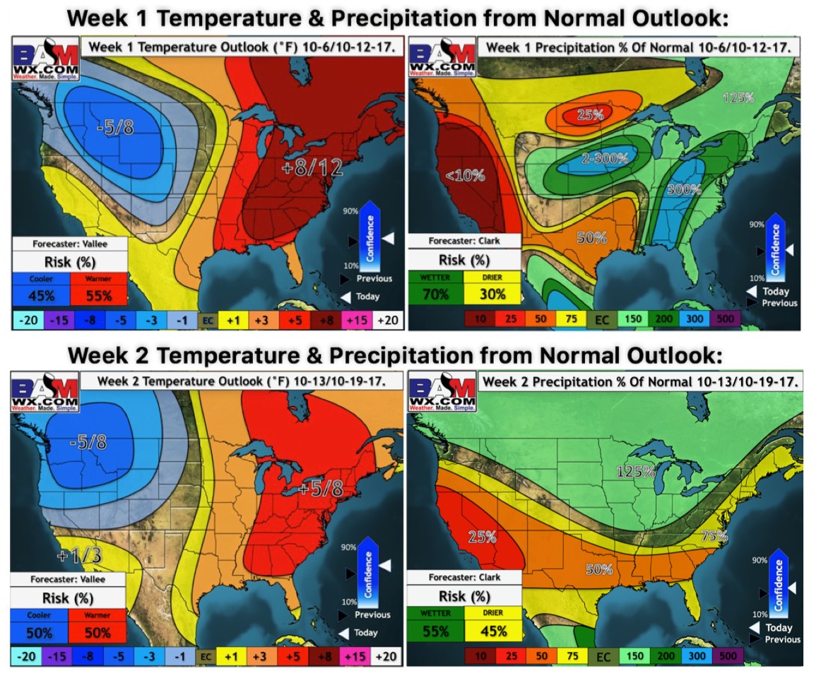
Week 1-2 temperature and precipitation from normal outlooks:
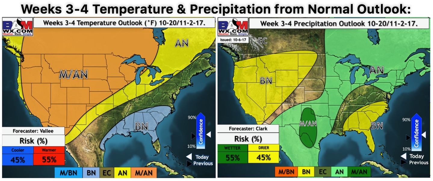
Weeks 3-4 temperature and precipitation outlooks as well are below (AN: above normal / BN: Below normal):