Key Points – Thursday, October 5, 2017:
Synopsis: Good Thursday morning! The heaviest rain continues to move through the I-70 corridor this morning with a few light showers weakening across northern locations (due to influences of high pressure). These showers will move out of the area to the east ~2-3pmEDT, with another shield of rain working in Friday morning into the afternoon from west to east. In today’s video we discuss the weekend rainfall chances as well as potential tropical rainfall implications early next week…a lot of risk in the forecast with this, however, with the exact track it may take. We also touch on the latest details regarding the cool down next week. If you have any questions please don’t hesitate to reach out, have a blessed day!
Today’s video (6 min):
Today’s weather hazard quick sheet: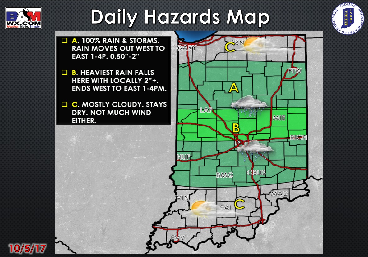
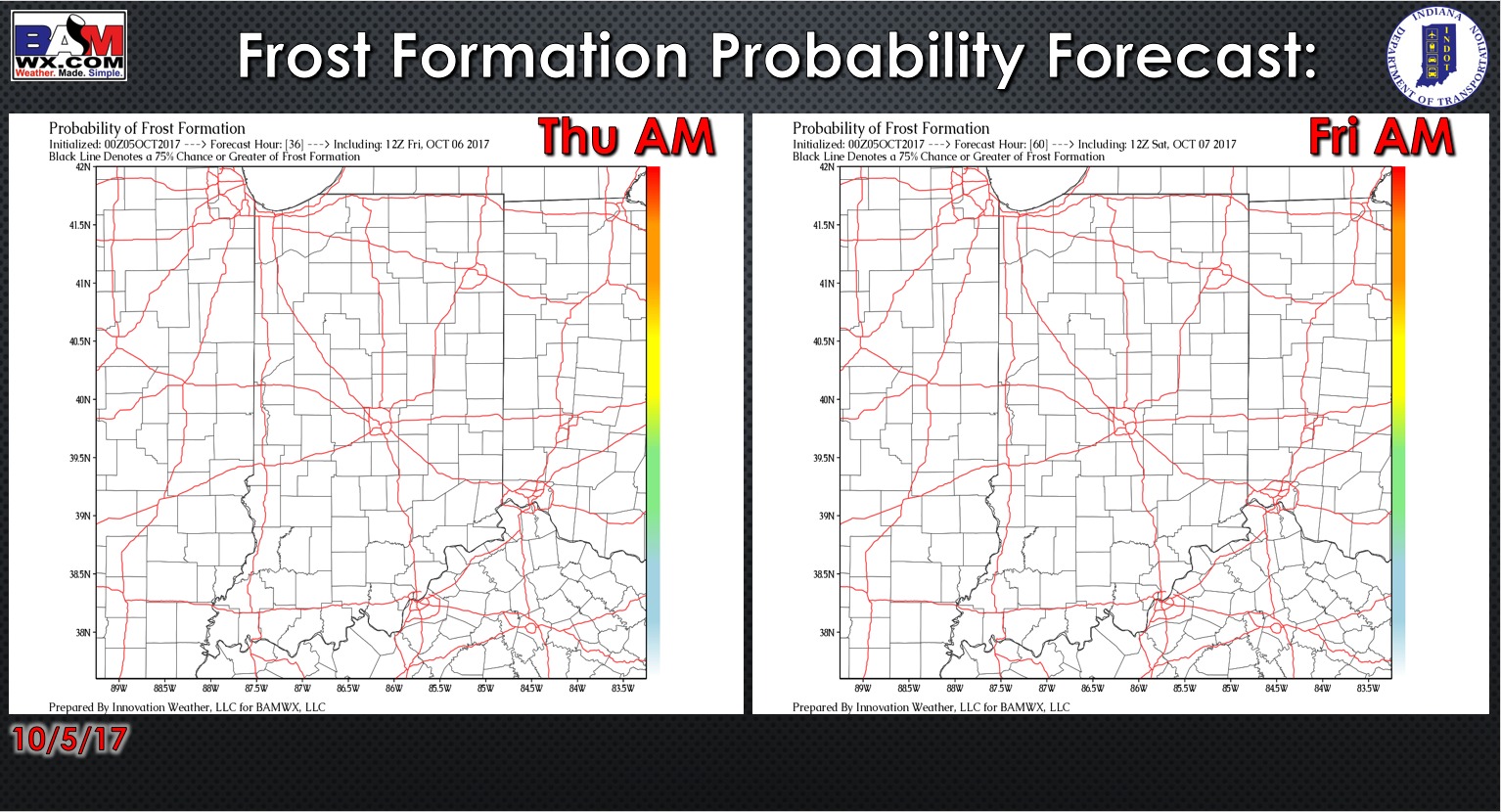
Exclusive BAMwx frost probability formation forecast over the next 2 mornings is below…no frost is expected:
Storm coverage over the next 2 days…rain continues to move east this morning across central Indiana, moving out by this afternoon. Showers work back in Friday morning across the northern half of the state, with a slightly drier trend for locations south of Indianapolis.

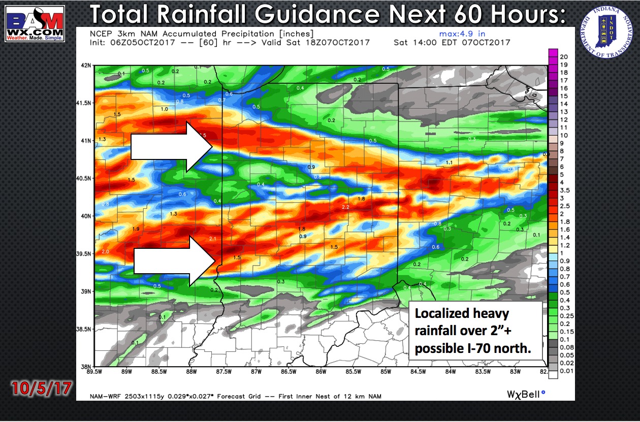
Total rainfall guidance over the next 60 hours favors localized heavy rainfall of 2″+ mainly across central and north-central Indiana:
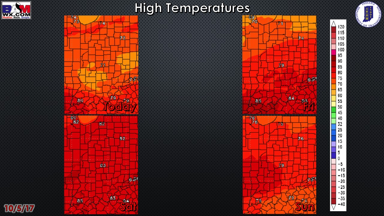
High temperature guidance over the next 4 days:
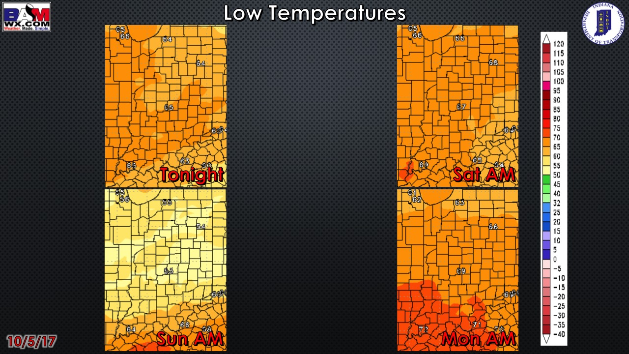
Overnight low temperature guidance over the next 4 mornings:
Wind gusts forecast guidance over the next 4 days: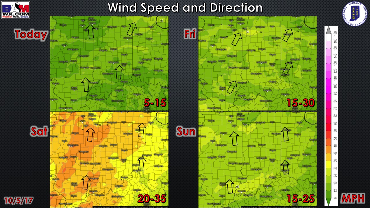
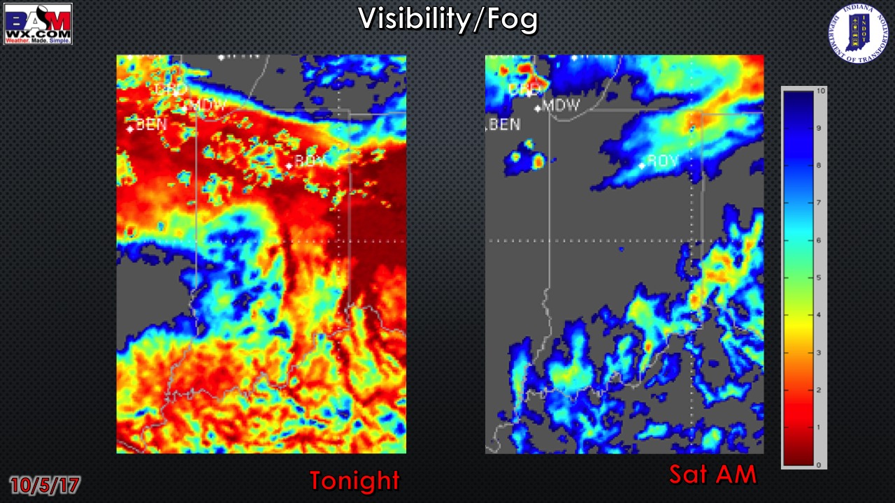
Visibility guidance over the next 2 mornings (the darker red the color shade, the more reduced the visibility…great tool for finding drizzle/fog):
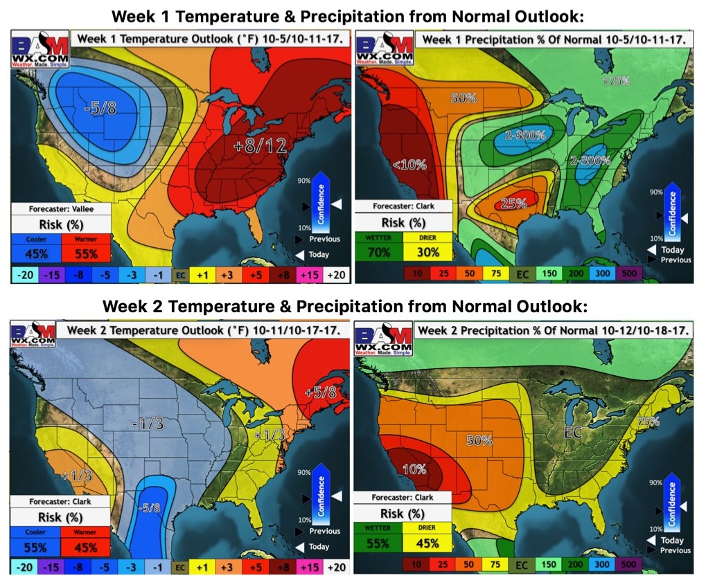
Week 1-2 temperature and precipitation from normal outlooks: