Key Points: Tuesday, October 3, 2017:
Synopsis: Good Tuesday morning! Another warm and dry day expected across southern Indiana. A frontal boundary will approach the forecast area on Wednesday and linger to our north through late week. This front will bring the risk for a few isolated showers/storms in northern and western parts of the area Wednesday, then slightly better chances in the north on Friday. Areas further south likely remain dry. Temperatures look to remain above average through the rest of the week before getting knocked down by a cold front this weekend.
Today’s video (6:45):
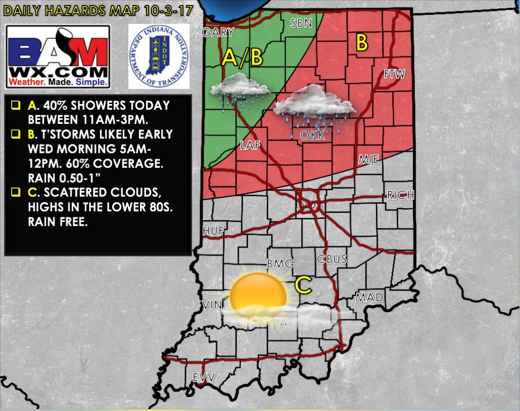
Today’s weather hazards quick sheet:
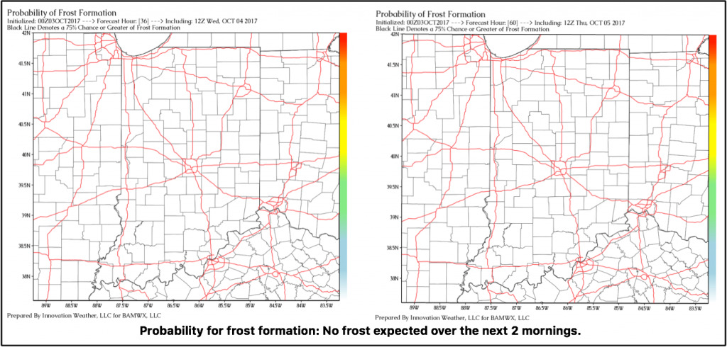
Exclusive BAMwx frost probability formation forecast over the next 2 mornings is shown below. No frost is expected:
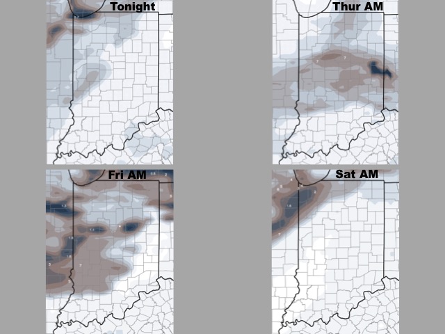
Storm coverage over the next 2 days is shown below. Spotty storm chances in the north Wednesday and Thursday, but most of the area stays dry.
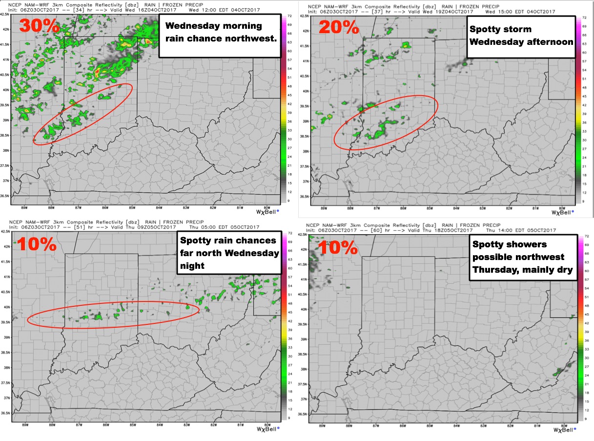
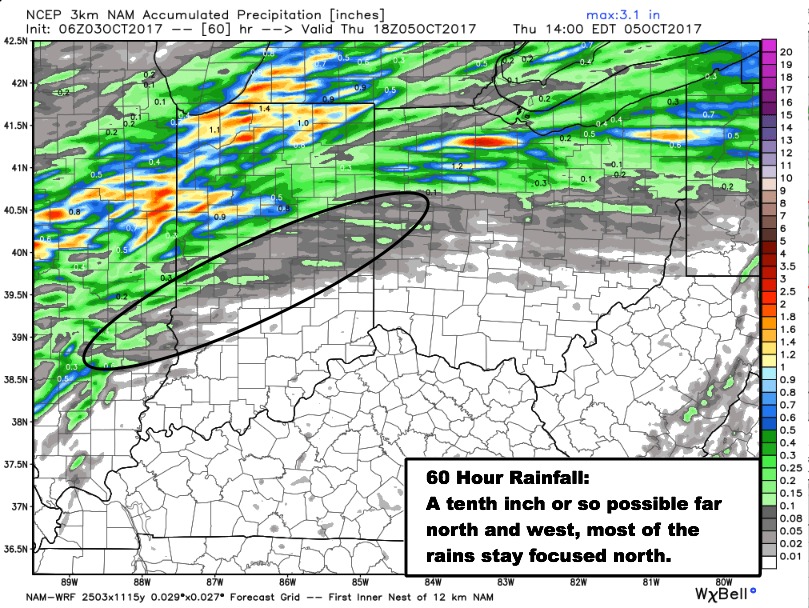
Total rainfall guidance over the next 60 hours is shown below. Far north/west areas could see locally a tenth to a quarter inch, but many areas stay dry.
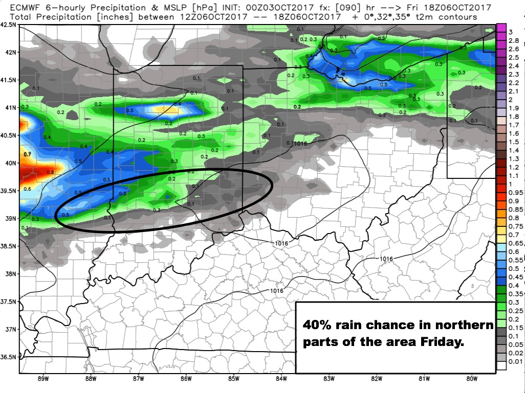
Slightly better rain chances look to move through the northern parts of the area Thursday night and Friday.
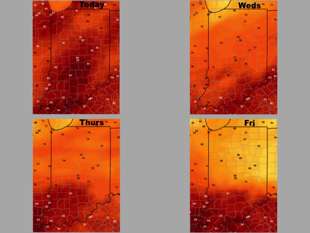
High temperature guidance over the next 4 days:
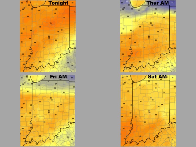
Low temperature guidance over the next 4 mornings:
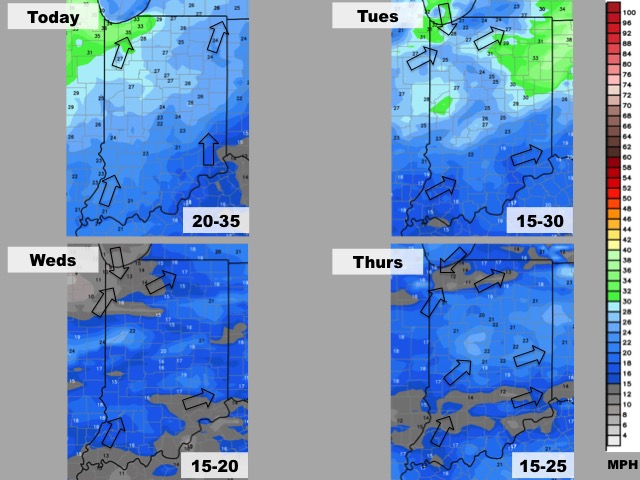
Wind forecast over the next 4 days:
Visibility forecast over the next 4 nights is shown below. Little to no visibility restrictions expected.
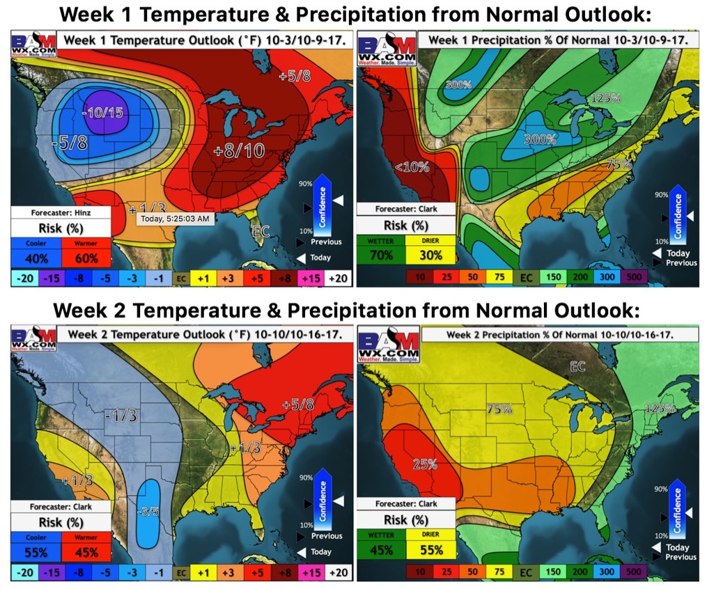
Weeks 1 and 2 temperature and precipitation outlooks: