Key Points – Tuesday, October 3, 2017:
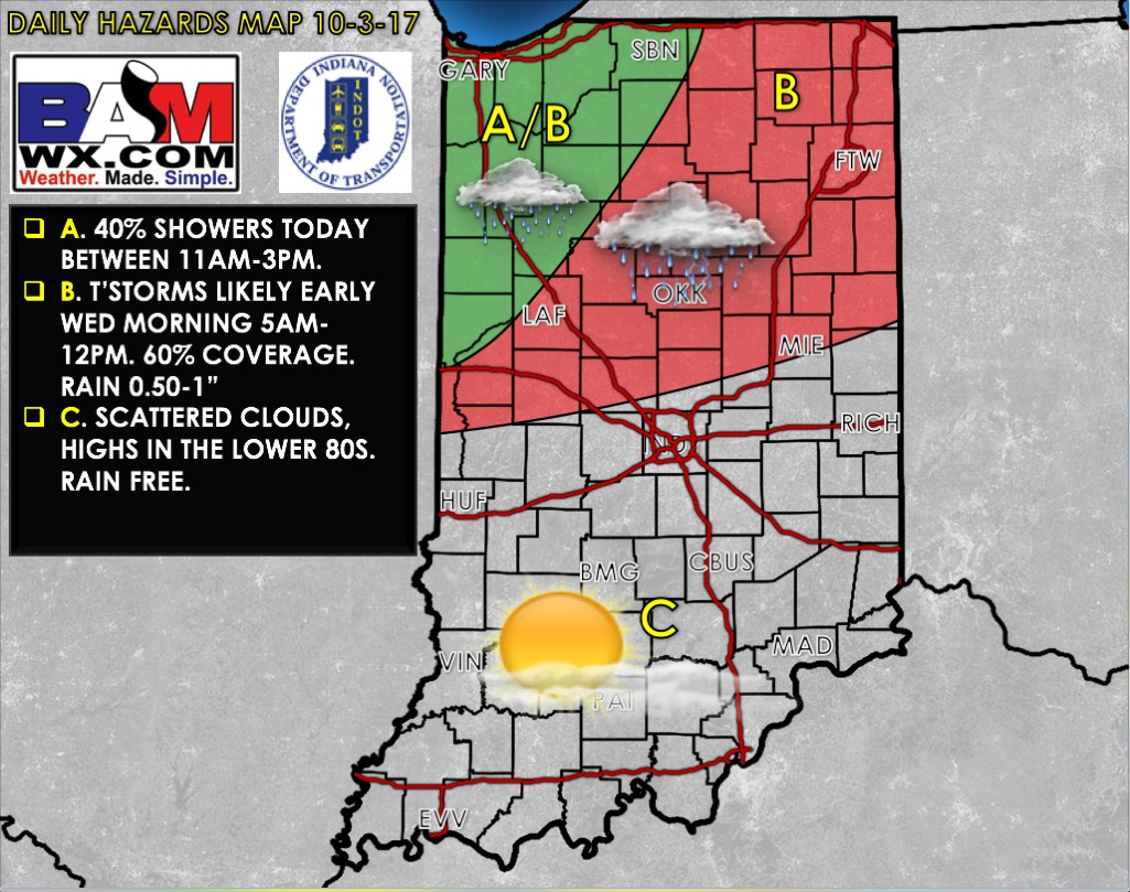
Synopsis: Good Tuesday morning and thanks for checking out the very first of many daily weather forecasts as we head into the fall and winter months! We stay warmer than normal as we head into late week before getting knocked down by a cold front this weekend. The northwestern half of Indiana has ~40% chance for showers from about 11a-3pm EDT. A front approaches early Wednesday morning with ~60% chance for storms as early as 5am EDT across the northern slice of the state, slightly weakening as we get into the afternoon. Additional heavy rains work in Friday into Saturday as a stalled out front lingers across the forecast area, all the details in today’s video. Let us know if you have any questions, have a blessed day! -Kirk
Today’s video (6 min):
Today’s weather hazards quick sheet:
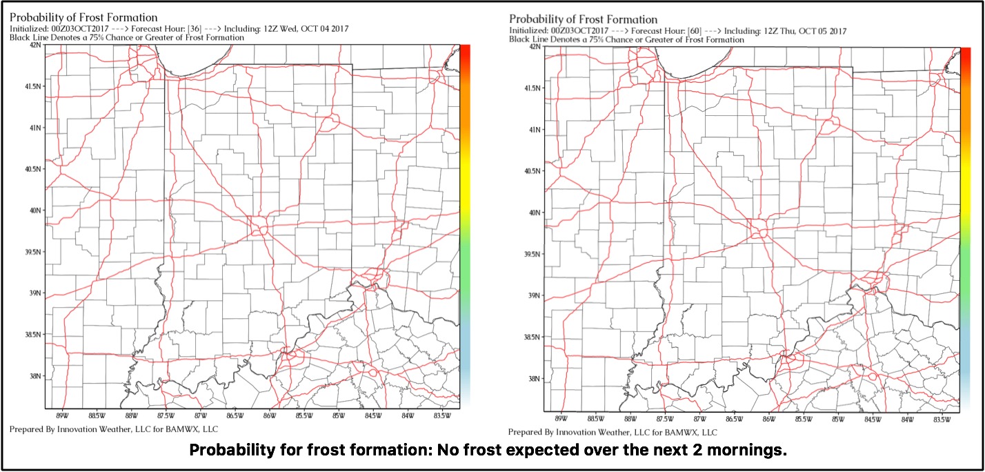
Exclusive BAMwx frost probability formation forecast over the next 2 mornings is below…no frost is expected:
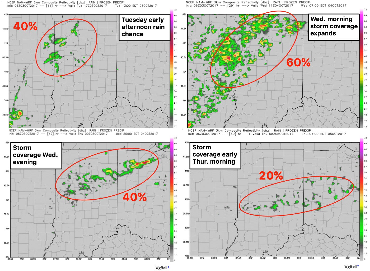
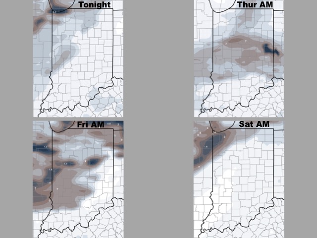
Storm coverage over the next 2 days…Wednesday morning will feature the highest coverage focused mainly across the northwestern locations:
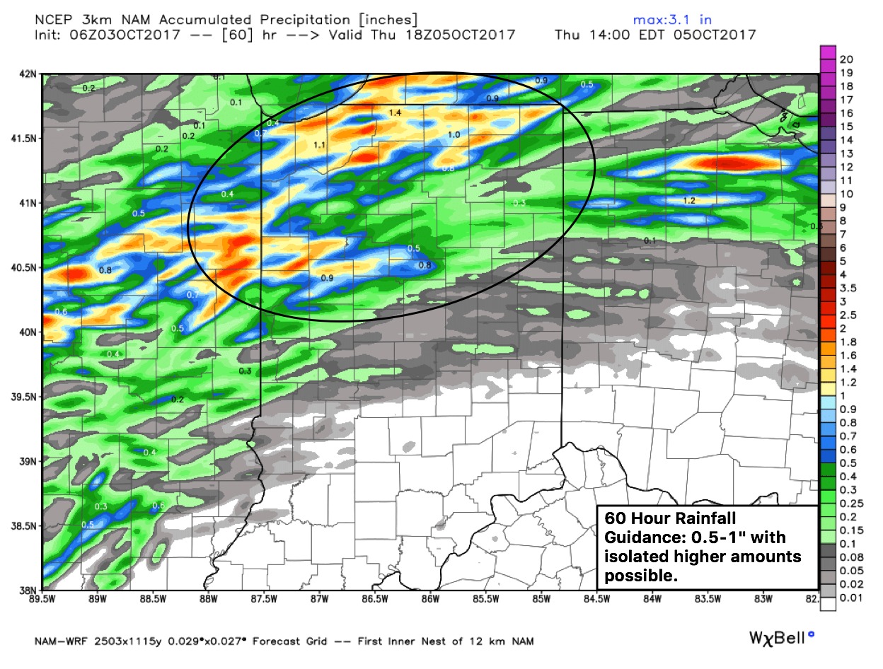
Total rainfall guidance over the next 60 hours:
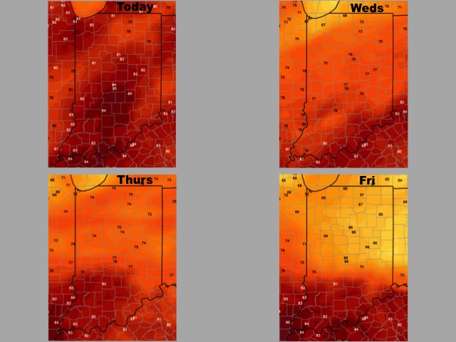
High temperature guidance over the next 4 days:
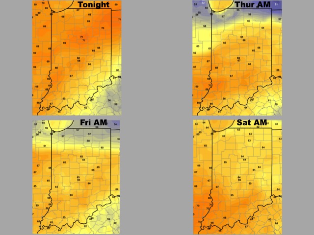
Overnight low temperature guidance over the next 4 mornings:
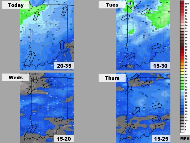
Wind forecast guidance over the next 4 days:
Visibility guidance over the next 4 mornings:
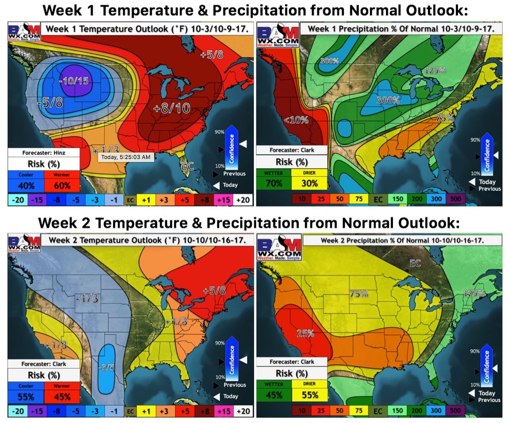
Weeks 1-2 temperature and precipitation outlooks…much warmer than normal with quenching rains for many over the next week; as we move into next week it’s a slightly less active pattern with slightly cooler temperatures closer to “normal”.