Key Points – Friday, October 27, 2017:
Synopsis: Good Friday morning! Today we discuss the rain threat that’s moving east along a cold front later this morning through ~8pm this evening, with colder air rushing in on the backside with a northwest wind. A few slicks spots will be possible Saturday morning before the sunrises and temperatures will warm enough to diminish the threat. We stay chilly on Saturday in the lower 40s, we are watching for additional frost possible Sunday morning as discussed in today’s video. Things trending wetter next week, will have a short-term update later this afternoon for additional updates on this weekend. If you have any questions please let us know, have a blessed day! -Kirk
Today’s video (5 min):
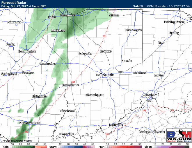
Simulated radar guidance throughout the day today as the cold front works from west to east bringing additional rainfall…the best rain chances will be east of the area:
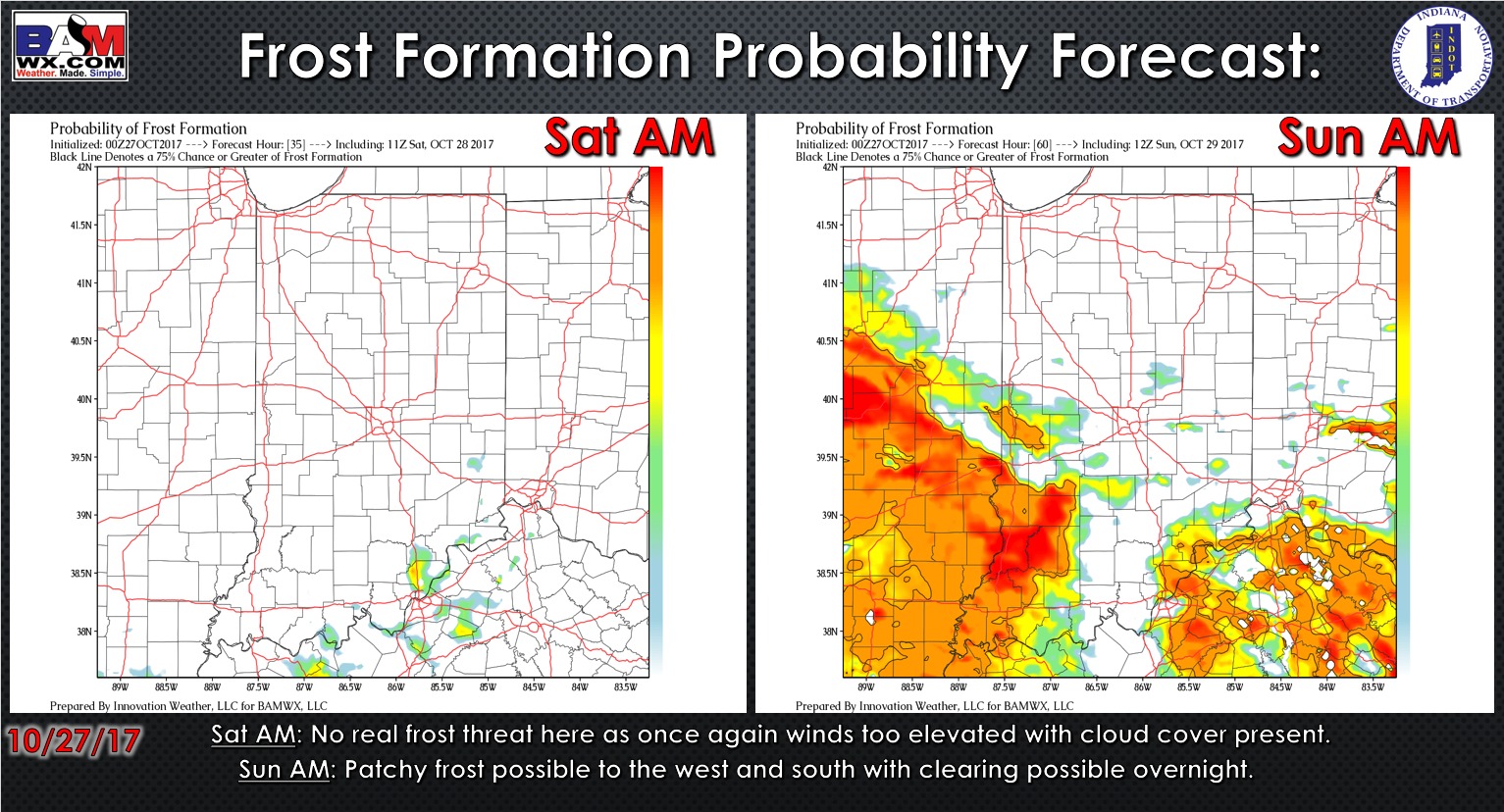
Frost probability tool over the next 2 mornings:
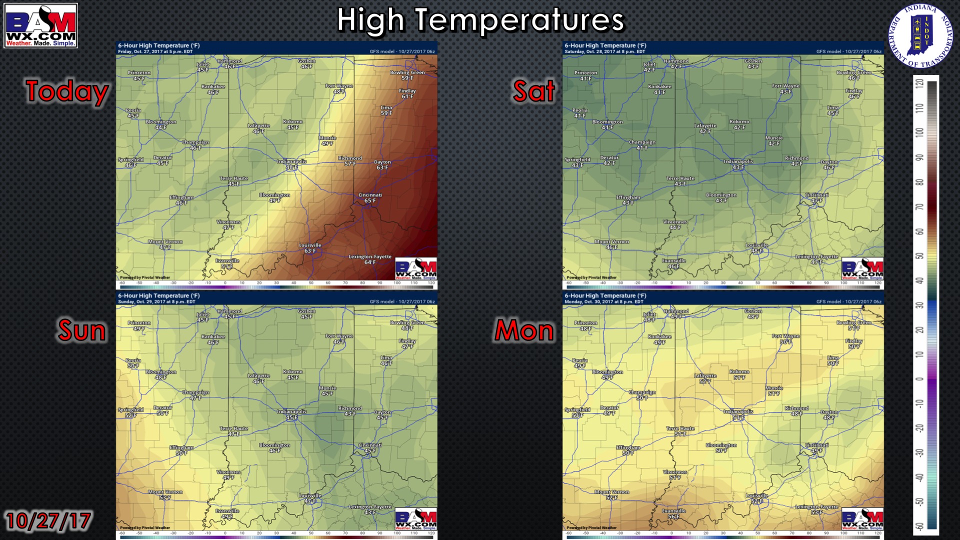
High temperature guidance over the next 4 days:
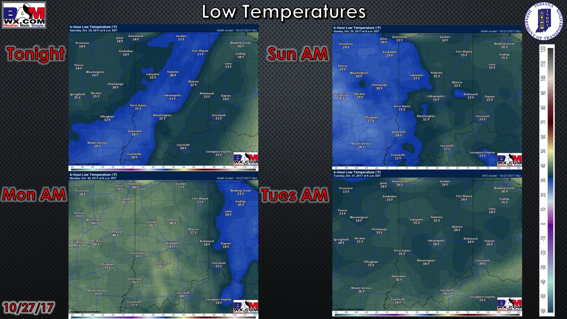
Low temperature guidance over the next 4 mornings:
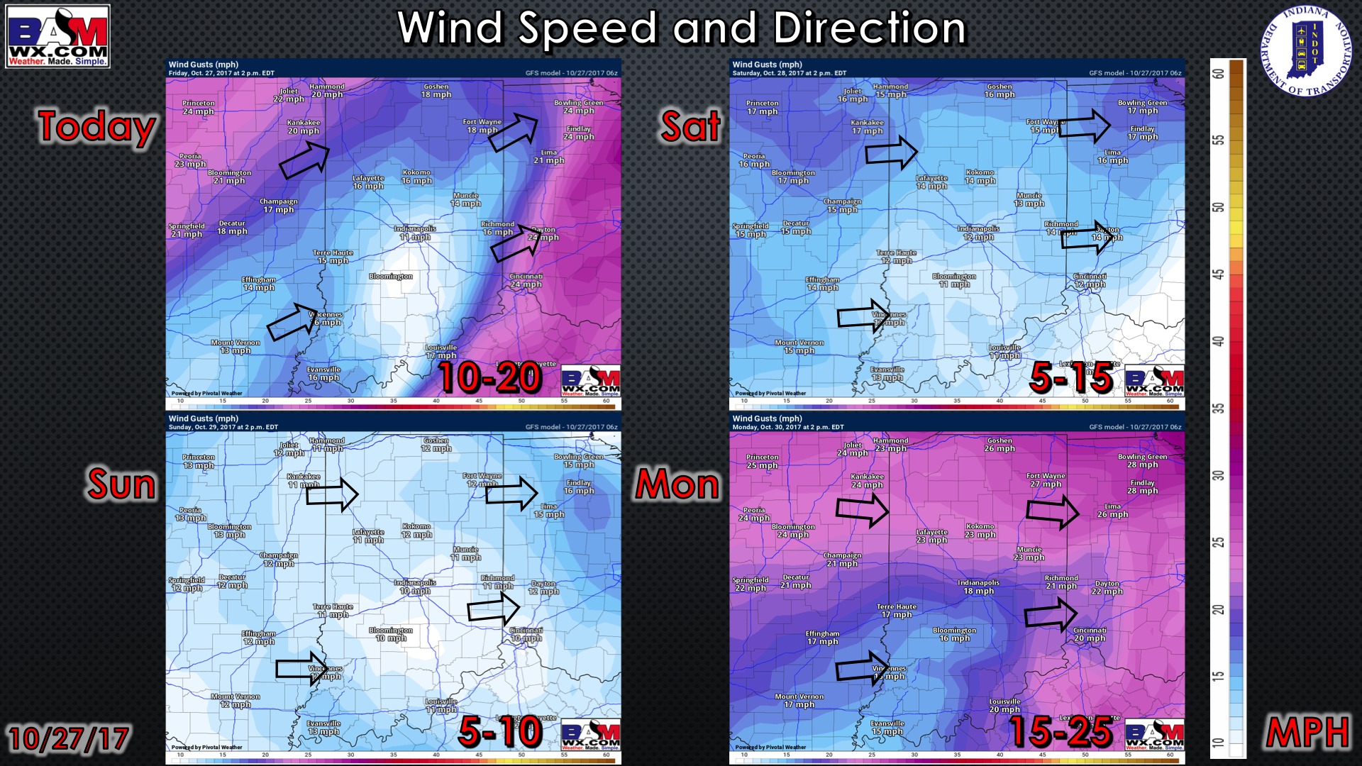
Wind guidance over the next 4 days: