Key Points – Friday, October 27, 2017:
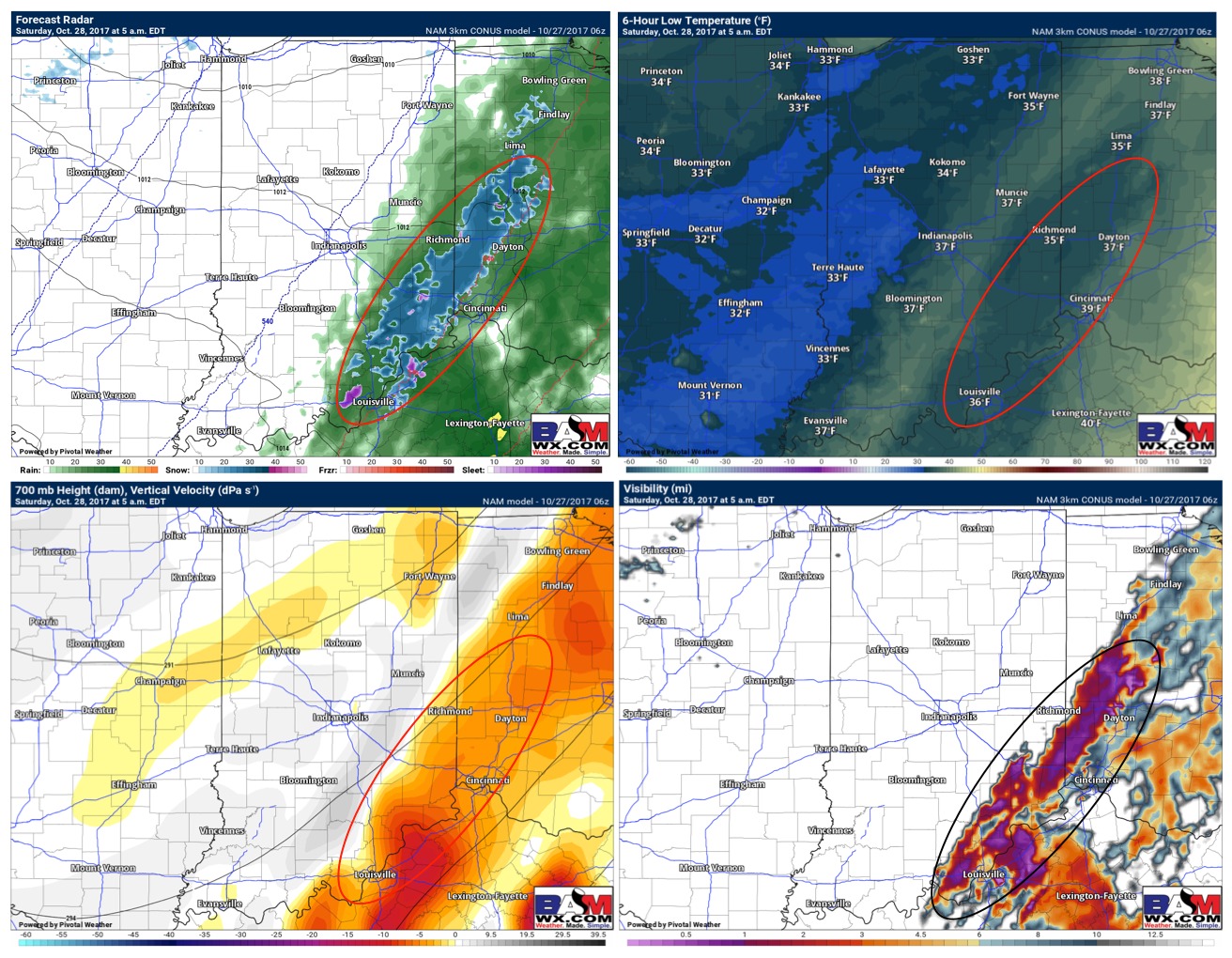
Synopsis: Good Friday morning! Today’s update across the southeast is focused on a wintry mix potential early Saturday morning. Rain showers work in the forecast area afternoon noon today…most of the evening consists of light to moderate rain. We start to see the threat for frozen precipitation to work in ~2-7am…at times some heavy, wet snow will be possible. The air aloft is cold enough for snow, however, the surface temperatures during this timeframe stay at or above freezing. Some slick spots will be possible as the cooler air rushes in, but also, we get winds behind the front to move in with temperatures rising in the upper 30s by mid-morning hours. We stay chilly on the day on Saturday in the upper 30s to lower 40s…in the video we mention some patchy frost waking up Sunday morning. If you have any questions please let us know! -Kirk
Today’s video (6 min):
Eyeing the hours of ~2-7am for the potential for frozen precipitation to mix in across the southeast districts of the state. There may be periods A few slick spots will be possible from ~5-7am but temperatures rise fairly quickly after sunrise with winds aiding in drying out the roads quickly.
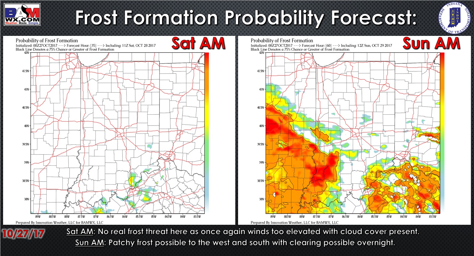
Exclusive probability tool over the next 2 mornings…patchy frost possible on Sunday morning with some skies clearing and winds settling…Saturday, cloud-cover and persistent winds will keep the frost at bay.
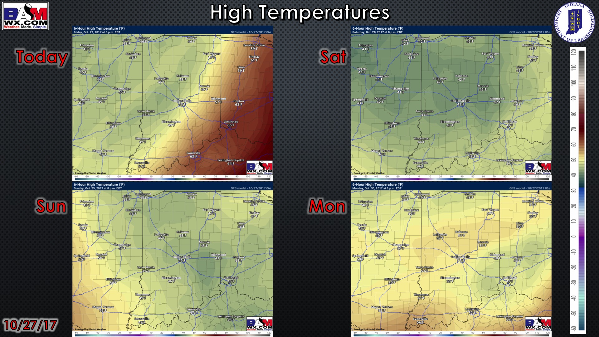
High temperature guidance over the next 4 days:
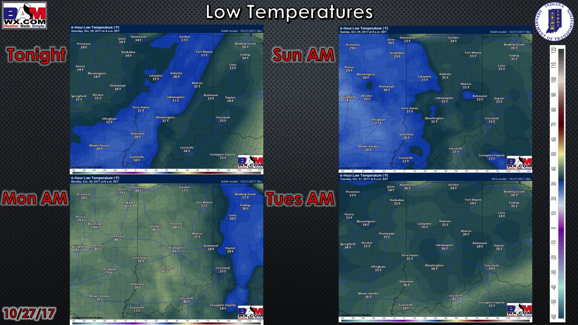
Low temperature guidance over the next 4 mornings:
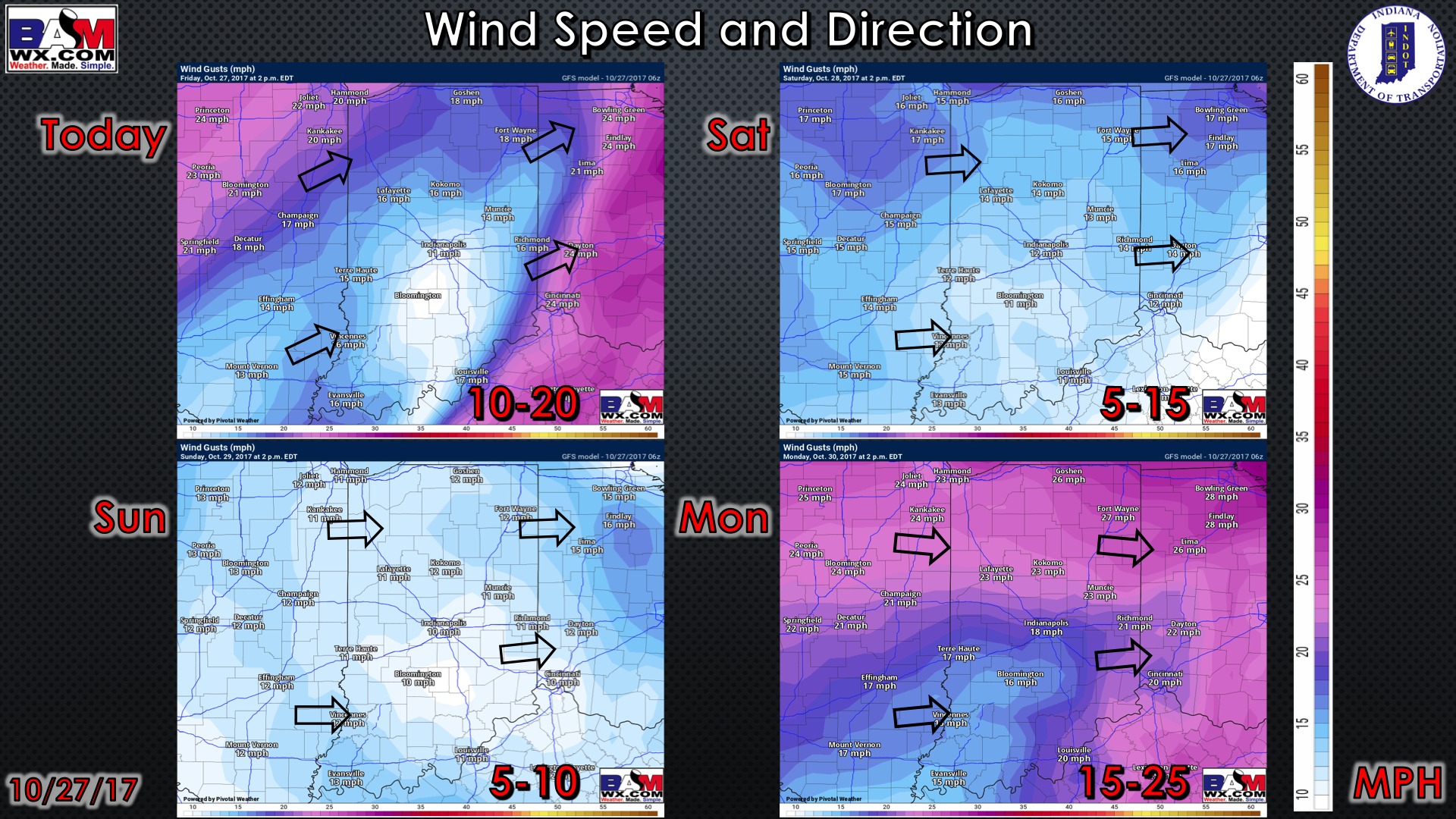
Wind guidance over the next 4 days: