Key Points – Wednesday, October, 25, 2017:
Synopsis: Good Wednesday morning! Majority of temps in the upper 30s to lower 40s…cloud-cover overnight keeping us a little warmer than guidance yesterday. Widespread frost advisories hoisted for Thursday morning frost potential as we are eyeing for temps to get down into the lower 30s even upper 20s in more rural areas as calm winds settle in; can’t 100% rule out a little patchy fog as well, but overall the threat has diminished since yesterday. We discuss in the video our next rainfall chance Friday night along a cold front into Saturday…residual showers lingering into Sunday as well (very raw, fall weekend coming). A few wet snow flakes will be possible pre-dawn hours of Saturday on the backside of the cold front…we do not anticipate currently any accumulation from this at this time nor any hazard to the roadways as the surface temps will be too warm. If you have any questions please let us know, have a blessed day! -Kirk
Today’s video (6 min):
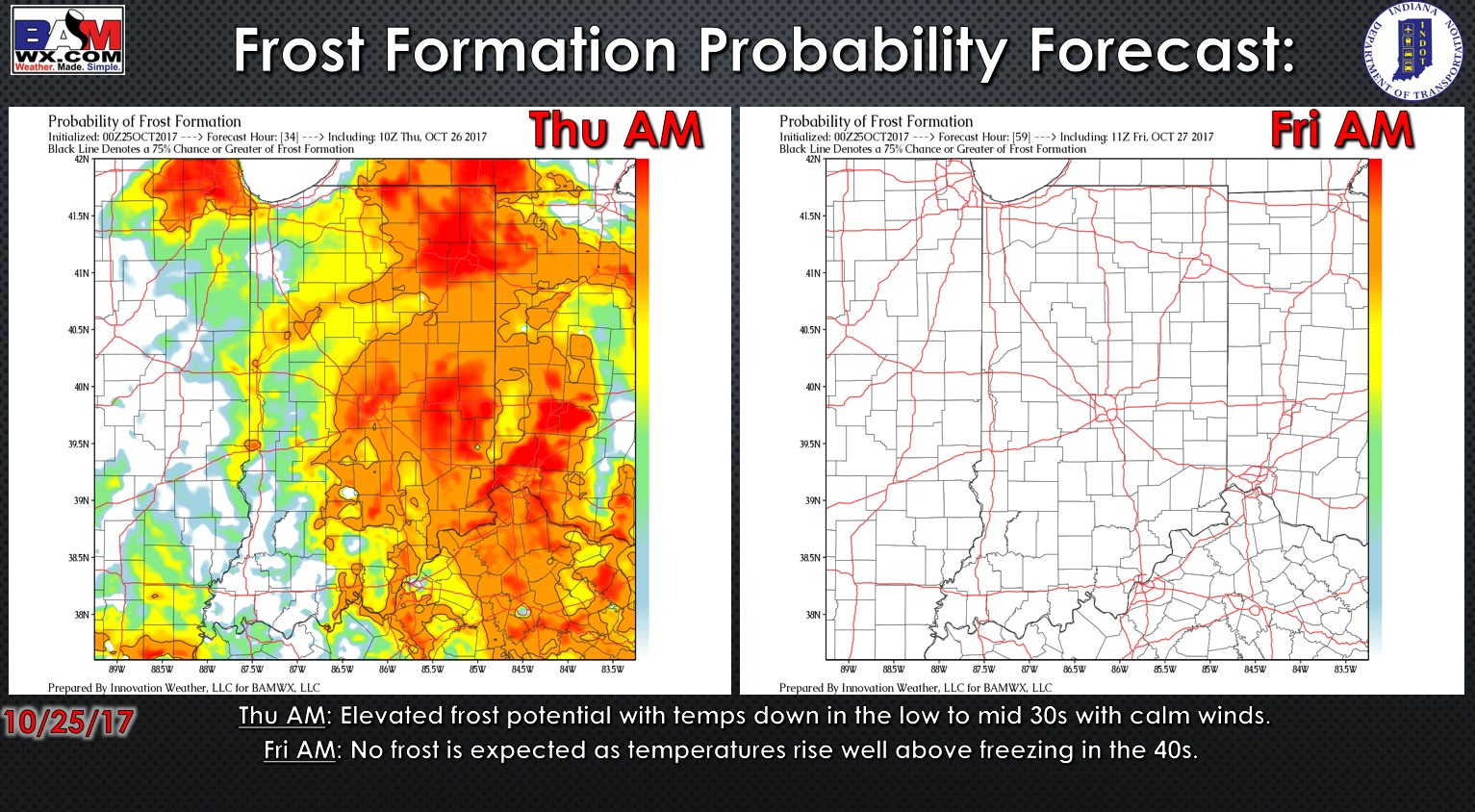
Widespread frost advisories issued for Thursday morning:

Here is the frost potential outlook over the next 2 days:
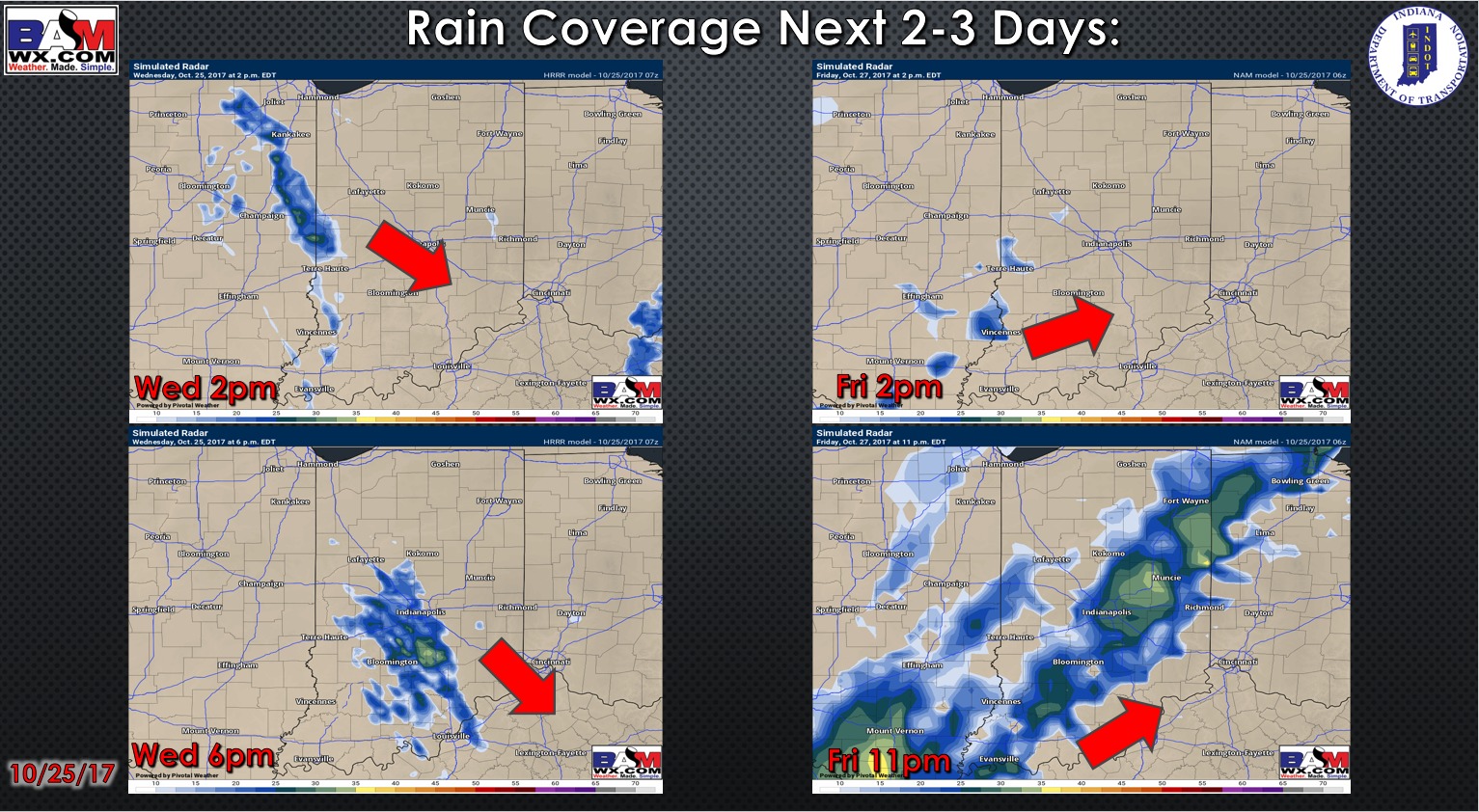
Simulated radar guidance as we go throughout the next 3 days…a few residual showers possible today…the next chance for rain comes later on the day Friday along a cold front:
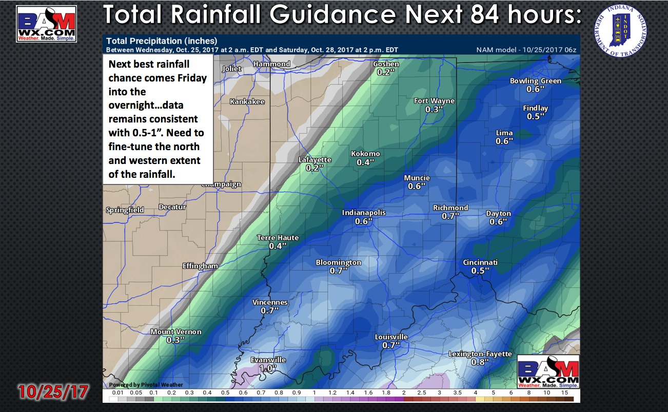
Total rainfall guidance over the next 84 hours:
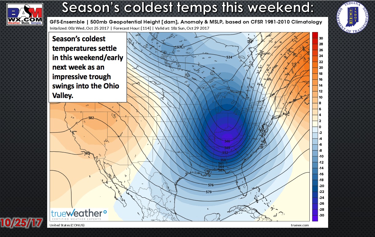
Staying consistently cold as we head into the weekend into early next week as a very deep trough settles in across the Ohio Valley…ushering in cold Canadian air:
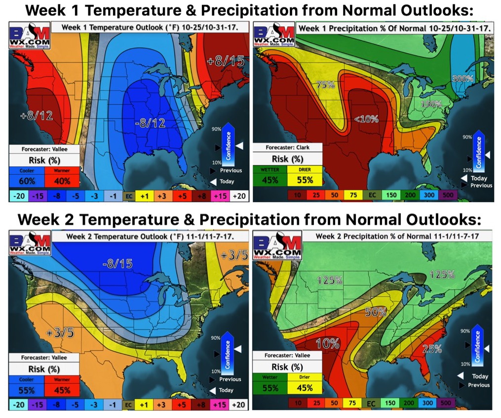
Weeks 1 and 2 temperature and precipitation from normal outlooks:
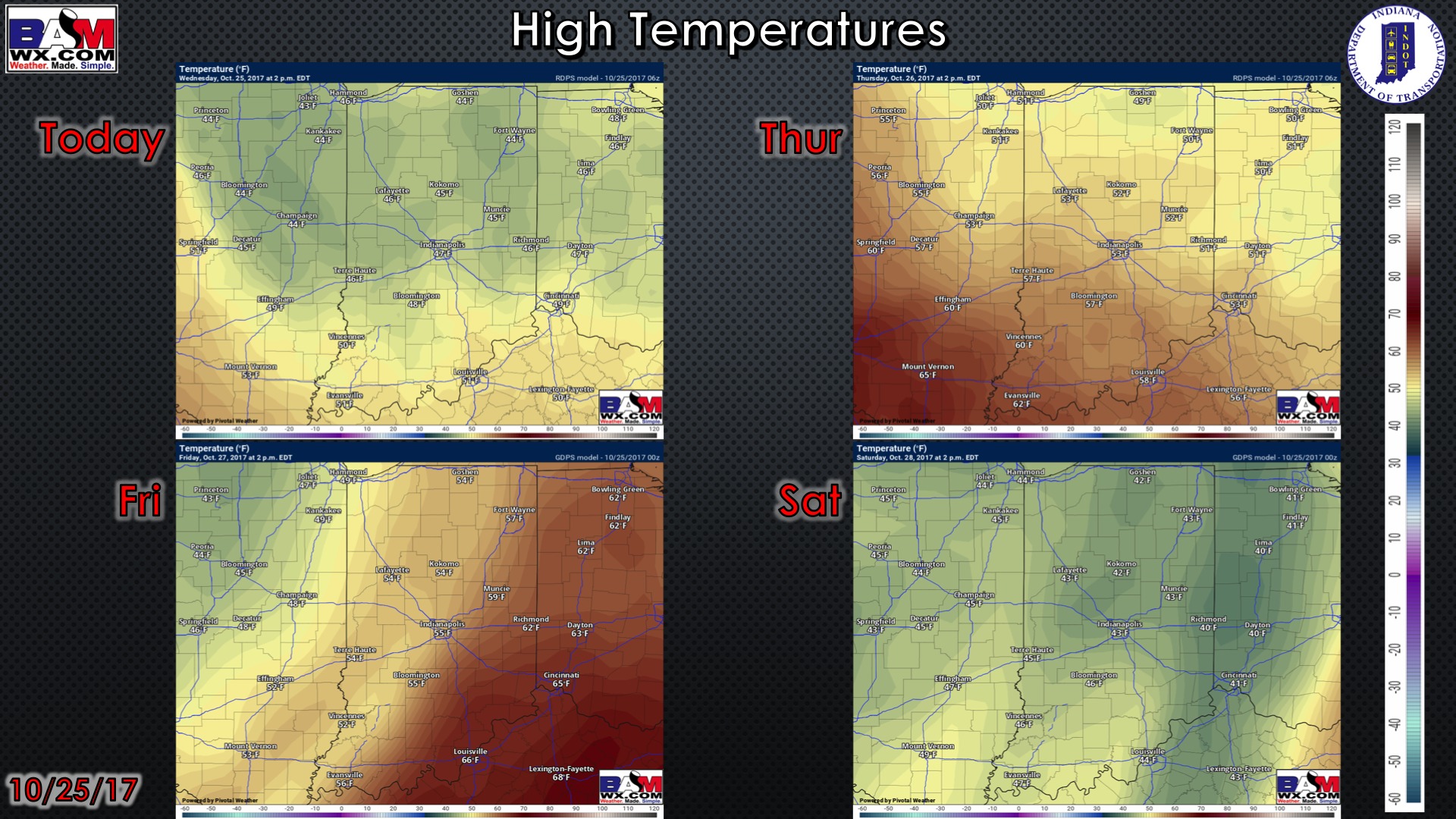
High temperature guidance for the next 4 days:
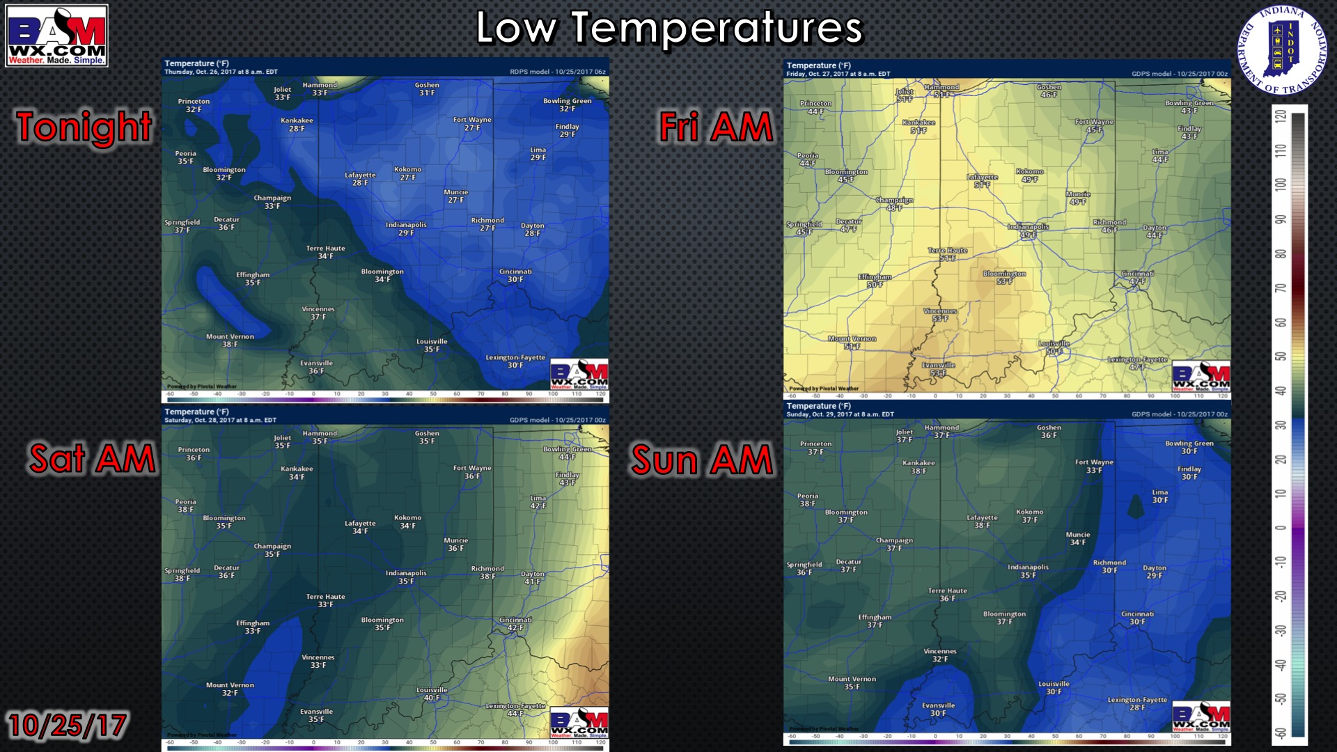
Low temperature guidance for the next 4 mornings:
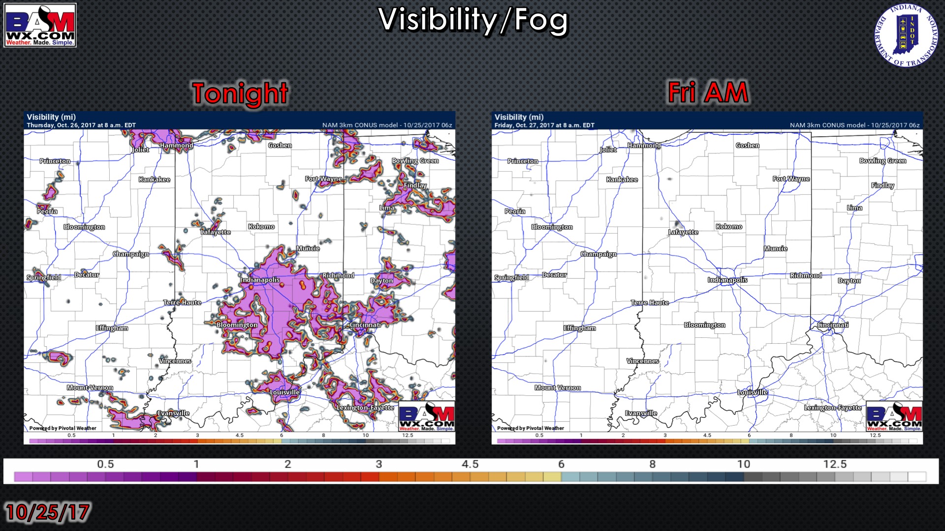
Visibility guidance over the next 2 mornings:
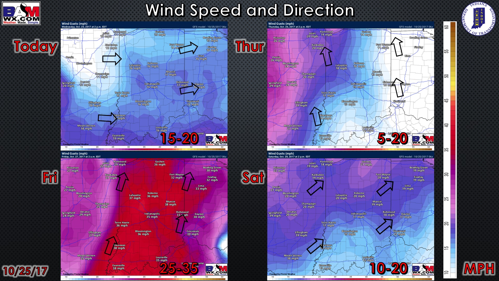
Wind guidance over the next 4 days: