Key Points – Thursday, October 19, 2017:
Synopsis: Good Thursday morning! Waking up to another day of clear skies and cool temperatures, we warm up by a couple degrees throughout the next 3 days under high pressure conditions. No rainfall continues to be the theme until Sunday as the cold front advances east…our latest data has slowed down the front a bit, not having showers into the state until later in the afternoon on Sunday. Current thoughts are light showers with some pockets of moderate showers possible later Sunday evening. We also mentioned in the video the risk for showers to linger into early next week, confidence is low on this mention but we wanted to make sure to relay the risks of this solution. Much cooler temperatures settle in behind the cold front next week as well, likely with many days seeing highs in the 50s. If you have any questions please don’t hesitate to reach out, have a blessed day!
Today’s video (6 min):
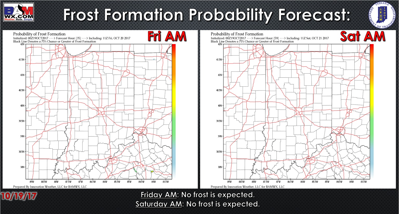
Exclusive BAMwx frost probability forecast over the next 2 mornings is below…with a more southerly wind in place, no frost is expected.
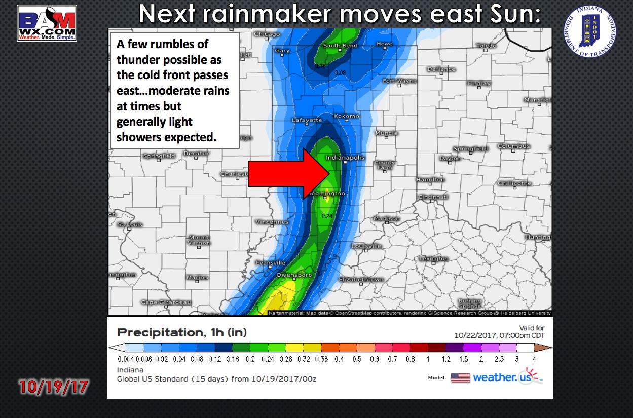
No rainfall expected in the forecast through Sunday as a cold front advances east..periods of moderate rainfall and thunder will be possible.
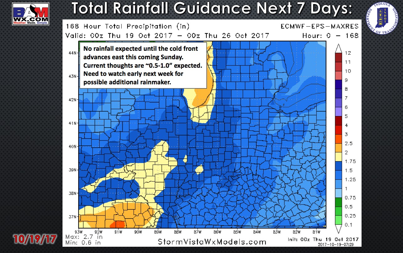
Total rainfall guidance over the next 7 days…no rainfall is expected until the cold front advances east this coming Sunday. Total rainfall guidance right now is ~0.5-1.0″ will be possible. Uncertainty still remains as to the next potential rain maker early next week…current confidence is it’s east, but will need to watch the trends closely.
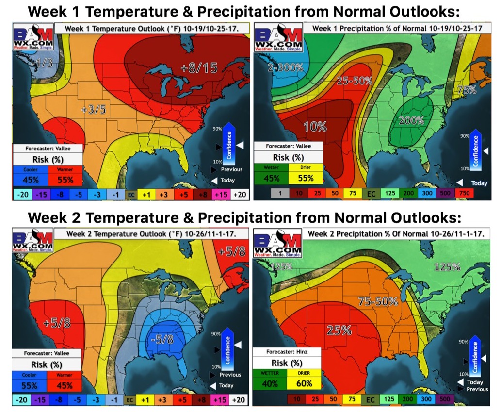
Weeks 1 and 2 temperature and precipitation outlooks:
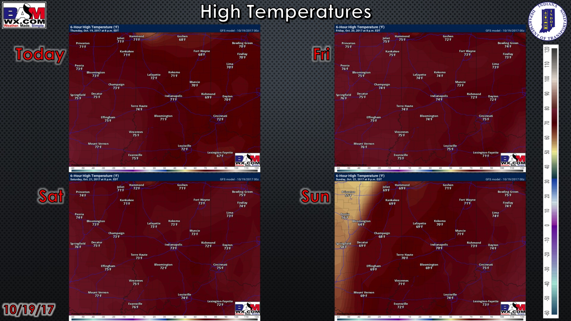
High temperature guidance over the next 4 days:
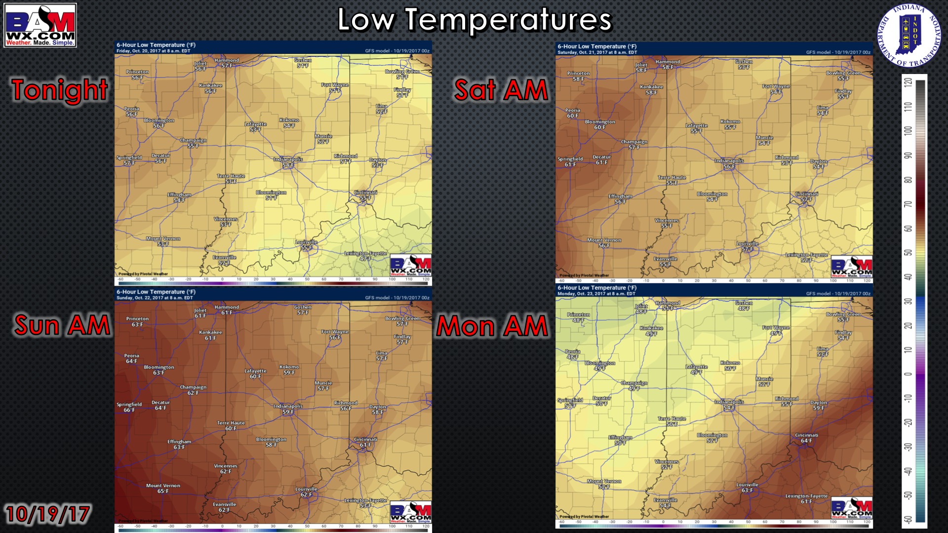
Low temperatures over the next 4 mornings:
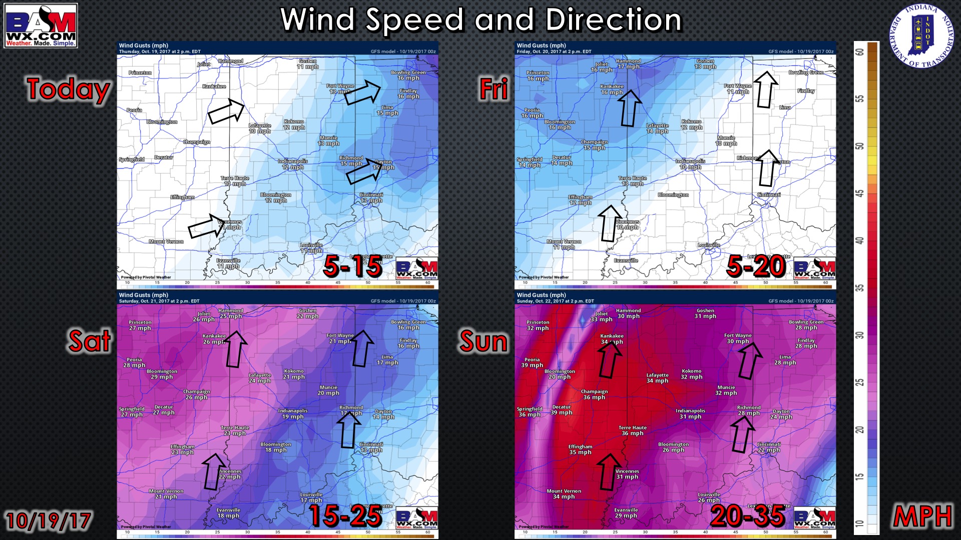
Wind forecast over the next 4 days:
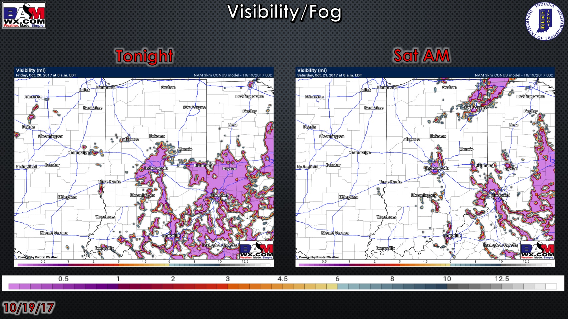
Visibility forecast over the next 2 mornings…a few areas of patchy dense fog will be possible Friday and Saturday mornings: