Key Points – Wednesday, October 18, 2017:
Synopsis: Good Wednesday morning! Very little changes to the forecast today, a nice stretch of quiet weather and more mild temperatures as we head into early weekend before our well anticipated cold front sweeps from west to east bringing some light-to-moderate showers and a few rumbles of thunder possible on Sunday. The cold air will trail in behind this front bringing a chilly northwest wind in…this will likely bring some lake effect showers for locations to the north into early next week, however, the majority of next week continues the dry trend across the state. In today’s video we discuss the latest winter data released today as well, you won’t want to miss it! If you have any questions please let us know, have a blessed day! -Kirk
Today’s video (5 min):
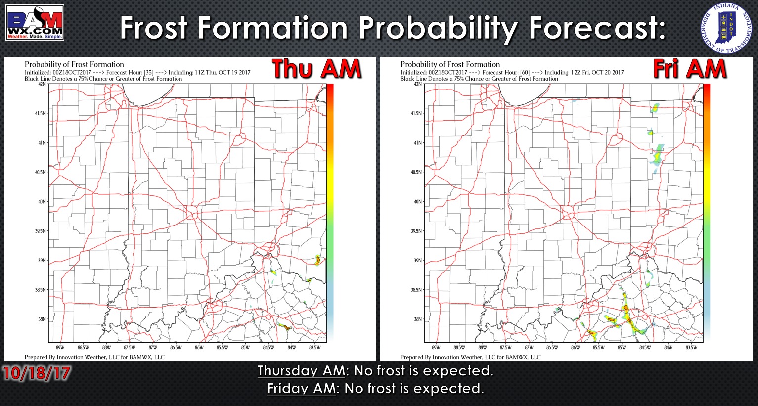
Exclusive BAMwx frost probability forecast over the next 2 mornings is below…with a more southerly wind in place, no frost is expected.
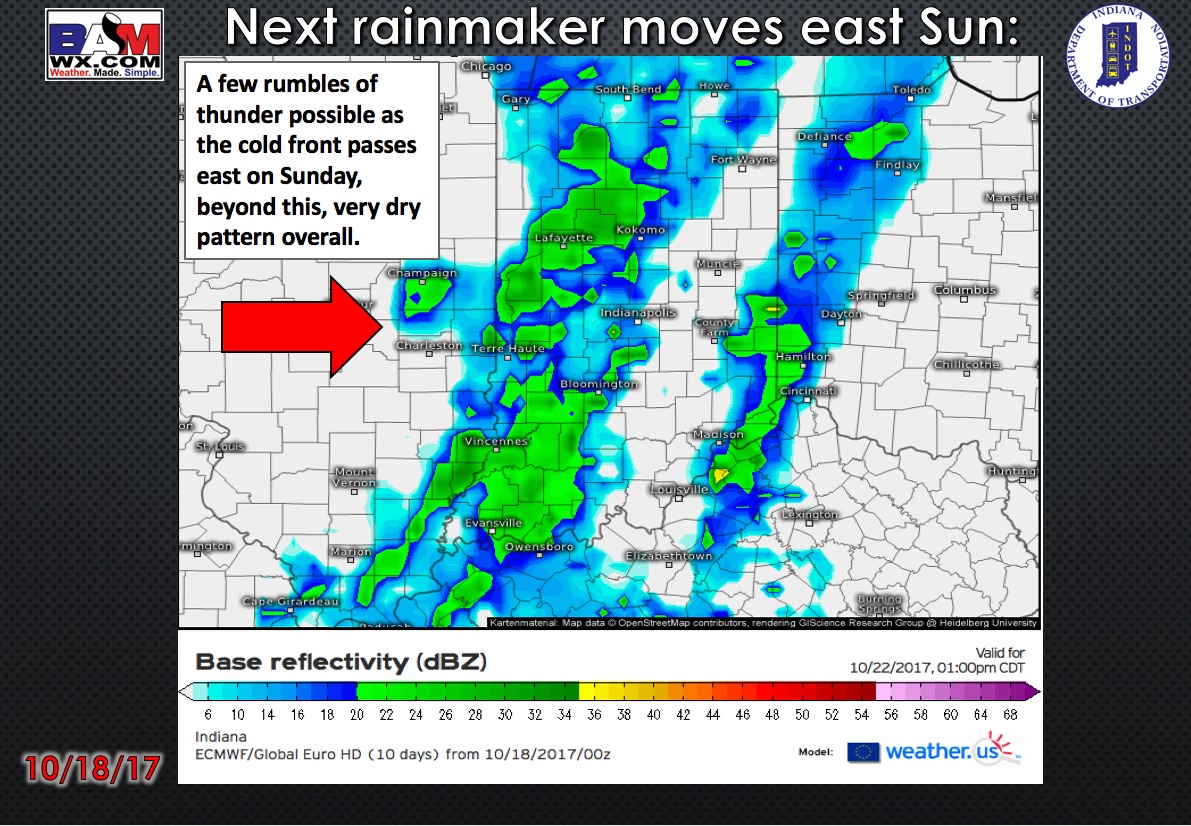
No rainfall expected in the forecast through Sunday as a cold front advances east..periods of moderate rainfall and thunder will be possible.
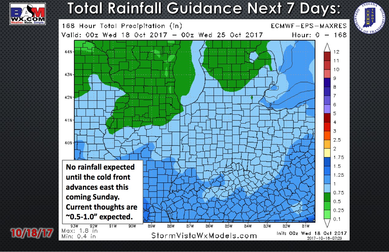
Total rainfall guidance over the next 7 days…no rainfall is expected until the cold front advances east this coming Sunday. Total rainfall guidance right now is ~0.5-1.0″ will be possible.
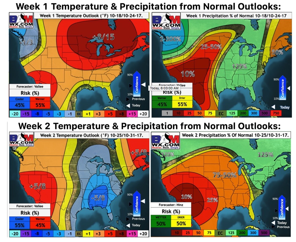
Weeks 1 and 2 temperature and precipitation outlooks:
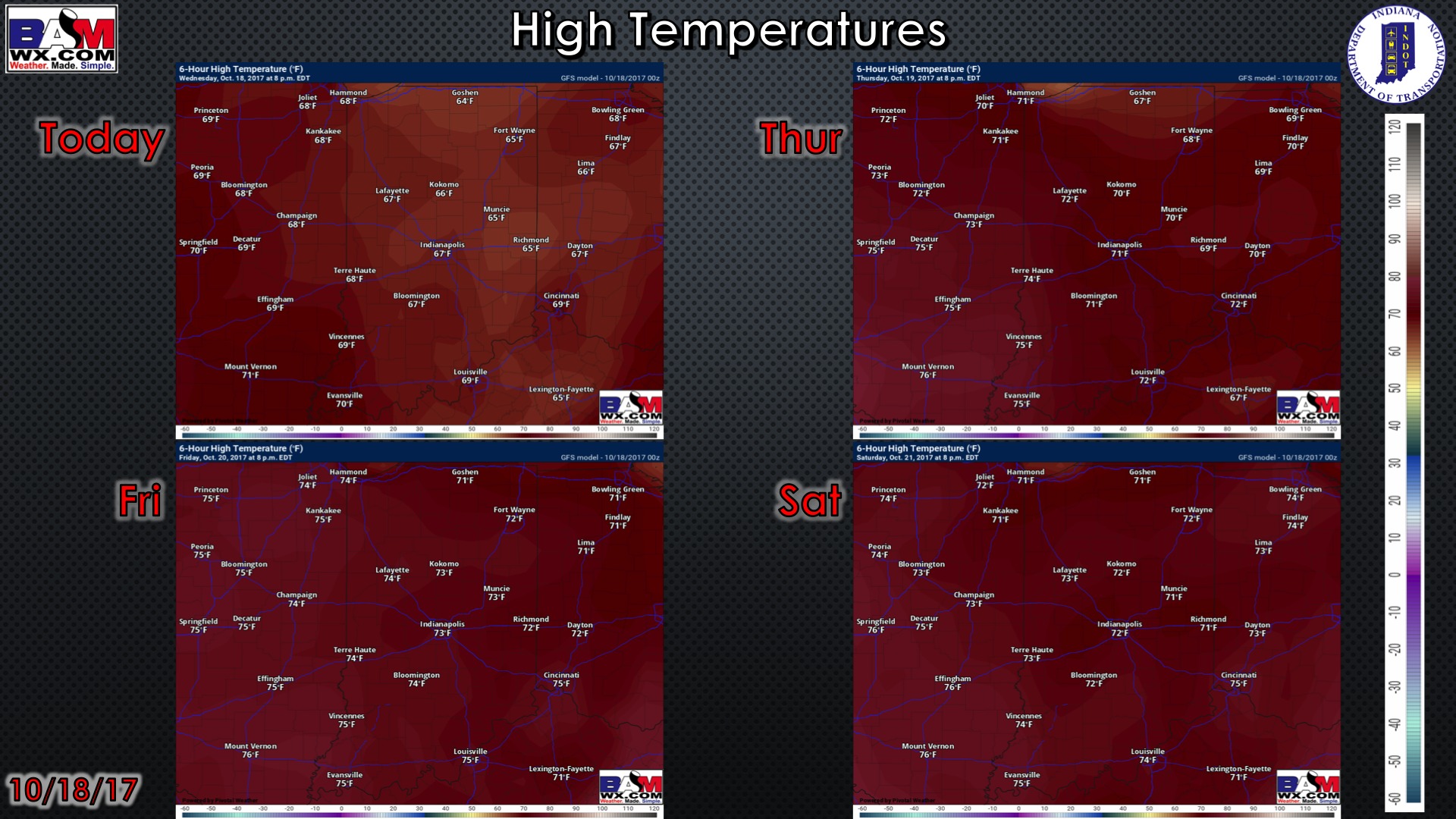
High temperature guidance over the next 4 days:
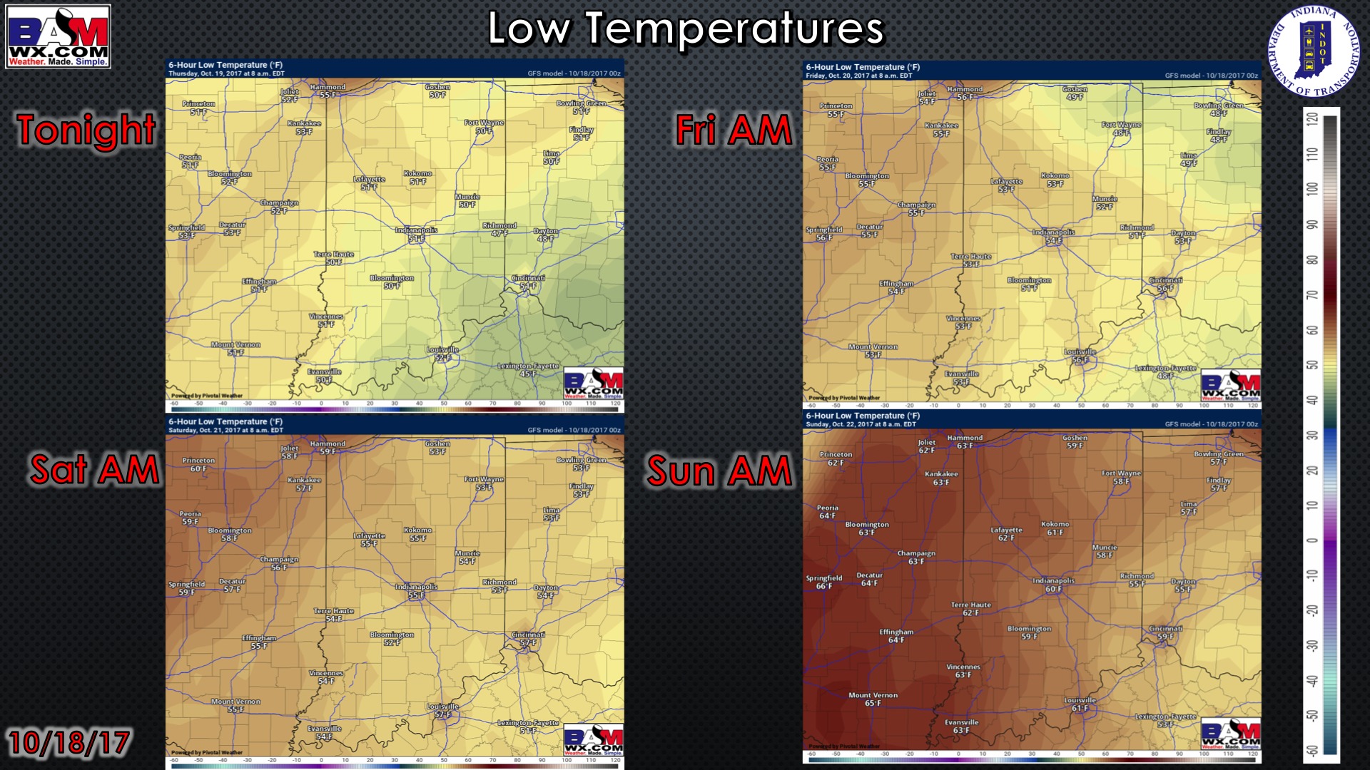
Low temperatures over the next 4 mornings:
Wind forecast over the next 4 days:

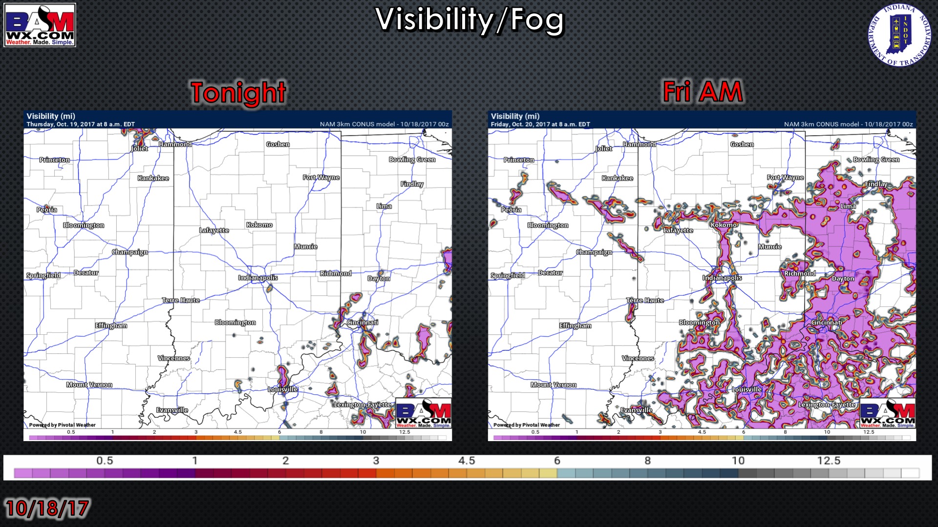
Visibility forecast over the next 2 mornings…can’t rule out very patchy fog especially near bodies of water and low-lying areas.