Synopsis: Good Friday morning! Patchy fog is noted across the forecast area this morning. We expect brighter skies today with the return of some sunshine, which will make for a warmer afternoon into the lower 70s. Nice weather continues on Saturday all across southern Indiana, with much warmer temperatures near 80º. A front looks to pass through Sunday morning, with showers from late Saturday night into mid-afternoon Sunday. Once the front passes, high pressure settles in for much of next week with very nice weather.
Today’s forecast video:
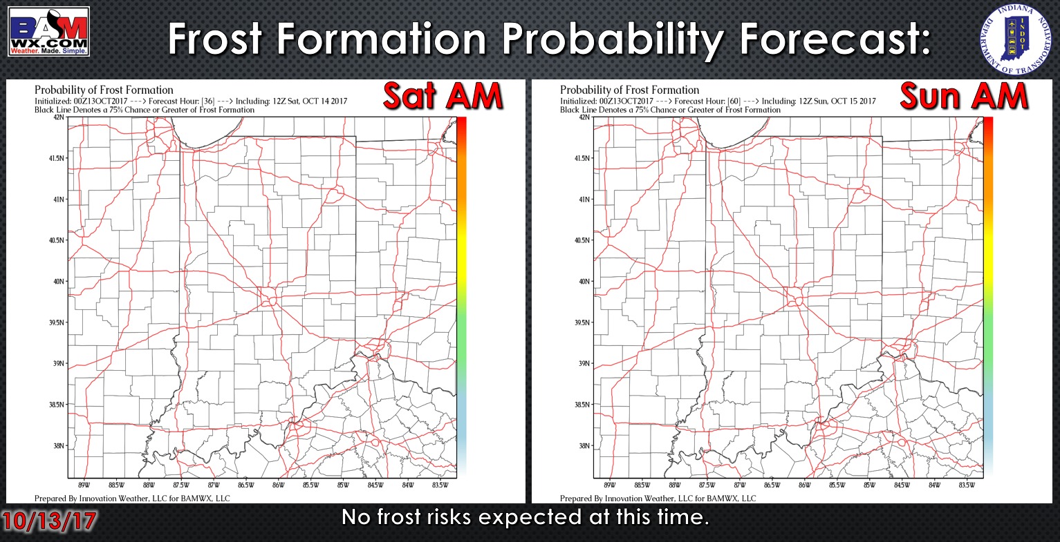
Exclusive BAMwx frost formation probability forecast over the next 2 days is shown below. No concerns for any frost with warm lows over the next two mornings.
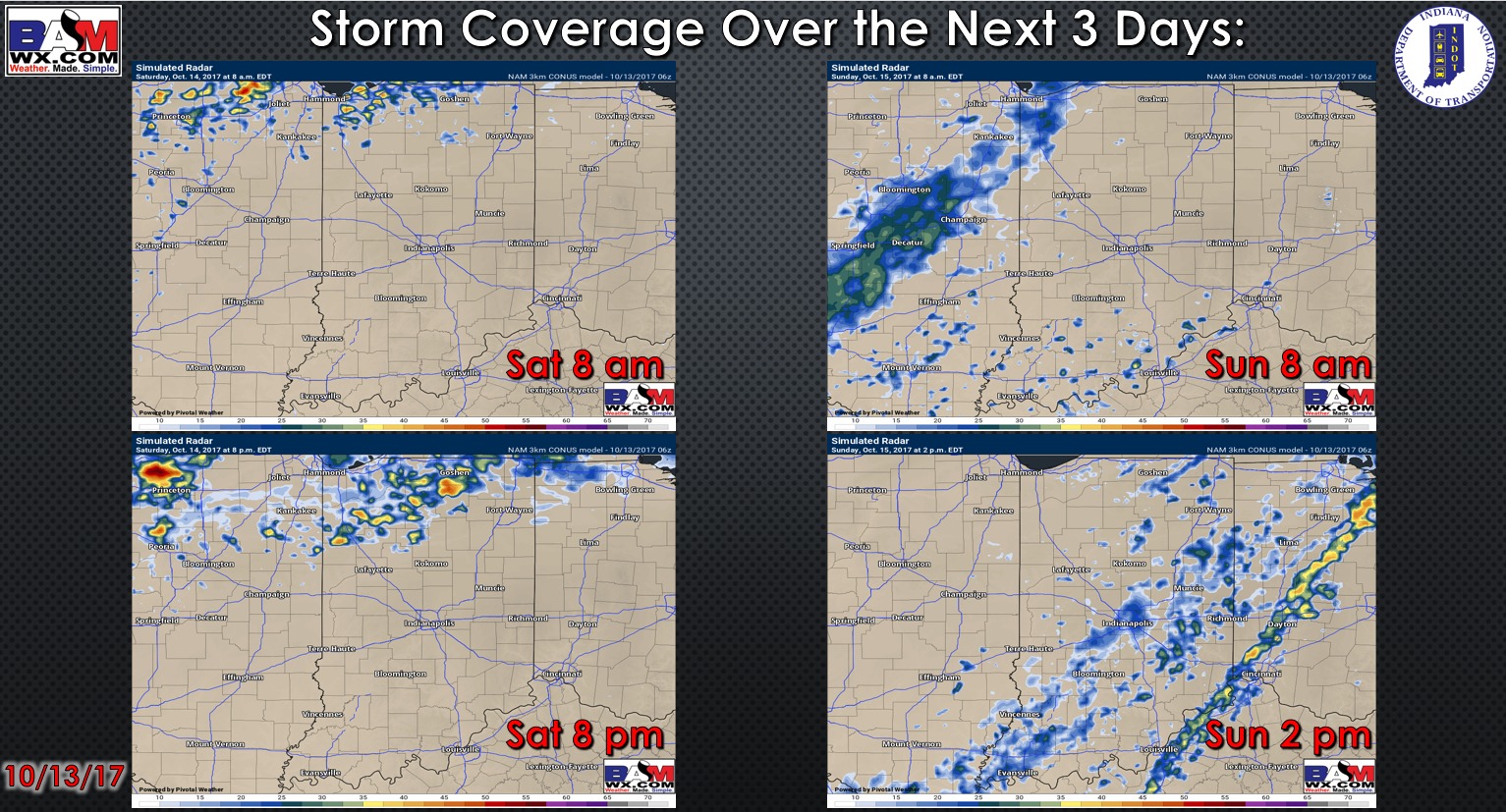
Here is a look at the rainfall coverage forecast on Saturday and Sunday. Expect dry conditions on Saturday with the return of showers late Saturday night and continuing into the mid-afternoon hours Sunday. These showers will be light and storms are not expected.
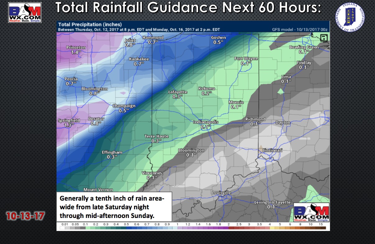
Rainfall totals will be light with an area-wide tenth inch of rain:
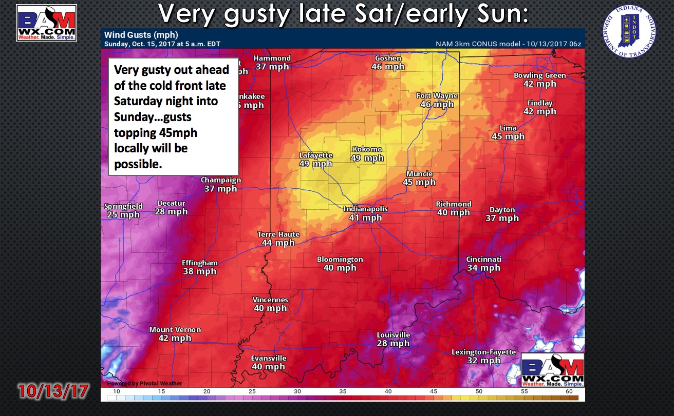
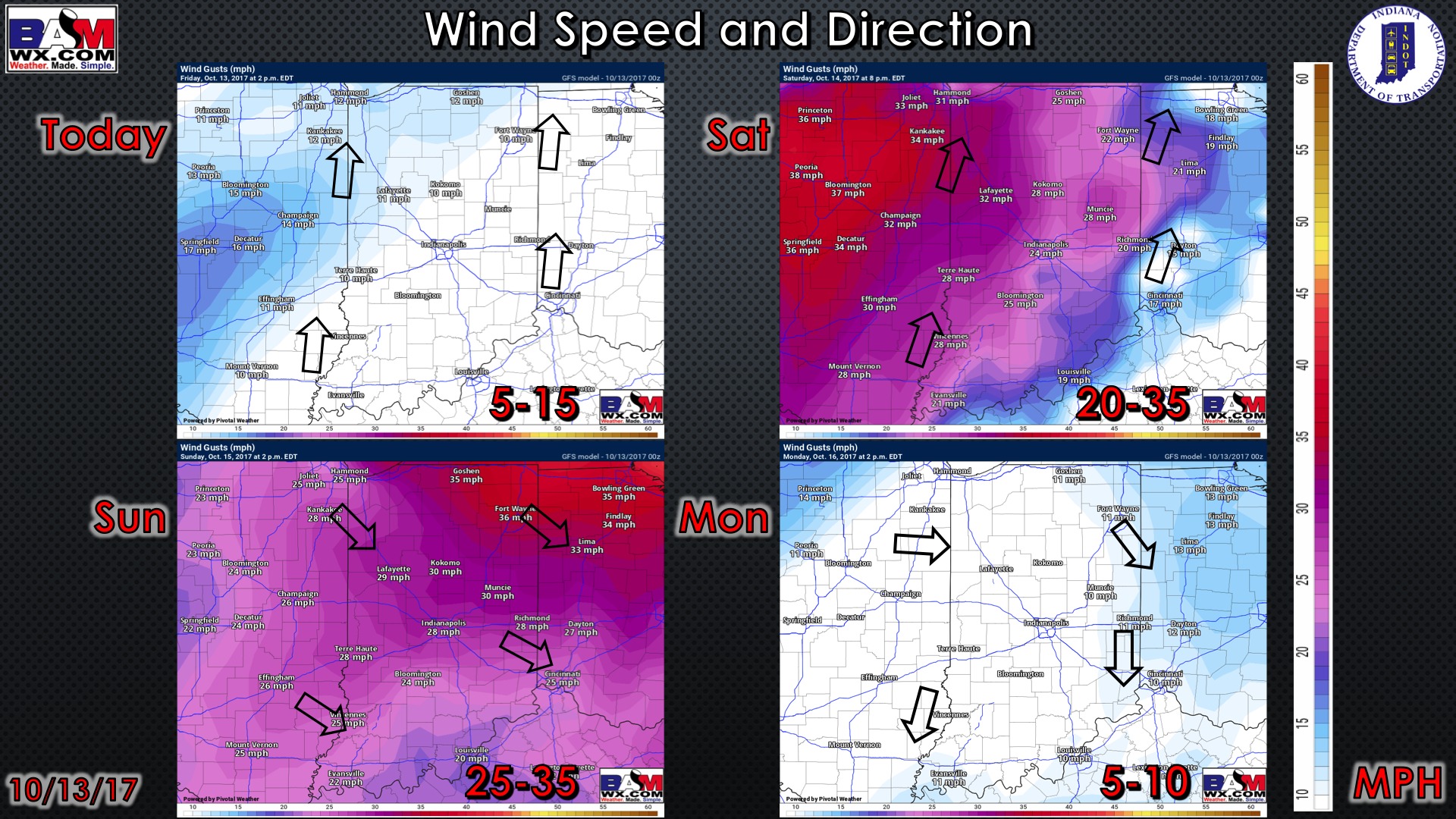
Expect windy conditions to develop Saturday night and Sunday morning as the front passes. Gusts up to 40 mph possible. Posted below are the forecast wind gusts at 5am EDT Sunday:
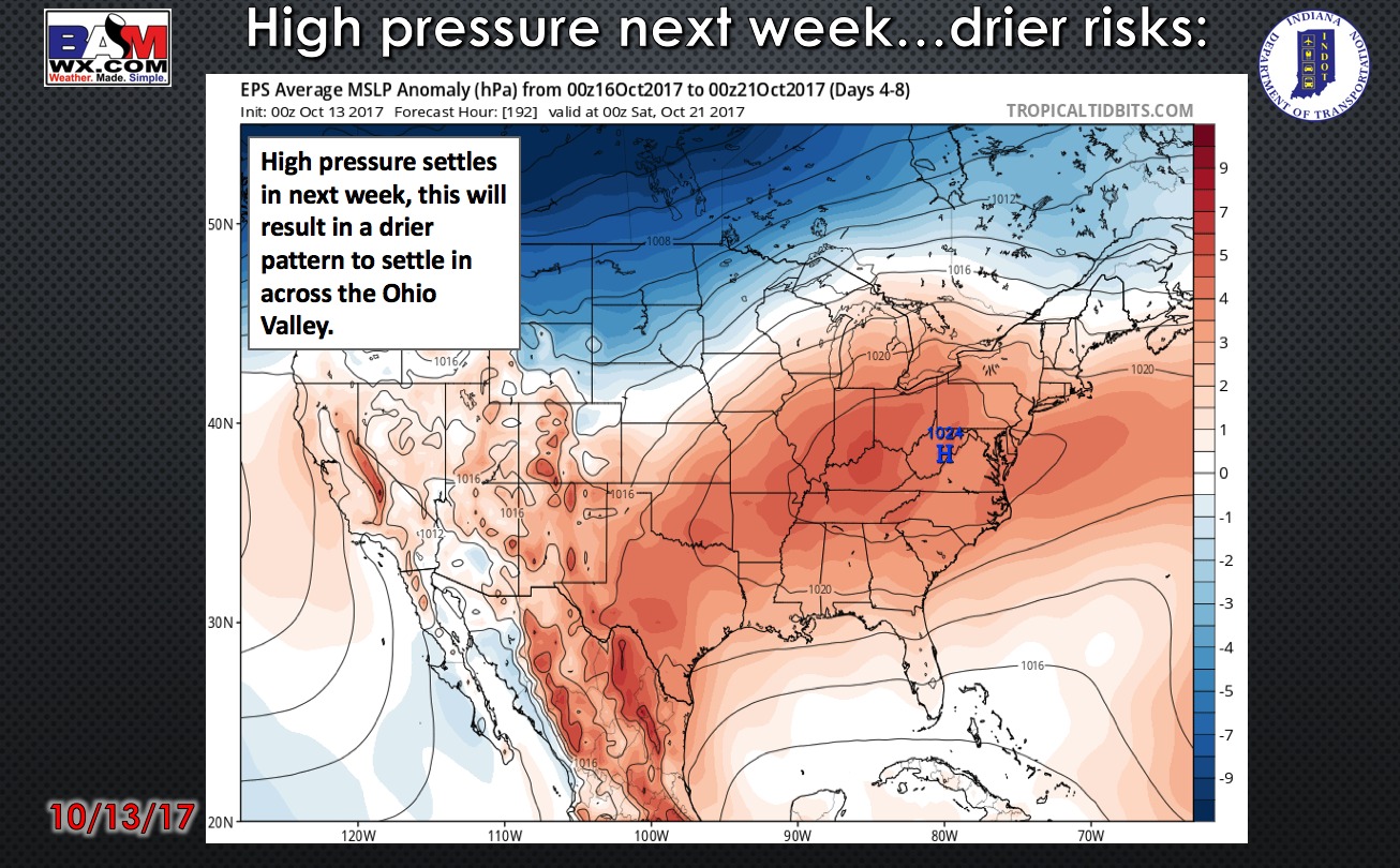
Expect temperatures to turn sharply cooler Sunday afternoon and evening as the front passes. A quiet weather pattern is in store for much of next week. Expect mostly sunny days and clear nights.
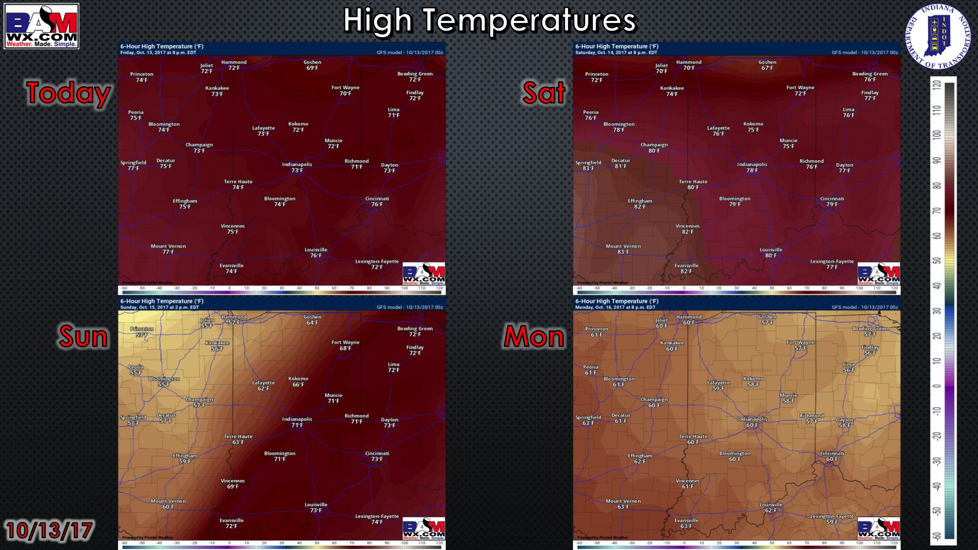
High temperatures over the next 4 days (keep in mind the highs on Sunday will be reached in the morning hours as temperatures fall in the afternoon):
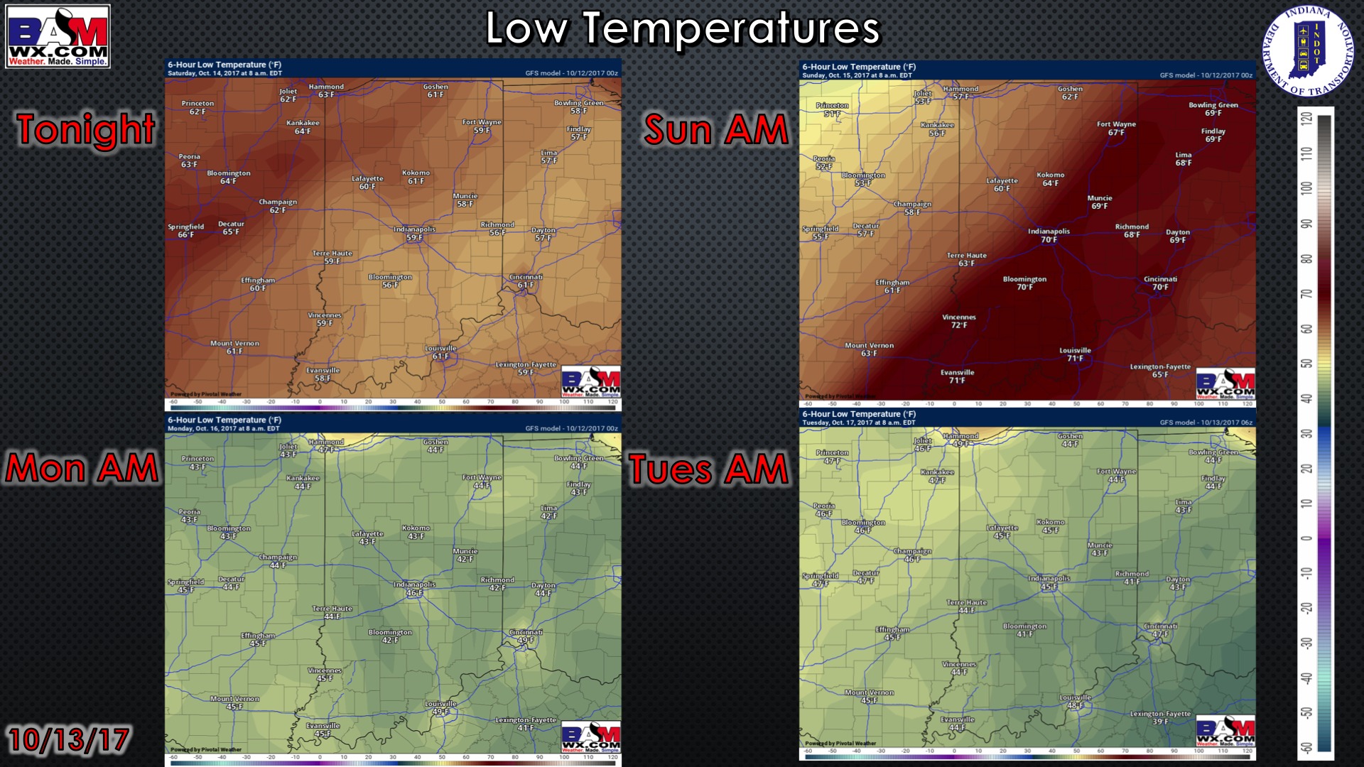
Low temperatures over the next 4 mornings…chilly next Monday and Tuesday morning!
Wind forecast over the next 4 days:
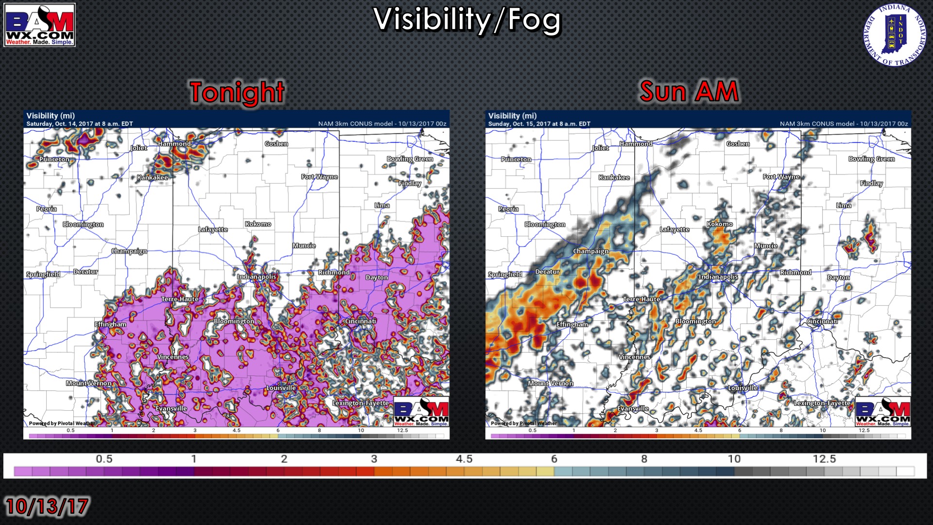
Visibility forecast over the next two nights…need to watch tonight and early Saturday for dense fog.
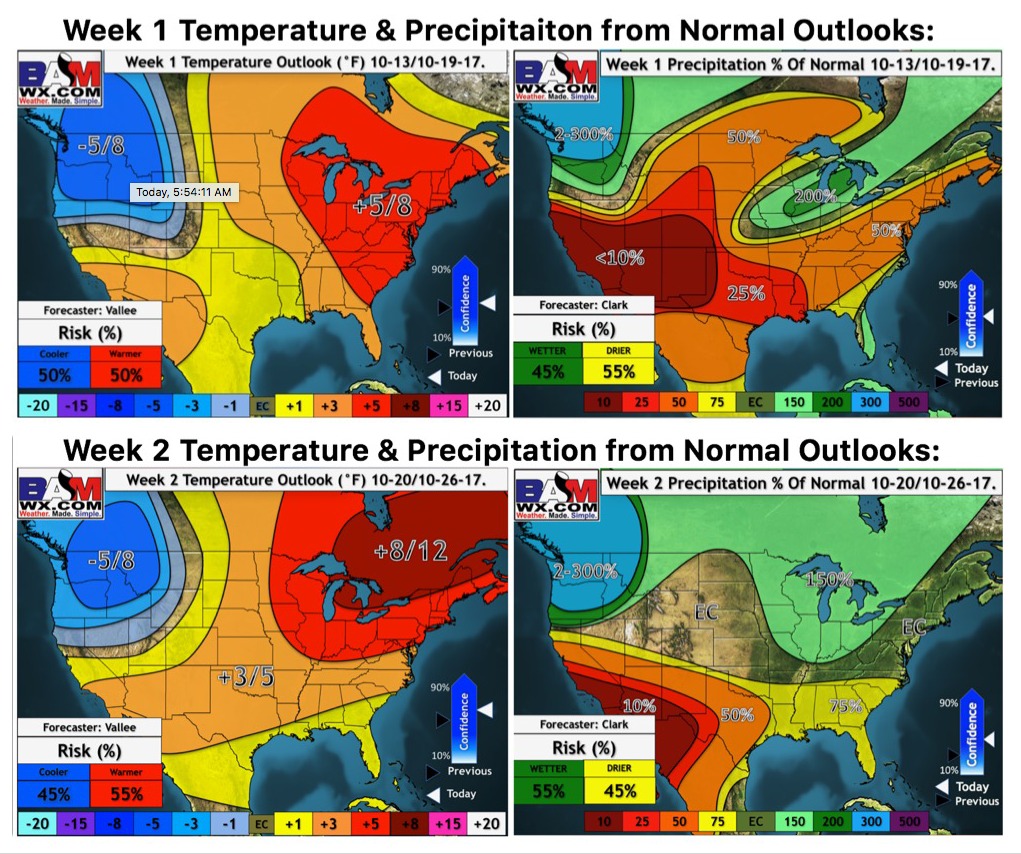
Weeks 1 and 2 temperature and precipitation outlooks:
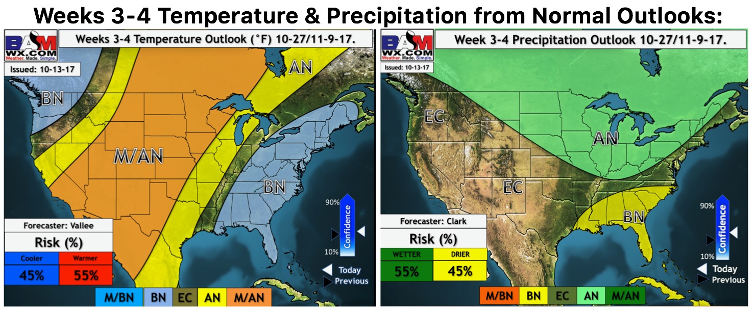
Weeks 3 and 4 temperature and precipitation outlook…we are looking at the risk for cooler temperatures as we end the month.