12:30 PM ET Update:
Click here for Nowcast/Timing Graphic: https://bamwx.com/wp-content/uploads/2023/01/Screenshot-2023-01-26-at-12.09.47-AM.png
Click here for Snowfall Accumulations: https://bamwx.com/wp-content/uploads/2023/01/Screenshot-2023-01-26-at-12.01.14-AM.png
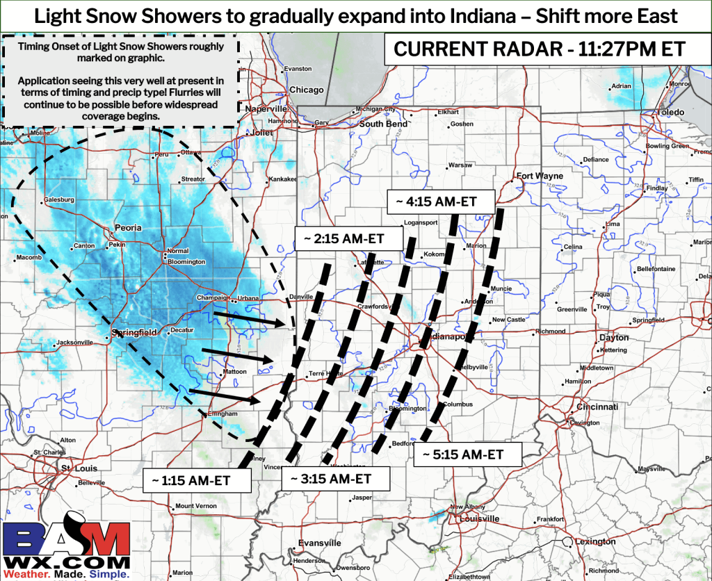
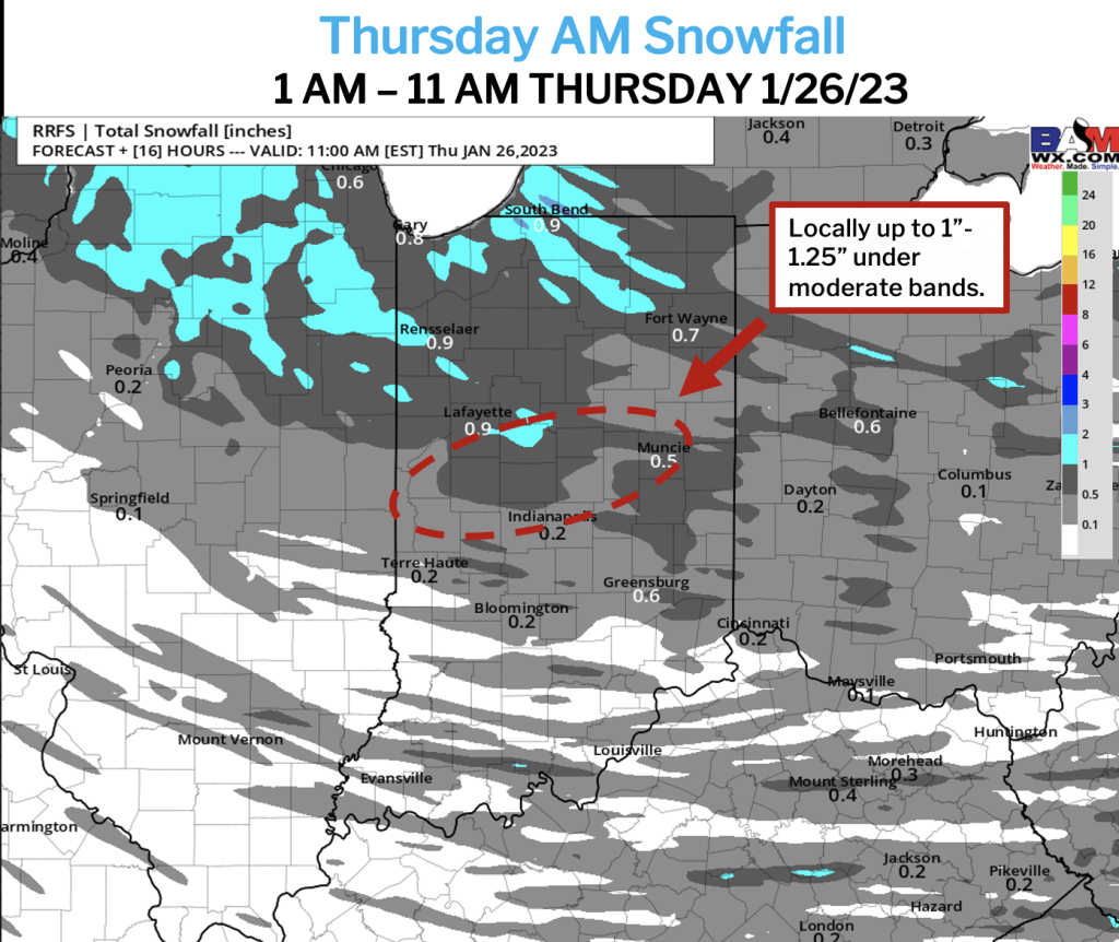
Bottom Line: Monitoring additional, light snow showers pushing eastward towards the IN/IL border. While flurries will continue to be possible for your area over the next few hours, more widespread coverage anticipated to spread over C Indiana. Despite better chances of snow shifting a bit southward towards Indianapolis, better moisture remains to the N of I-70, where a favored corridor of locally higher totals will be possible by 8AM-ET. ALL pavement in this zone will especially need to be monitored following arrival of activity, despite prior treatment. Please see latest nowcast/timing and snowfall graphic for additional details, and reach out if you have any questions.
–John