
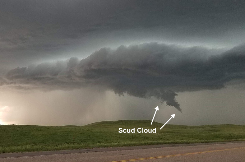
When severe weather enters your area, ominous clouds can fill the sky. A lot of times we will receive false reports of funnel clouds due to a low-lying cloud called a scud cloud.
 By Hope Kleitsch
A scud cloud looks awfully similar to a funnel cloud, however, these clouds are completely harmless. Scud clouds are very commonly found on the leading edge of storms.
The formation of a scud cloud is usually found in areas where it is extremely humid. Normally, warm, moist air is lifted into the updraft part of the storm. The air must cool to the temperature in the upper part of the atmosphere, to then condense into a cloud. 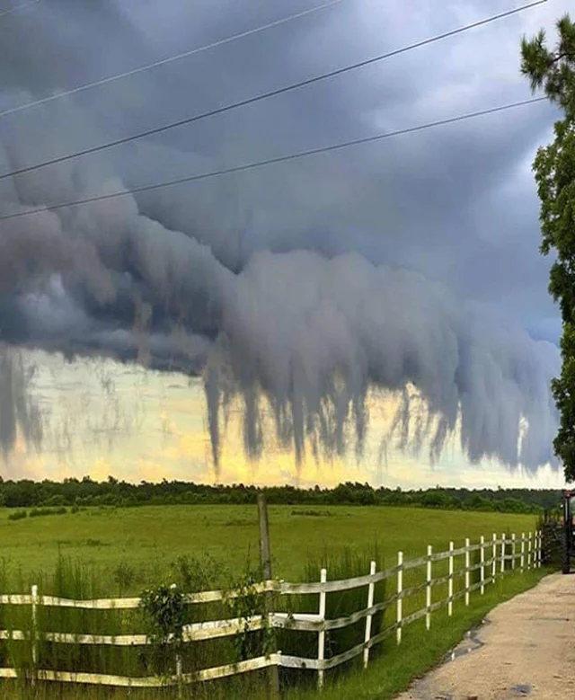
With scud clouds, however, the air is filled with so much moisture that it cannot wait until the upper layers of the atmosphere to condense. Instead, it condenses lower than the cloud deck and forms into the low-hanging clouds that we see!
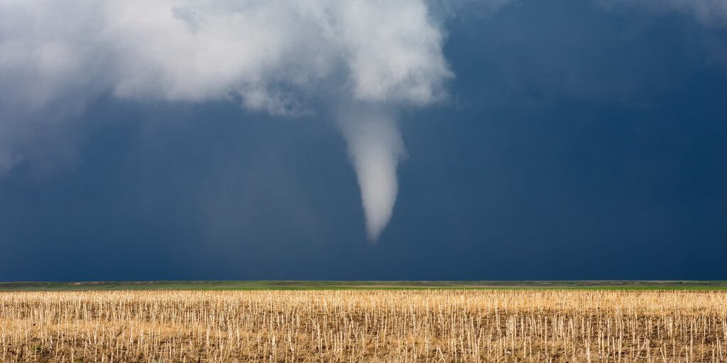
It is important to note the difference between the harmless scud cloud and a potentially harmful funnel cloud. Funnel clouds are the beginning stages of a tornado. Once a funnel cloud reaches the ground, it is then considered a tornado.
Funnel clouds form in a much different way. They form out of a wall cloud, which is a rotating disk-like cloud that descends from the cloud deck. A funnel cloud is essentially a rotating, vertical cloud that must be connected to the wall cloud above.
| Here’s how you can tell the difference between scud clouds and funnel clouds: | ||
| Scud Cloud | Funnel Cloud | |
| Shape | Ragged and wispy | Column or pipe-like |
| Rotation | No rotation | Tight rotation |
| Cloud Connection | Seemingly disconnected | Connected to the disk-like cloud above |