
As we get further into March and severe weather season gets fully underway, it’s important to understand the different types of storms and how they can impact your region. The three we will discuss are Supercells, Pulse or “Pop-Up” Storms, and Storm Complexes.
By John Kemper
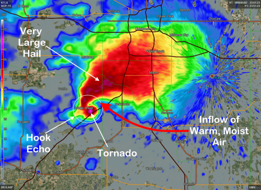
Supercells: A single, but powerful storm that mainly develops during the afternoon and evening hours. These are typically associated with spring / early summer systems, but have historically occurred in every month. These storms by far are the best at producing large hail (softball sized or greater in extreme cases), and are most commonly associated with weak to violent and intense tornadoes. Large hail does not always indicate the presence of an active tornado, but does confirm the inflow of warm, moist air (see above image). These storms are also in certain circumstances able to split into two separate cells, a “left mover” and a “right mover”. The right mover will typically be associated with a tornado vortex signature / most likely to produce a tornado, while the left mover will typically be associated with the largest hail locally.
Pulse ” Pop – Up Storms” are usually associated with weather patterns in the late spring through late summer as increasing temperatures and dew points result in a volatile environment for thunderstorm development. These storms usually are brief in nature, and while they can easily dumb a quick 1″ – 2″ and allow for some gusty winds/small hail, they are more of an annoyance than a widespread severe threat. One of the more prominent hazard associated with these types of cells is lightning, as these cells can produce with little to no warning a cloud to ground strike. During the summer months, this can be concern for beachgoers along the coast and outdoor events across the US. As one of these pulse storms is in the process of dying, they can “shoot out” what we call an “outflow” or strong gust, which weakens the cell but can pop up additional storms in the surrounding area.
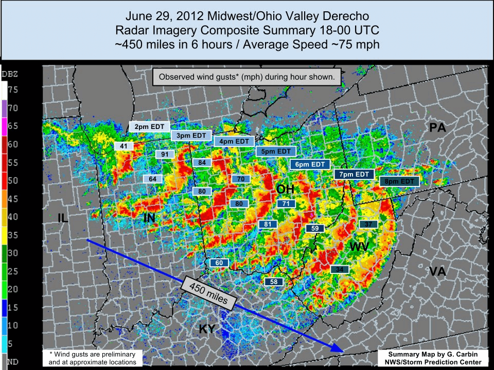
Storm complexes or “Mesoscale Convective Systems” are often times a weekly occurrence across the great plains during the summer months, but can impact just about anywhere in the united states. These are “widespread” or organized storms that can extend in hundreds of miles in any direction and are often associated with cold fronts. The strongest of these complexes can result in widespread damaging winds of 70mph+, and be capable of producing brief tornadoes. As these storms mature, they can often move from 50 – 70mph, making it almost impossible to detect rotation / tornadoes as the storms push quickly in either direction. We call the worst of these widespread storms “derechos”, which on average will happen once a year across the US. They can produce straight line damaging wind gusts of 100mph+ in some instances, and travel over 500 miles in a short period of time.
Regardless of which type of storm event you are facing in a upcoming forecast, the important thing to consider is
- Do I have a safety plan in place for me/family when severe weather strikes?
- Do I have emergency gear (flashing light, portable charger, etc) in case I / my family loses power for an extended period.
- Do I have a reliable source of information (hours or days) in advance of a severe weather event.
If you struggled to answer any of these above questions ^, reach out to us and let’s talk more about how we can help!