
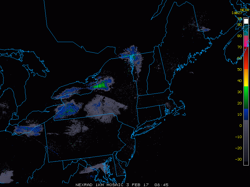
Good morning! The radar this morning is quiet with only a few flurries in southern PA along a slow moving front that moved through much of the region yesterday. Here’s the radar as of 6 AM.
Flurries and even a few sprinkles will move along the Mason Dixon line into NJ through the day with little to no accumulation through the day. Elsewhere, high pressure will settle into the region from the northwest promoting some sunshine along with chilly temperatures. This will continue into Saturday.
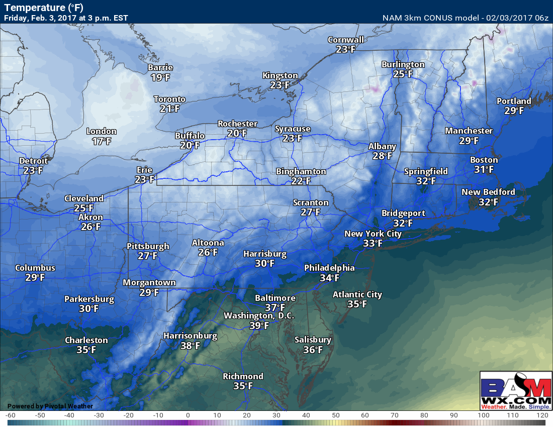
Temperatures today will be chilly behind the front with most places near or below freezing all day. The only exception will be southern NJ and PA where some middle to upper 30s are likely. Here are the projected highs for today.
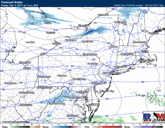
By Saturday night into Sunday, a weak disturbance will move through the Ohio Valley and Northeast bringing a few snow showers from west to east. Temperatures Sunday will be above freezing so accumulation looks unlikely at this juncture. Here’s the projected radar for Saturday night into Sunday.

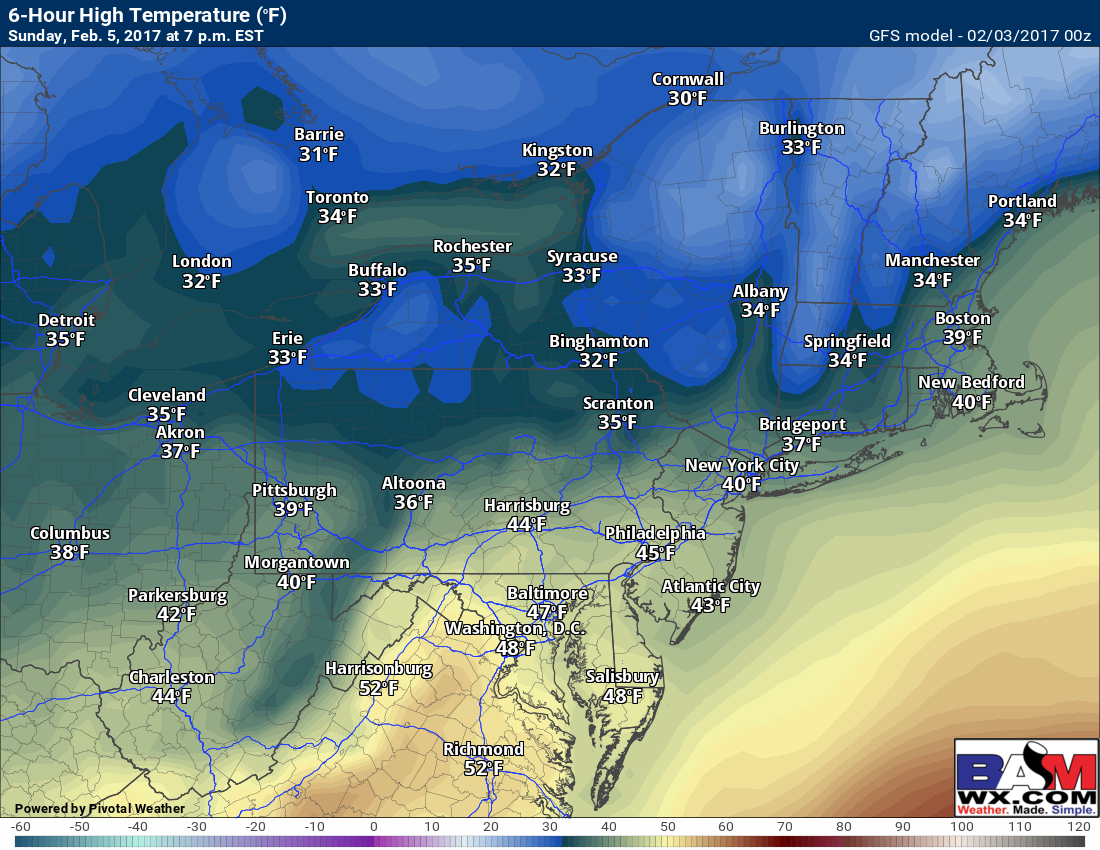
Here are Sunday high temperatures – well above freezing for most people.
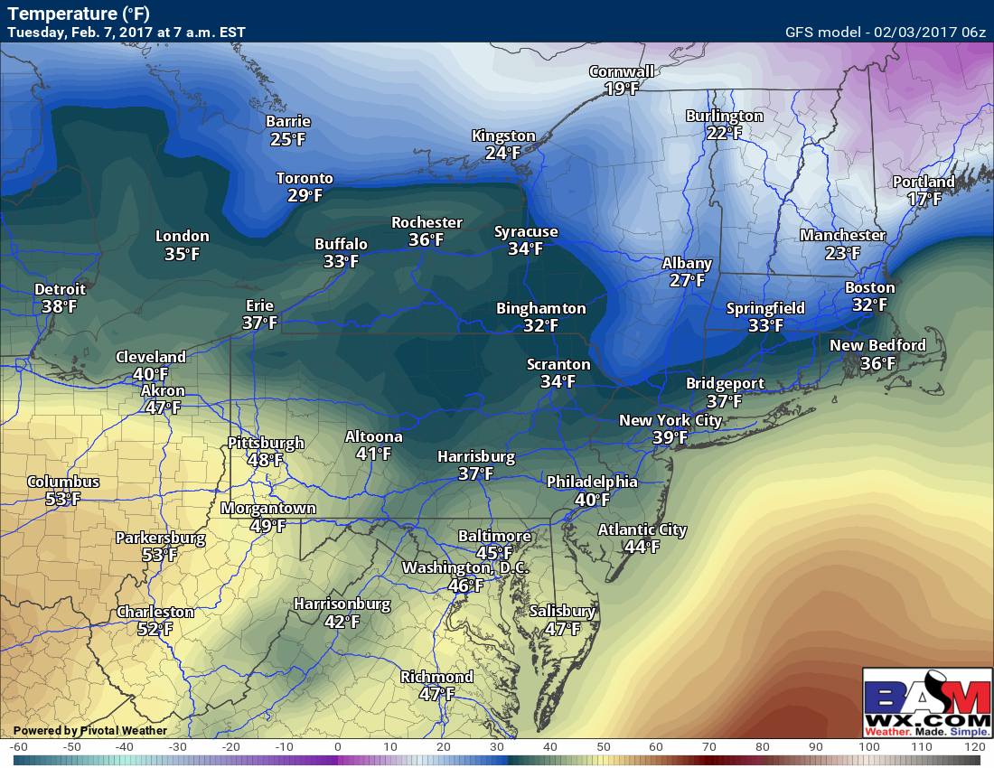
Our next storm comes Tuesday into Wednesday, likely starting as some snow and ice inland with some colder air in place initially. Here are the projected temperatures – this would support some snow and ice away from the coastline initially Tuesday morning before a change to rain as warmer air rushes in.
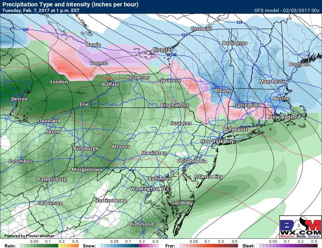
 Here’s what the radar may look like Tuesday morning. There remains uncertainty as to how much wintry precipitation there will be, but some front-end wintry precipitation is possible especially across interior southern New England.
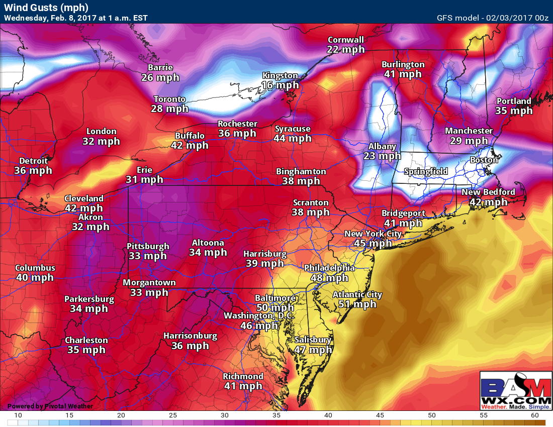
 This storm will be quite strong, which raises a wind concern as well later Tuesday into early Wednesday. Here are the current forecast wind gusts Tuesday night, locally surpassing 40-50 mph in some locations along the coast!
Precipitation will wind down Wednesday with colder air returning during the day.
Confidence and Risks:
- High confidence on calm conditions today and tomorrow with colder than normal conditions for early February.
- Moderate to high confidence on a weak disturbance bringing a few snow showers Sunday.
- High confidence on a storm bringing precipitation Tuesday into Wednesday.
- Low to moderate confidence on some wintry precipitation occurring Tuesday morning across the interior before a change to rain.
- Moderate confidence on strong winds occurring along the coast Tuesday night into early Wednesday.
Today’s video is about 5 minutes. ~Ed