
Good afternoon! Quick update to the forecast regarding two storms this week: one on Tuesday-Wednesday, and then watching another one Wednesday night into Thursday. Let’s start with the first event Tuesday into Wednesday. Low pressure will pass through Michigan Monday night into Tuesday spreading precipitation into the region from west to east. Here’s the GFS forecast for the event.
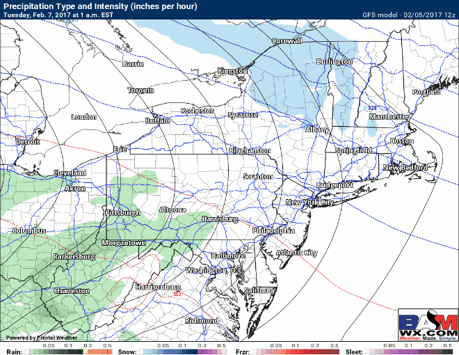
Notice precipitation will start as a period of snow ad ice away from the coast in northeastern PA into New England Tuesday morning before a change to rain during the afternoon. This will lead to poor travel for a time with impacts likely to schools and the morning commute. Here’s the GFS and European snowfall forecasts.
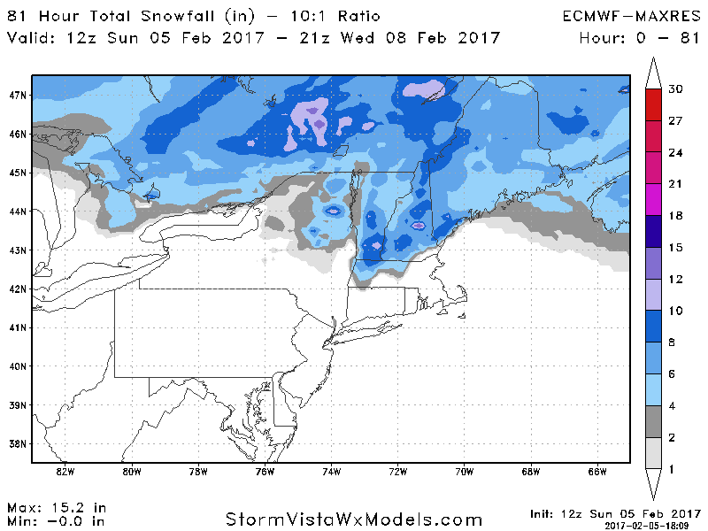
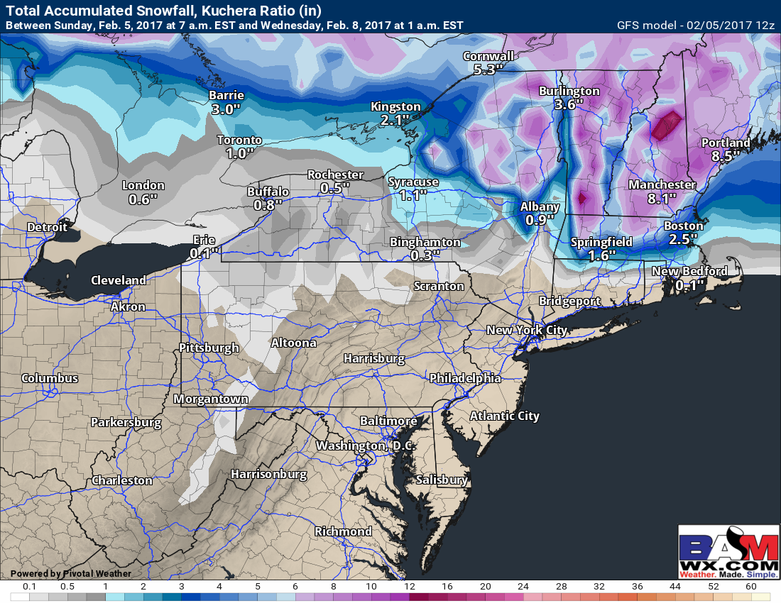
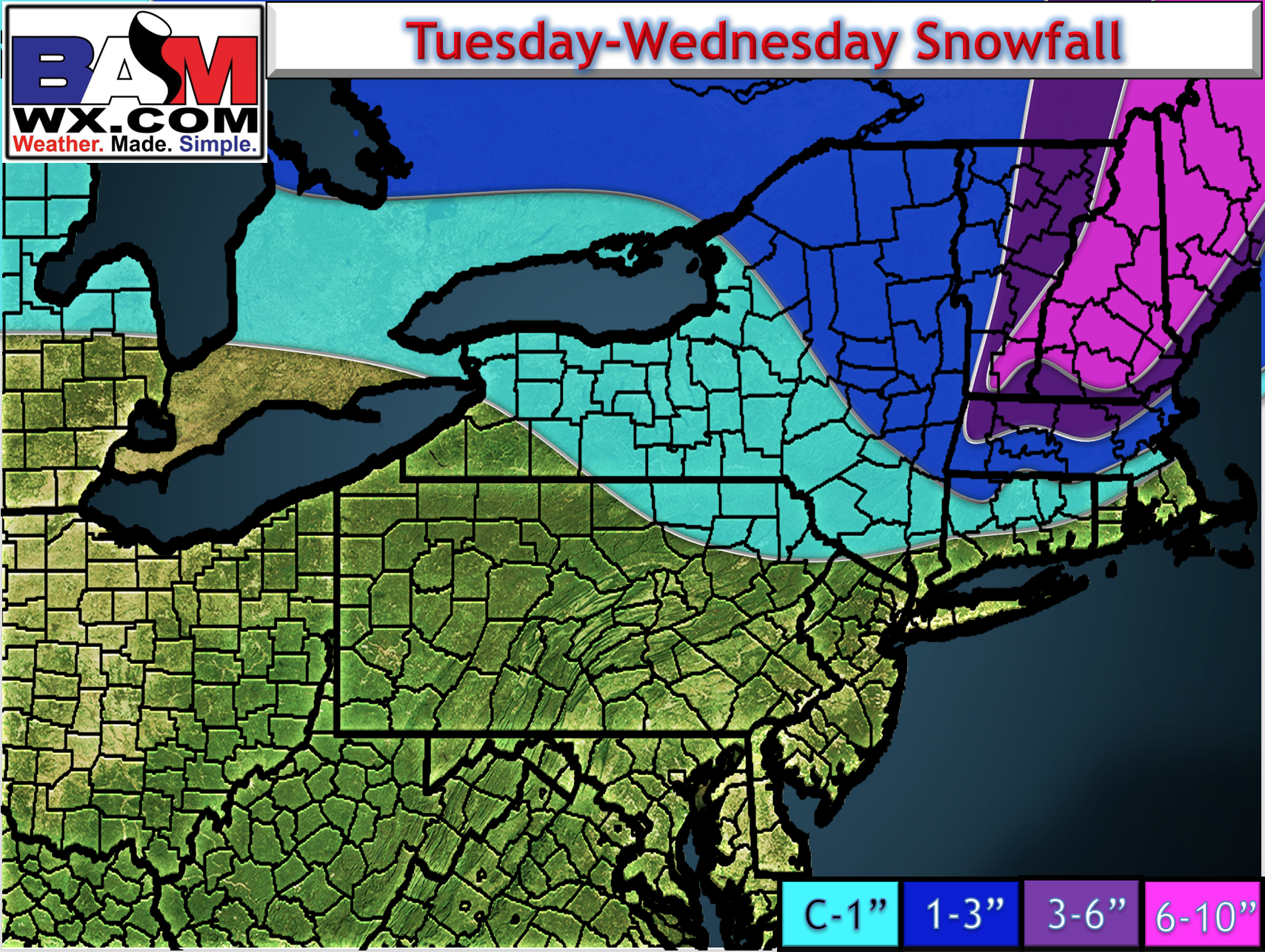
Here’s my take on snowfall for this storm.
Ice will also be a concern after any snowfall Tuesday night. Here’s the GFS’s estimated freezing rain.

Winds still look gusty Tuesday into Wednesday as the storm departs. Here’s the projected wind gusts through Wednesday.

Outside of the snow and wind, rainfall looks to dent the drought across much of the Northeast. Widespread 0.50-1.50″ expected.

The next storm is still quite uncertain as there is plenty of different pieces of energy running around (yellow and orange in the map below).
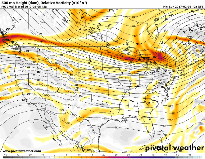
Plenty of time to watch this system, but latest model guidance gets some light snow into southern areas Wednesday night into Thursday morning. Here’s the latest GFS forecast for example.

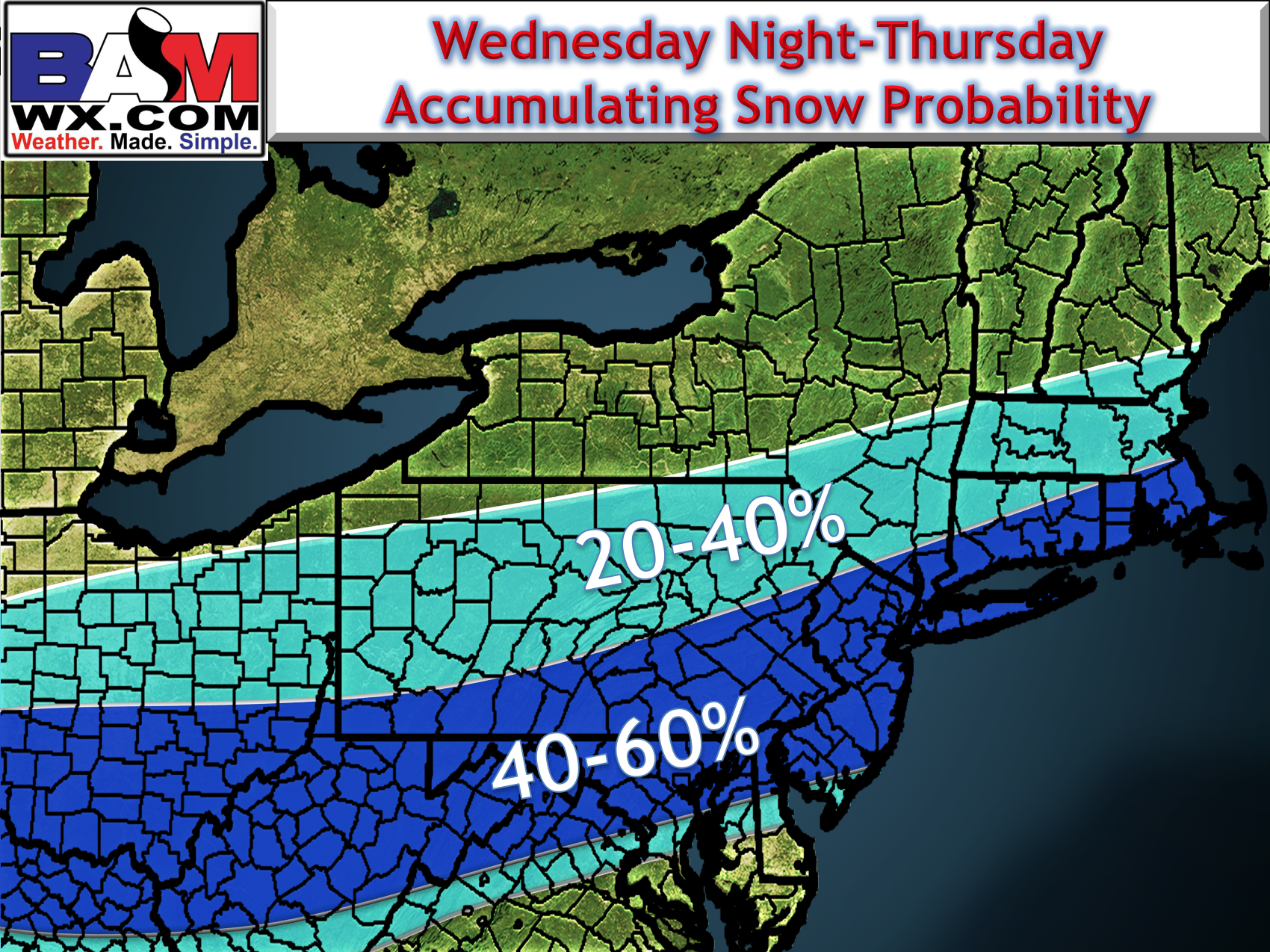
Here’s my first stab at the probability of 1″ of snow based on the data we have.
Have a great afternoon. ~Ed