
Key Points – Monday, April 24, 2017:
Synopsis: Overall active pattern looks to return over the next 7-10 day with multiple rounds of heavy rainfall potential in the forecast as well as some accumulating snow (yes, you heard that right) late week into the weekend that we still need to fine-tune. Concern also continues with below normal temps expected as we usher in May, this will certainly not help the evapotranspiration process much getting rid of this heavy rainfall quickly. Details below, have a great week.
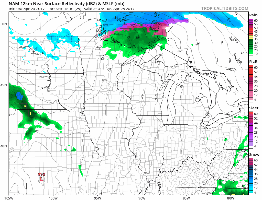
- Tuesday: area of low pressure to the south brings scattered rain showers and some thunder across Nebraska into Northwestern Iowa.
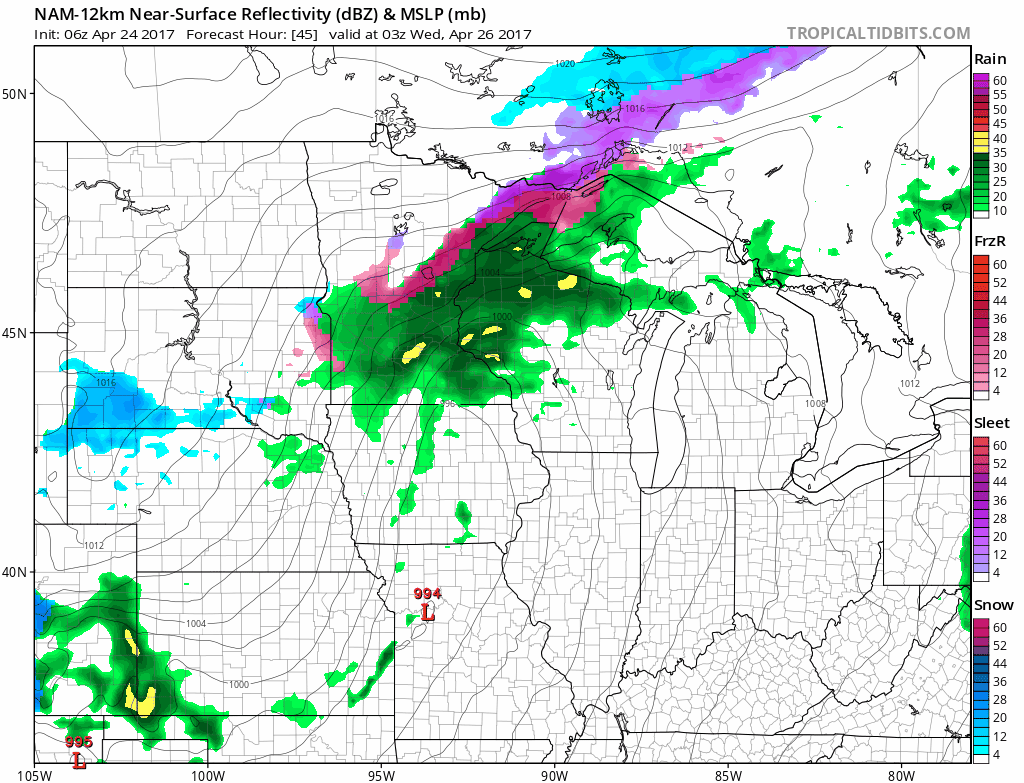
- Wednesday: Waking up Wednesday to some showers and thunder across eastern Kansas, Missouri into eastern Iowa…drier further west across western Kansas into Nebraska on Wednesday. Likely some heavy rains across MO into IA, flash flooding concerns also remain on the table. The system pulls out by Thursday morning further east.
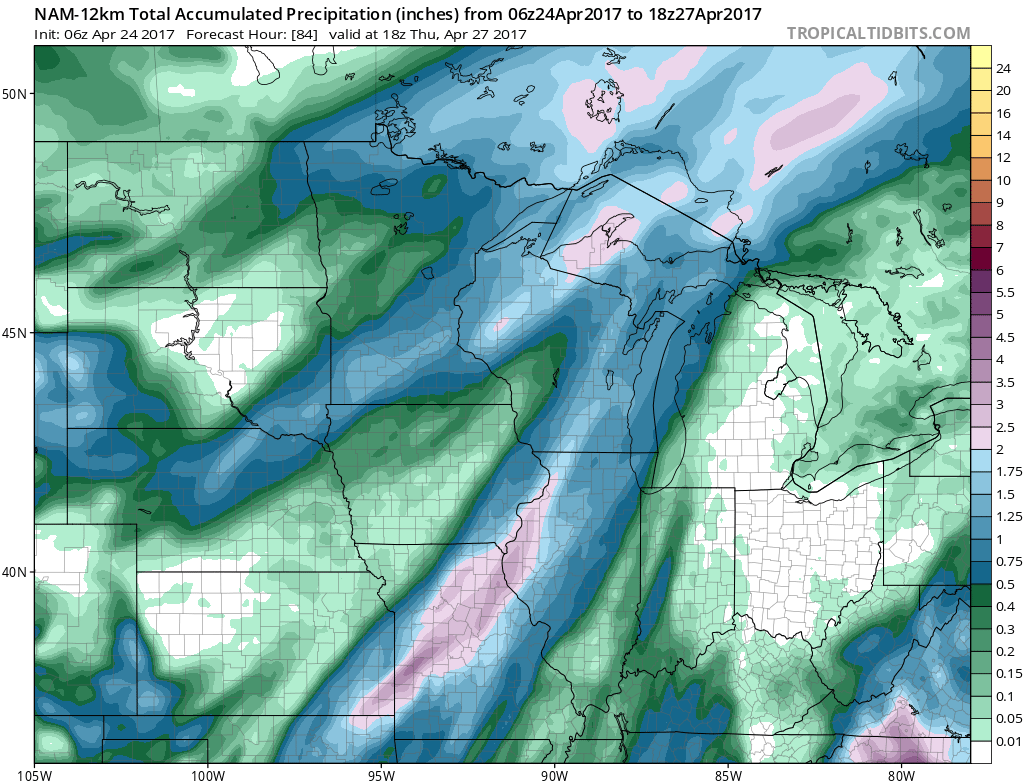
- Total rainfall through Thursday: 1-3″ expected across eastern KS, MO into eastern IA, 0.5-1.0″ possible across Nebraska into NW IA. However, some dryness noted across most of Kansas into most of Iowa and southern Nebraska here as well through mid-week.
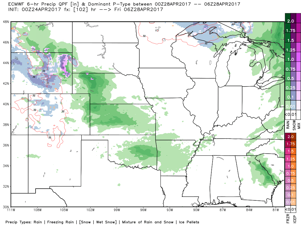
- Next chance for rainfall and some thunder comes late Thursday into Friday morning across western KS and western NE, shifting east throughout the day into IA and MO through Saturday morning.
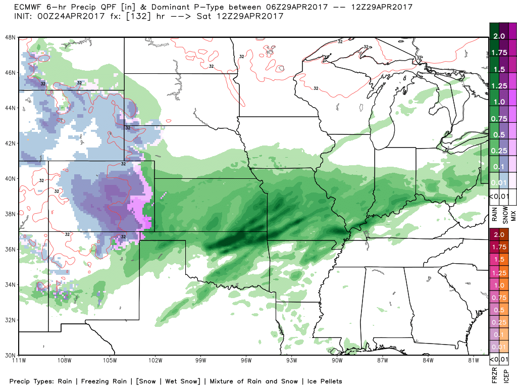
- Warm front lifts north on Saturday, bringing locally 1-2″ per hour rainfall rates and very heavy rainfall as well across Kansas into Missouri moving north in to eastern Nebraska and Iowa.
- The European model guidance suggesting some very heavy, wet snow possible on Saturday into Sunday morning from western Kansas into Nebraska as well…the risk still remains above average as we need to continue to fine-tune this.
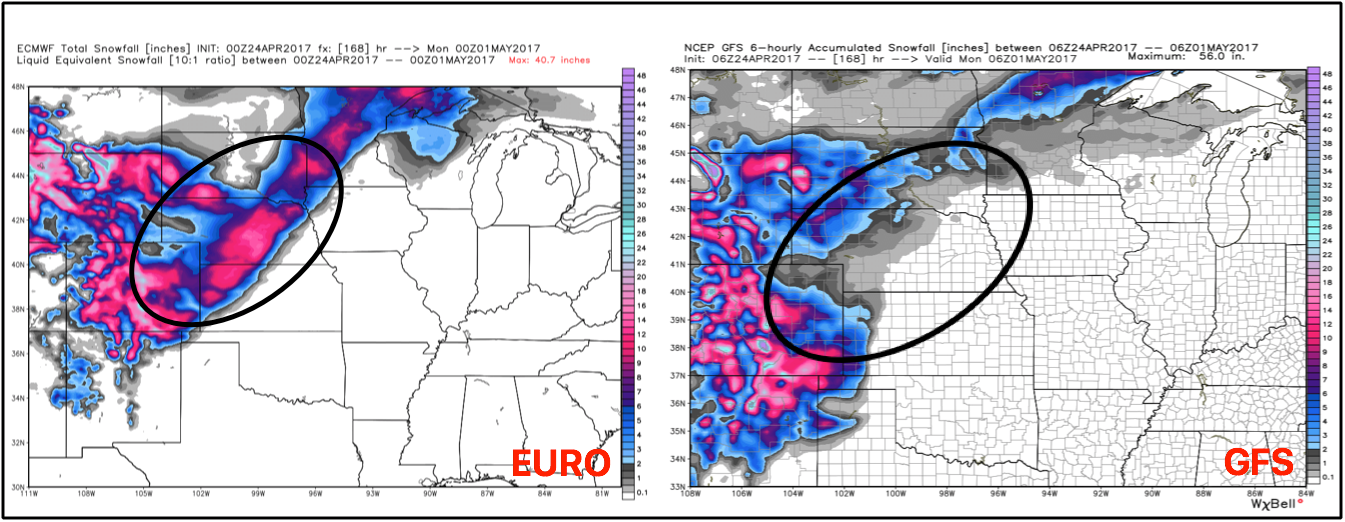
- Latest glance at the Euro vs GFS snowfall totals: both suggesting snow potential, but confidence remains lower on how much and exactly where. If the Euro pans out, it will be a heavy, wet snow maker with totals > 6.0″+.
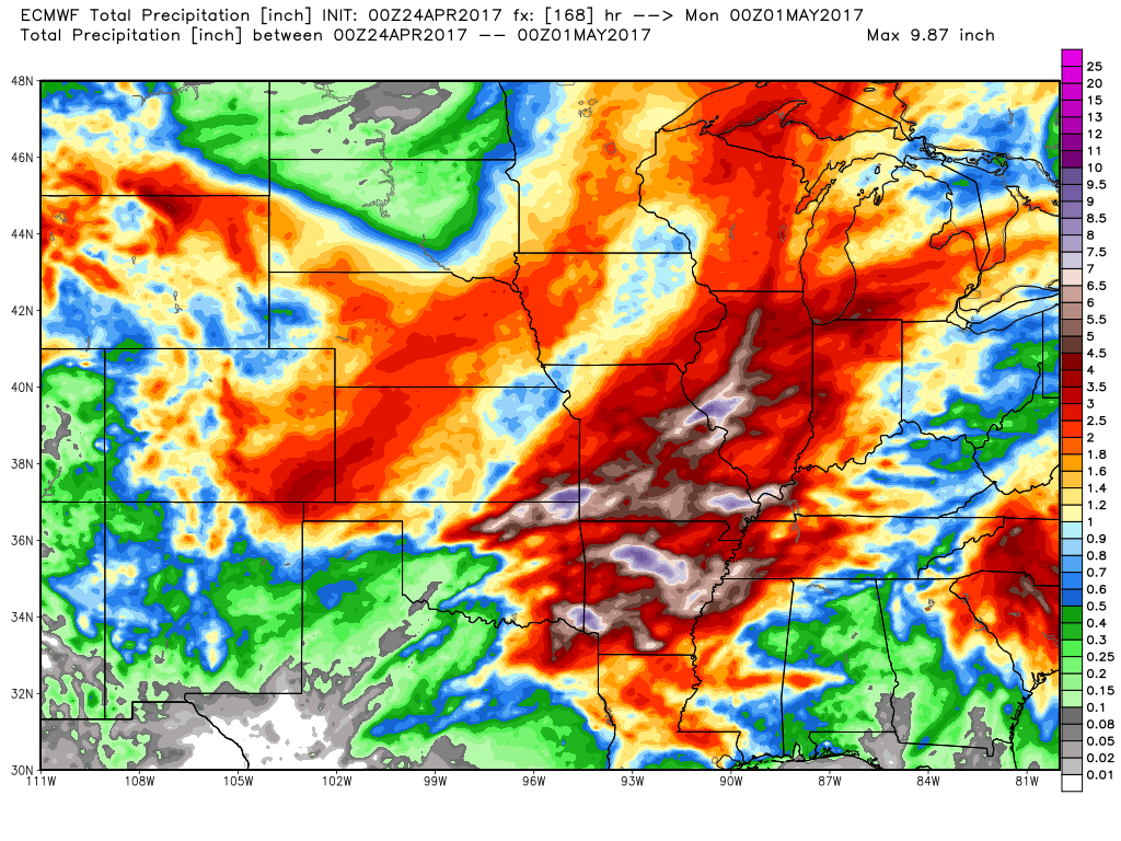
- Total rainfall out by next Monday morning: much of MO with 2.5″+ of rainfall into extreme eastern KS as well.
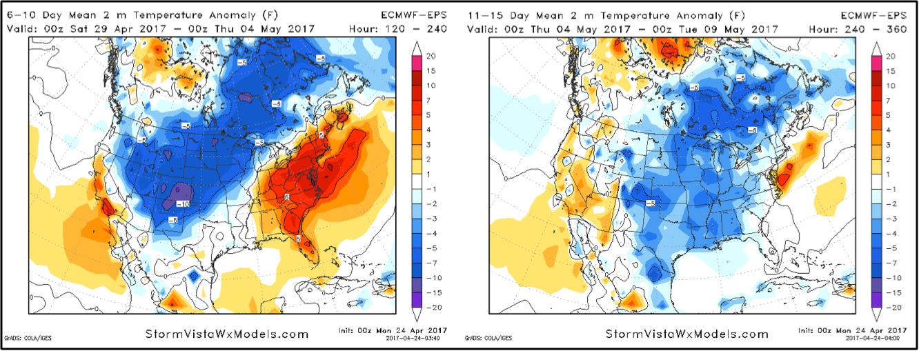
- Temps from normal in the 6-10 and 11-15 day timeframe…this is a concerning looking because the cooler temps will not allow these heavy rains to evaporate quickly, keeping fields sutured longer.
Confidence and Risk:
- Average confidence scattered showers and storms possible from west to east Tuesday into Wednesday.
- Average risk for heavy rainfall across portions of Missouri into eastern Iowa Wednesday as well.
- Average confidence additional showers and storms possible later Thursday into Friday.
- Average confidence warm front lifts north Saturday into Sunday bringing localized very heavy rainfall.
- Average to above average risk of accumulating snowfall Saturday into Sunday due to discrepancies in the data.
- Increasing confidence the pattern stays conducive to below normal temps into May
Today’s video (8 min):