
Key Points – Monday, April 24, 2017:
Synopsis: Good Monday morning! We have a VERY busy week ahead in the weather department, we highly encourage folks to pay close attention to each update as some of the details later this week into the weekend are still fluid. In the video we discuss our chances for strong storm potential and very heavy rainfall across portions of the Midwest over the next week. If you have any questions, please let us know. Have a wonderful week.
- We are watching late Tuesday into Wednesday and then exiting east on Thursday a cold front to sweep from west to east that will likely bring some heavy rainfall especially across Illinois (some flash flooding cannot be ruled out as well) and some gusty storms as well.
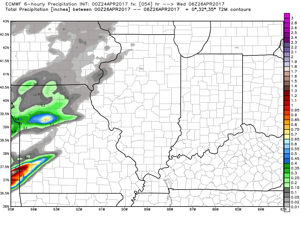
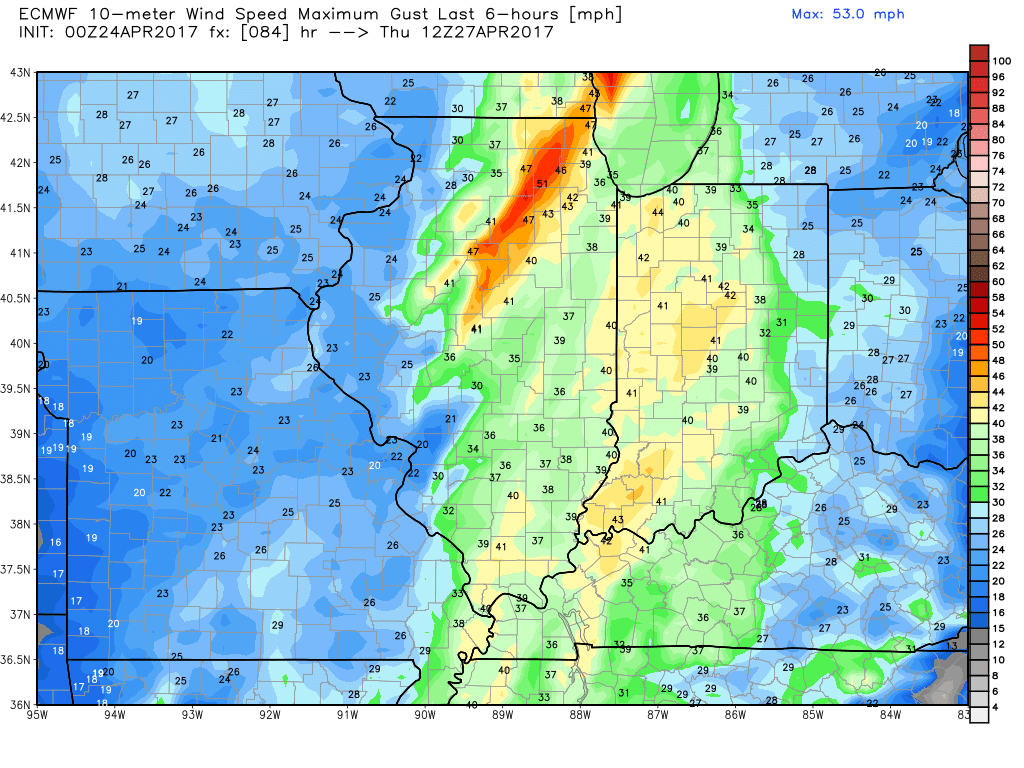
- Some gusty winds possible across the Midwest late Wednesday into Thursday as the actual cold front sweeps east with winds out of the south to southwest gusting at times upwards of 40mph+.
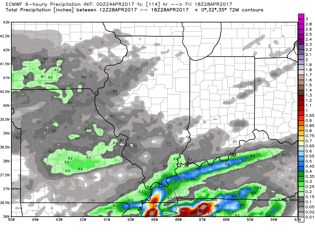
- As we move Friday night into Saturday we have a warm front lifting north into this weekend that looks to bring some very heavy rainfall growing in coverage from south to north.
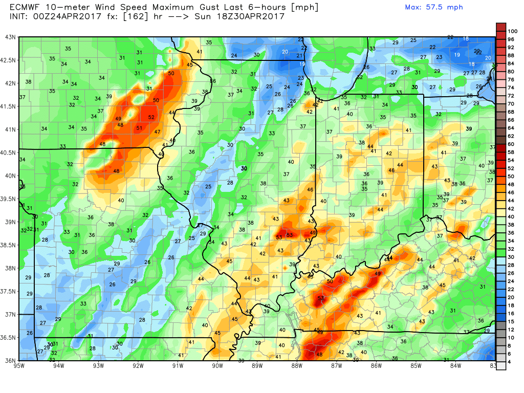
- Cold front then sweeps east Saturday night into Sunday across eastern Iowa and Illinois, and Sunday into Monday east across Indiana and Ohio bringing additional heavy rainfall and gusty winds.
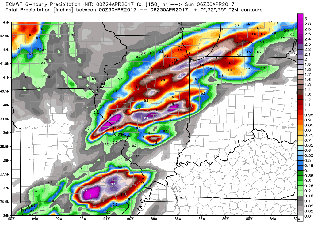
- Wind gusts topping 50mph+ will be possible as this cold front moves through on Sunday into Monday out of the Southwest, can’t rule out a few severe wind gusts as well.
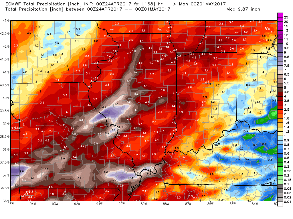
- Rainfall over the next 7 days from the latest European very wet especially across Illinois…to put this into perspective this is 2-300%+ above normal in some locations especially west.
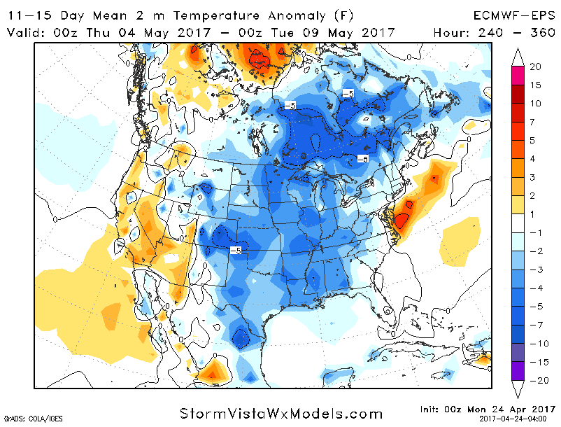
- The next week or so we are largely above normal in the Midwest, however getting further out more into mid-next and beyond we have concern for cooler than normal temps to settle in that certainly won’t help the evapotranspiration process getting rid of any excessive rainfall that falls over the next 7-day days.
Confidence and Risk:
- Above average confidence next 2 days are pleasant across the Midwest.
- Average confidence in the details of inclement weather moving in Wednesday east into Thursday along a cold front.
- Above average risk for stronger storms including damaging winds in this same timeframe.
- Average confidence in additional inclement weather Friday into Saturday and then late Saturday night into Monday morning from west to east.
- Average but increasing confidence of very heavy rainfall late week into the weekend.
Today’s video (8 min):