10:30 PM Update (Includes Monday Forecast)
Nowcast:
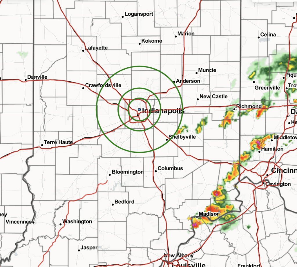
Tracking a few moderate to heavy cells 30-50 miles SE of ISF, moving about 4-6MPH to the W. Low end lightning potential will exist, but not favoring these to impact ISF if at all until after 1AM-ET. Anticipating dry conditions through 12AM.
Current Radar:

Favored Thinking Ahead:
Favoring 20%-30% chances of scattered, moderate to heavy showers/storms from 1AM-9AM. Overall, low confidence majority of this activity will extend as far westward as latest data suggest. Lightning potential will remain low for this activity, but can’t be ruled out entirely in addition to periods of moderate to heavy rainfall.
While favoring mostly dry conditions from late morning into early afternoon, anticipating 20%-30% chances of scattered showers/storms to begin again Monday at 3PM and continue through 9PM. Anticipating majority of coverage to remain S of Indy, but further updates will likely be needed tomorrow in terms of % and lightning potential.