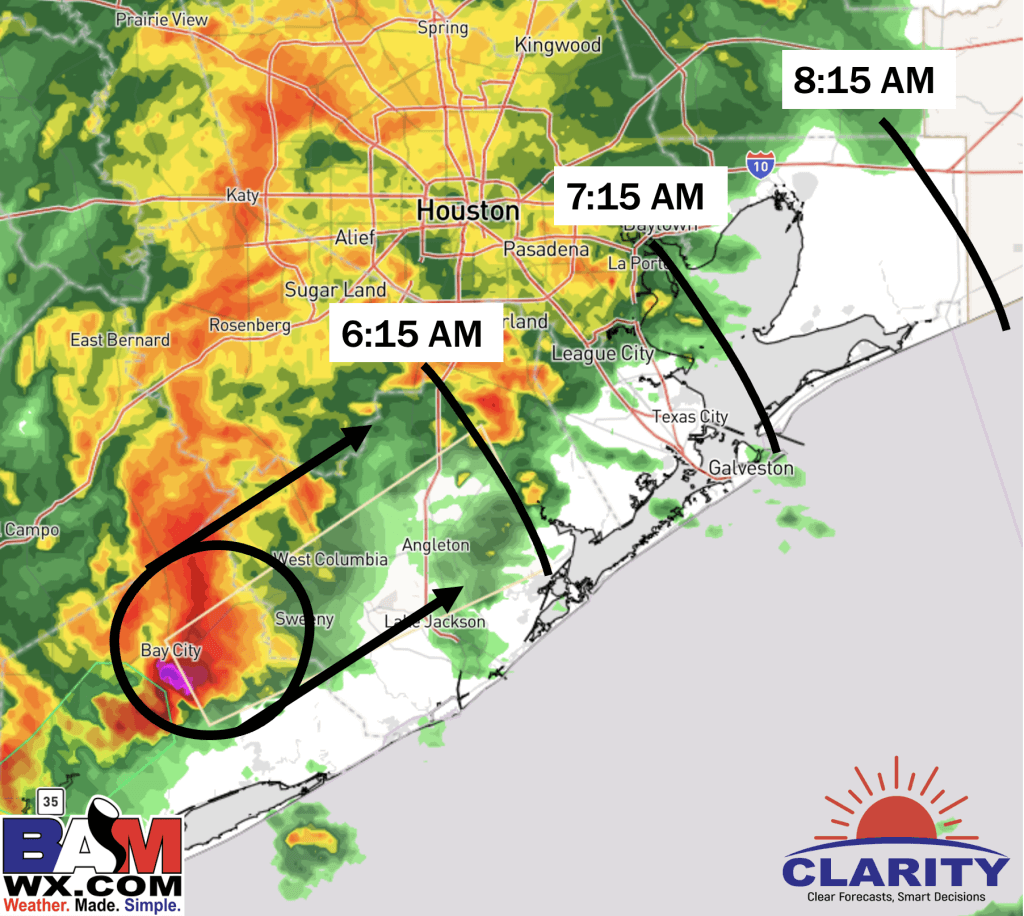
Forecast as of 5:20 AM FRI 1/5/24
- A localized stronger cell is moving NE, please check out the image for best thinking on arrival timing.
- Reduced visibility from heavy rain, lightning, and wind gusts of 35-45+ knots will be possible.
- Outside of this cell, gusts over open waters S of Morgan’s Point of 25-35 knots will be possible.
- Expecting the worst of this cell to last 15-20 mins as this cell passes.
