26
Dec
12-26-17 Central IN short-term: Targeting sneaky snow showers next 2-3 days. K.
Synopsis: Hey guys, today's short-term update focuses on the sneaky snow shower chances over the next 2-3 days that models will handle very poorly with such cold temps. As always let us know if you have any questions at all we are around 24-7 to help. Have a blessed day.…
26
Dec
12-26-17 South America: Warmer/drier trend overall this week across Argy…discussing the rainfall risks into early Jan. K.
Apologize for the later delivery today, we are really trying to fine-tune the week 2 forecast as we confidence is lower in the rainfall placement (data is split). If you have any questions please don't hesitate to reach out, have a blessed day! -Kirk Today's video: http://youtu.be/BUY6tWRbn6Y?hd=1
26
Dec
12-26-17 Energy and Power Report: Much colder pattern next 7-10 days…risks increasing for a moderation into mid-Jan? Details here. M.
12-26-17 Energy and Power Report: Much colder pattern next 7-10 days...risks increasing for a moderation into mid-Jan? Details here. M. Today's video (7 min): https://www.youtube.com/watch?v=2fn-EZCWKXo Energy Report (PDF): Energy
26
Dec
12-26-17 Ohio: Very cold week ahead…targeting a potent weekend snowmaker…details here! K.
Today's video: http://youtu.be/k41IDeF2tlY?hd=1 Very chilly over the next week with multiple days dipping into the single digits if not below zero where the snow pack is the heaviest (north of I-70): Will see on and off snow showers south of I-70 today ~30% (a light coating is possible) as well…
26
Dec
12-26-17 Northern INDOT Districts Forecast – Very cold week ahead…targeting multiple bouts of snowfall. K.
12-26-17 Northern INDOT Districts Forecast - Very cold week ahead...targeting multiple bouts of snowfall. K. Synopsis: Good Tuesday morning, we hope you all had a very Merry Christmas! Today's video is a lengthy for the main reason that there is A LOT going on in terms of targeting snowfall over…
25
Dec
12-25-17 Northern INDOT District Update – Latest on pesky lake effect snow next 60 hours + eyeing weekend accumulating snowfall event/extreme cold. K.
12-25-17 Northern INDOT District Update - Latest on pesky lake effect snow next 60 hours + eyeing weekend accumulating snowfall event/extreme cold. K. Synopsis: Merry Christmas from all of us at BAM, we hope you got an opportunity to spend some time with family. Today we discuss pesky lake effect…
24
Dec
12-23-17 Indiana late AM forecast: heavier snow to move in this afternoon into the evening. K.
Hey all, just wanted to touch based again with the latest data for what's still ahead this afternoon/evening. No change from what we discussed in the videos this morning. Latest radar update as of 11:15amEST: Simulated radar as we go throughout the rest of the event (timing is in the…
24
Dec
12-24-17 Northern INDOT District Forecast – Latest on timing & accumulations of snowfall today. K.
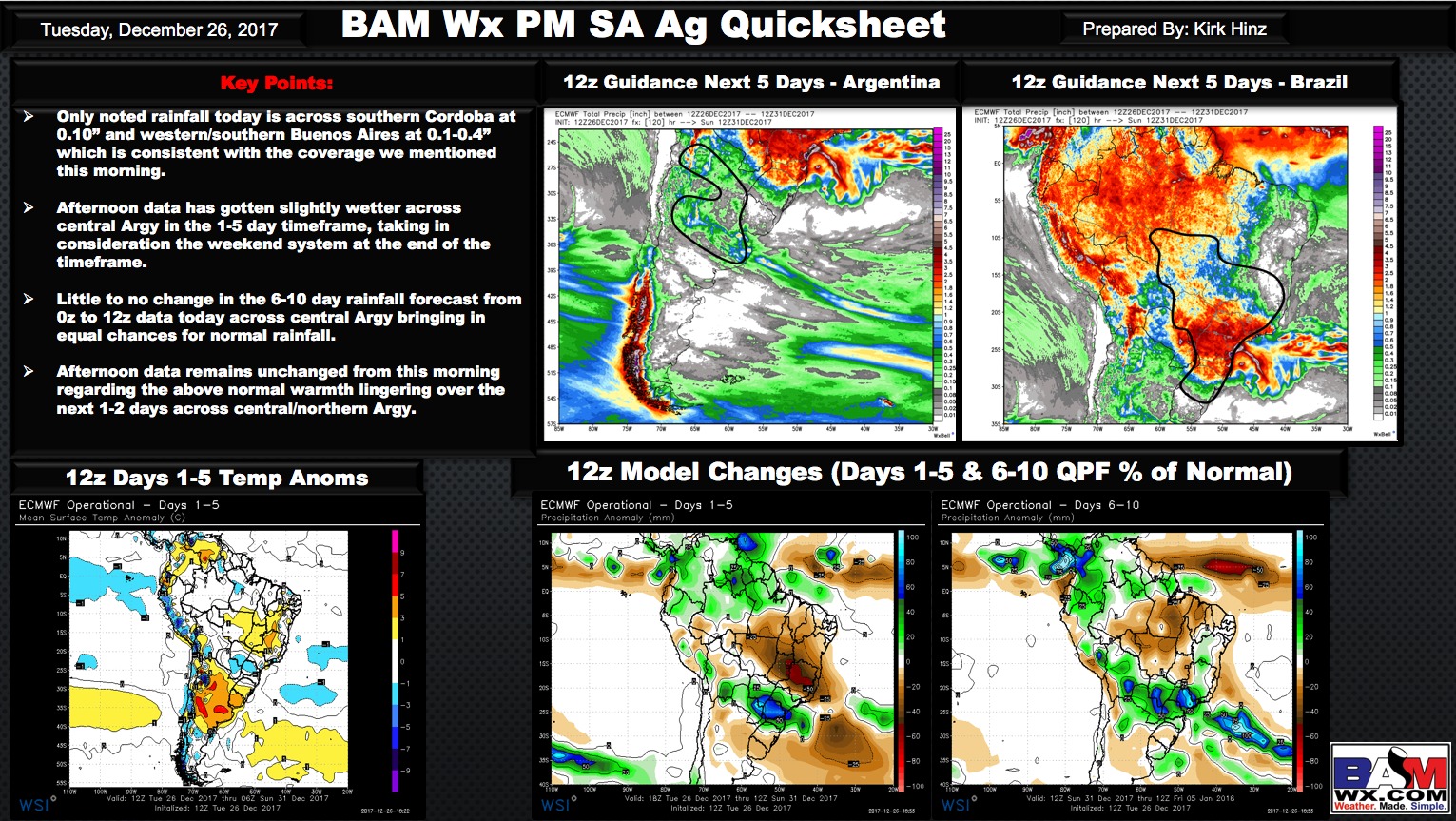
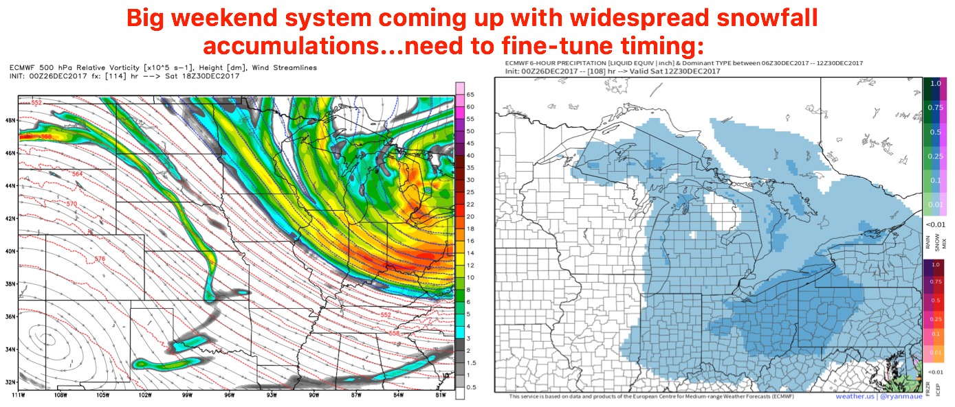
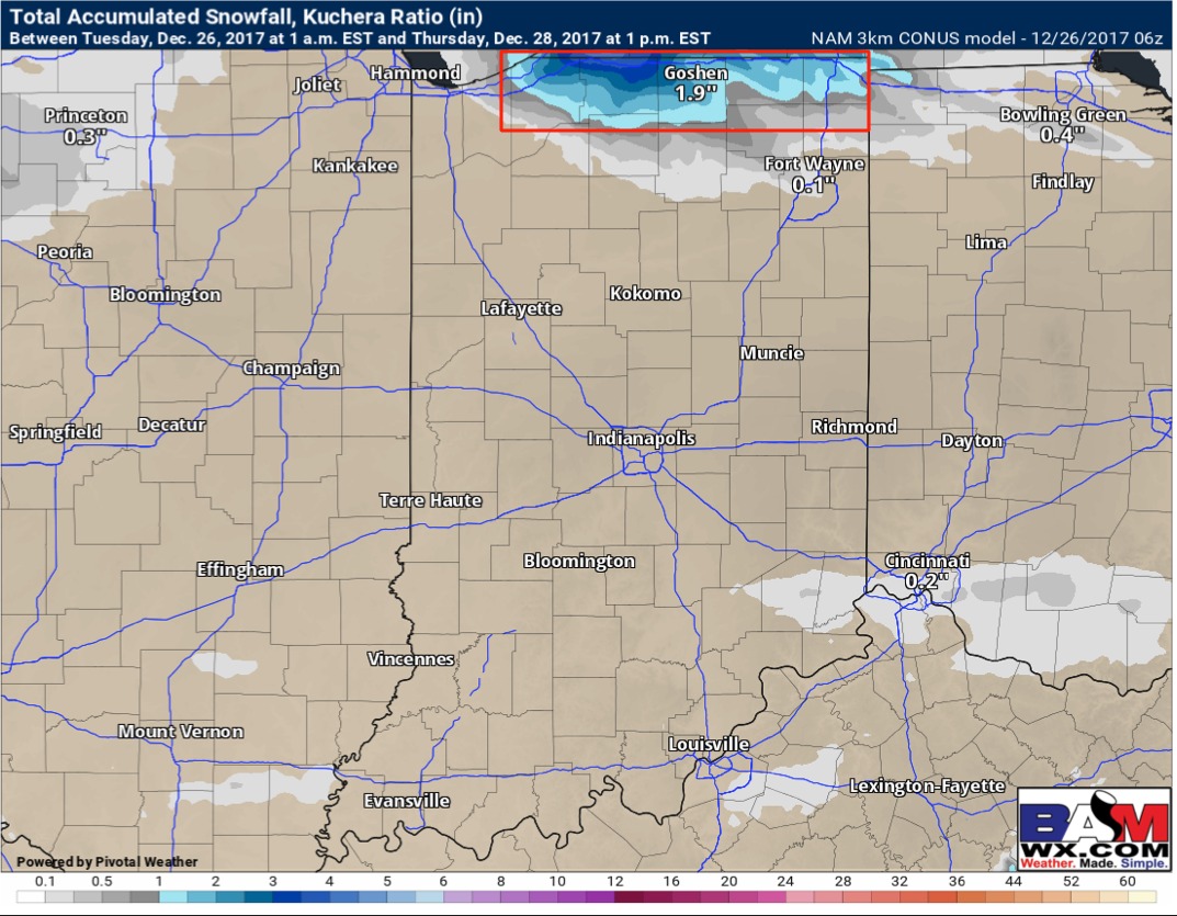
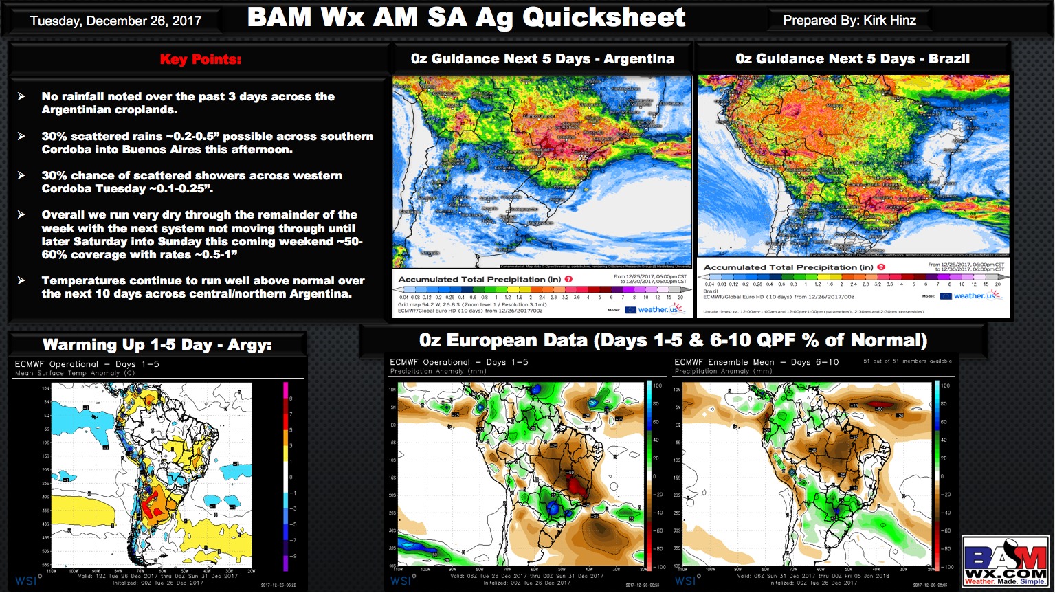
Today's video (5 min): http://youtu.be/0NCIokQkoRo?hd=1 Updated snowfall map, no change from what we shared last night we expect a blanket of 3-5" of snow and locally 5-8" where the lake effect band sets up shop (red color). In that lake effect band, reduced visibility at times of 0.25-0.5 mile as…

