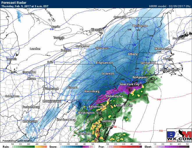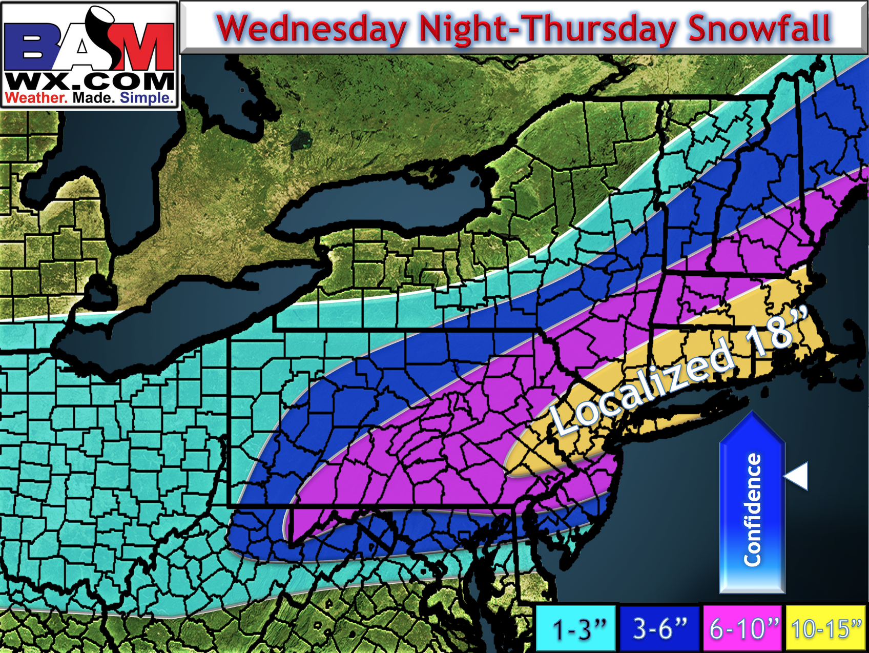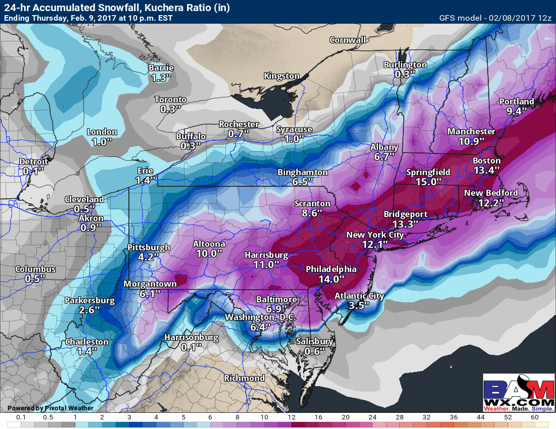
Morning long range #AGwx report. Warm now..cold later..active into March. #NatGas M.
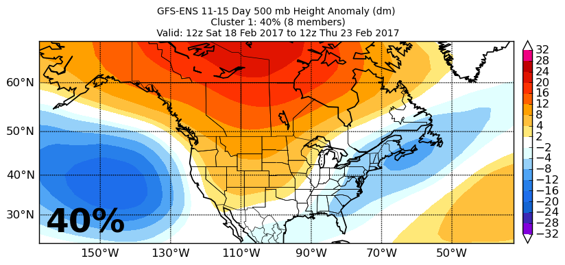
Morning long range #AGwx report. Warm now..cold later..active into March. #NatGas M. Folks wanted to make sure you were aware what the maps with the % on them mean. We call this megacluster data. Its where we take all 91 models from the ECMWF/CMC and GFS and blend them together.…