Good Monday morning! A front will bring the risk for a few t'storms over the next couple of days, then a larger system looks to move through the region Wednesday into Thursday bringing the threat for more widespread showers and storms, and possibly some severe weather. All the details in…
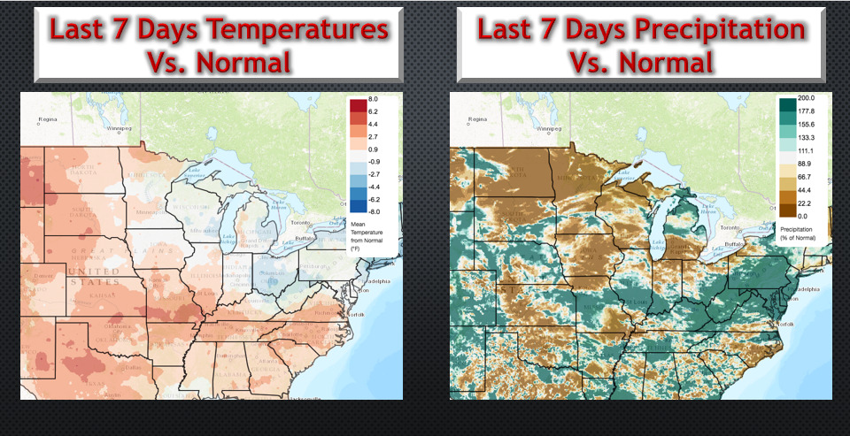
Good Sunday evening. The video below highlights our thinking over the next few weeks with detailed analysis. The video is 13 minutes. https://www.youtube.com/watch?v=EykR3YHEz4c&feature=youtu.be&hd=1 Temperatures and precipitation compared to normal over the last 7 days. Significant cooler risks will continue, especially in the 6-10 day with some 10-20°F below normal. Precipitation…
Friday #AGwx Update: Latest details regarding August pattern. N. Today's Video (11 min): https://www.youtube.com/watch?v=tMldjz_YPFQ&feature=youtu.be Slides:
Good Thursday morning! The video below discusses the uncertainties regarding the Friday-Sunday forecast. If you have questions, don't hesitate to reach out. Have a great day! -Ed http://youtu.be/U59pBsyF-xQ?hd=1
#NDwx #SDwx #MNwx #WIwx Scattered storms focused mainly west into the weekend. N. Good Thursday morning! Synopsis: The best storm chances over the next few days will remain confined over the western half of the region. Not expecting anything overly widespread, with marginal severe risks over the western Dakotas into…
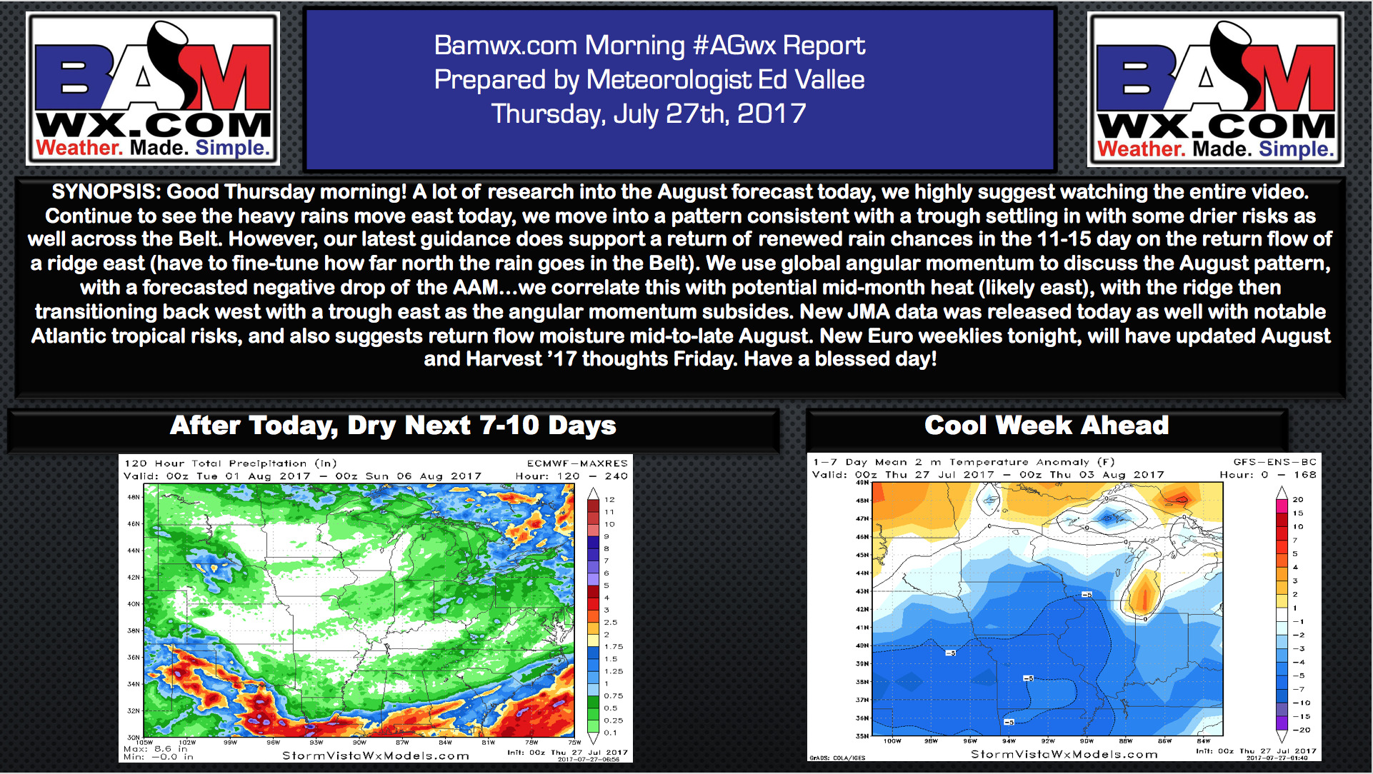
Thursday #AGwx Update: Detailed Info Regarding August Pattern. E. Today's Video (10 minutes): https://www.youtube.com/watch?v=U3YH326UQWc&feature=youtu.be&hd=1 Slides:
#KYwx #OHwx #INwx #ILwx #IAwx #NEwx #KSwx #MOwx Latest on heavy rain and severe potential into late week. N. Good afternoon! In this update, we will take a look at the thunderstorm potential and heavy rain risks over the next couple of days. Current radar shows showers and storms…