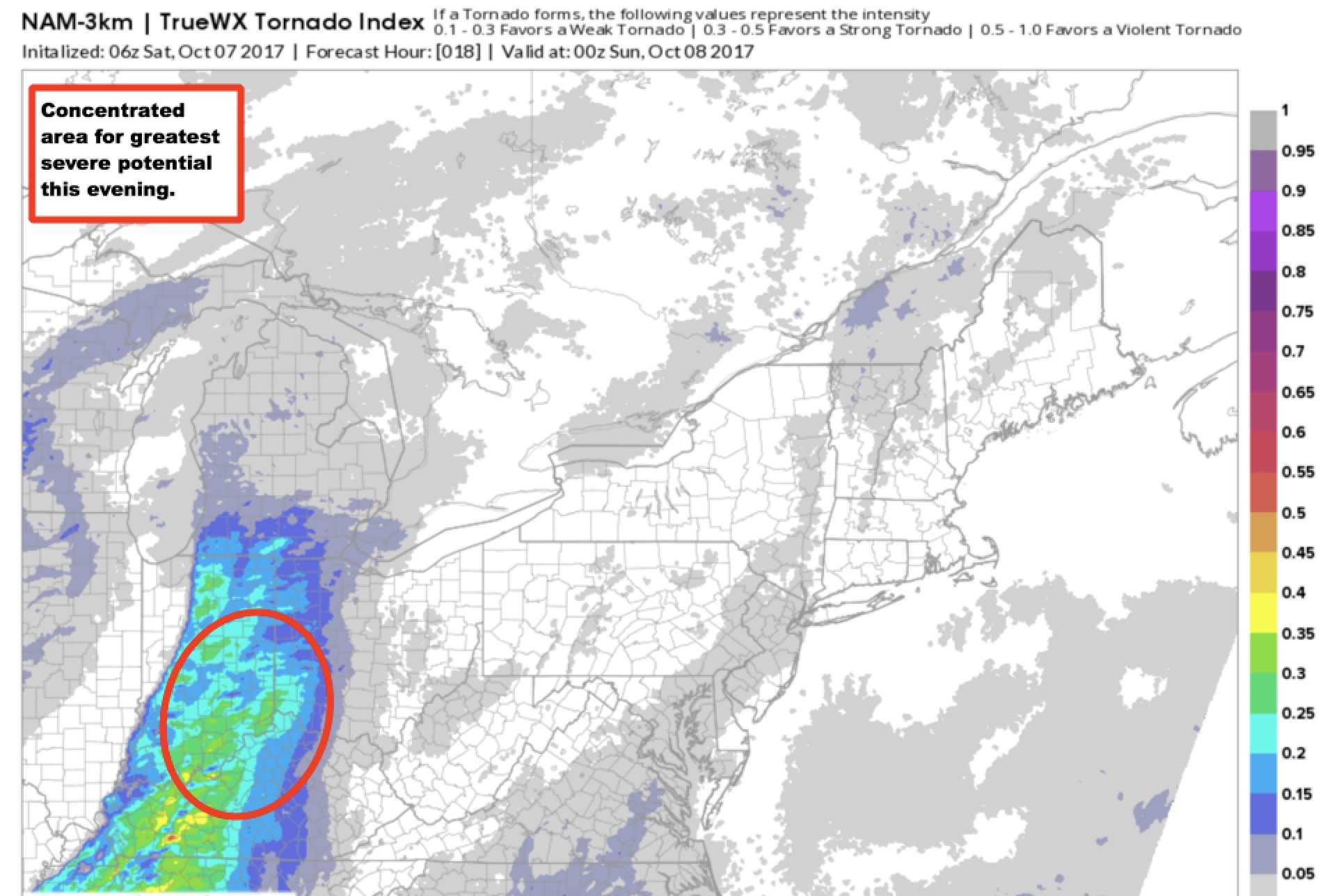
Synopsis: Good Saturday morning! We are starting off the day with dry conditions and unseasonably warm temperatures. Most of day-time today is dry and breezy with highs in the low to middle 80s! Scattered showers and storms start to bubble up late afternoon into early evening, and activity will rapidly…
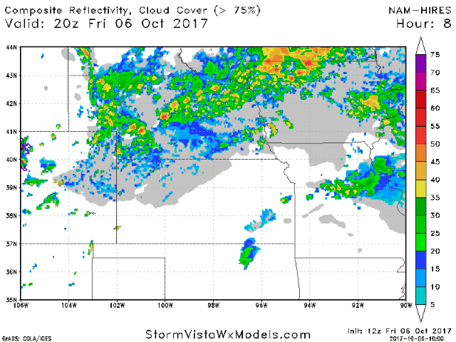
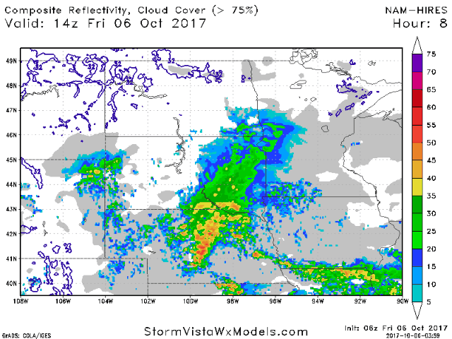
Good afternoon! The video below covers the latest threats for severe weather and flooding across zone 8 tonight into tomorrow morning. Have a great afternoon, and let us know if you have any questions!! -Ed http://youtu.be/KkA3t2IbB8w?hd=1 The projected radar through tomorrow is shown below. Rains wind down tomorrow morning from…
Synopsis: Good Friday afternoon! This update covers the latest trends in rain chances over the next few days. Rain showers continue to move west to east for locations north of I-70 along a stalled frontal boundary. This front will move north as a warm front tonight and into Saturday, briefly…
Key Points - Friday, October 6, 2017: Synopsis: Good Friday morning! Very active day ahead of us with potential for very heavy rains in portions of the area along with the threat for severe storms - especially from late this afternoon through the overnight hours. We clear things out as…
Key Points: October 6, 2017 Synopsis: Good Friday morning! We are tracking heavy rains moving into southeastern South Dakota this morning. This rain will move into southern Minnesota and Wisconsin today and tonight leading to some heavy rainfall amounts and localized flooding. Drier conditions are expected Sunday into early next…
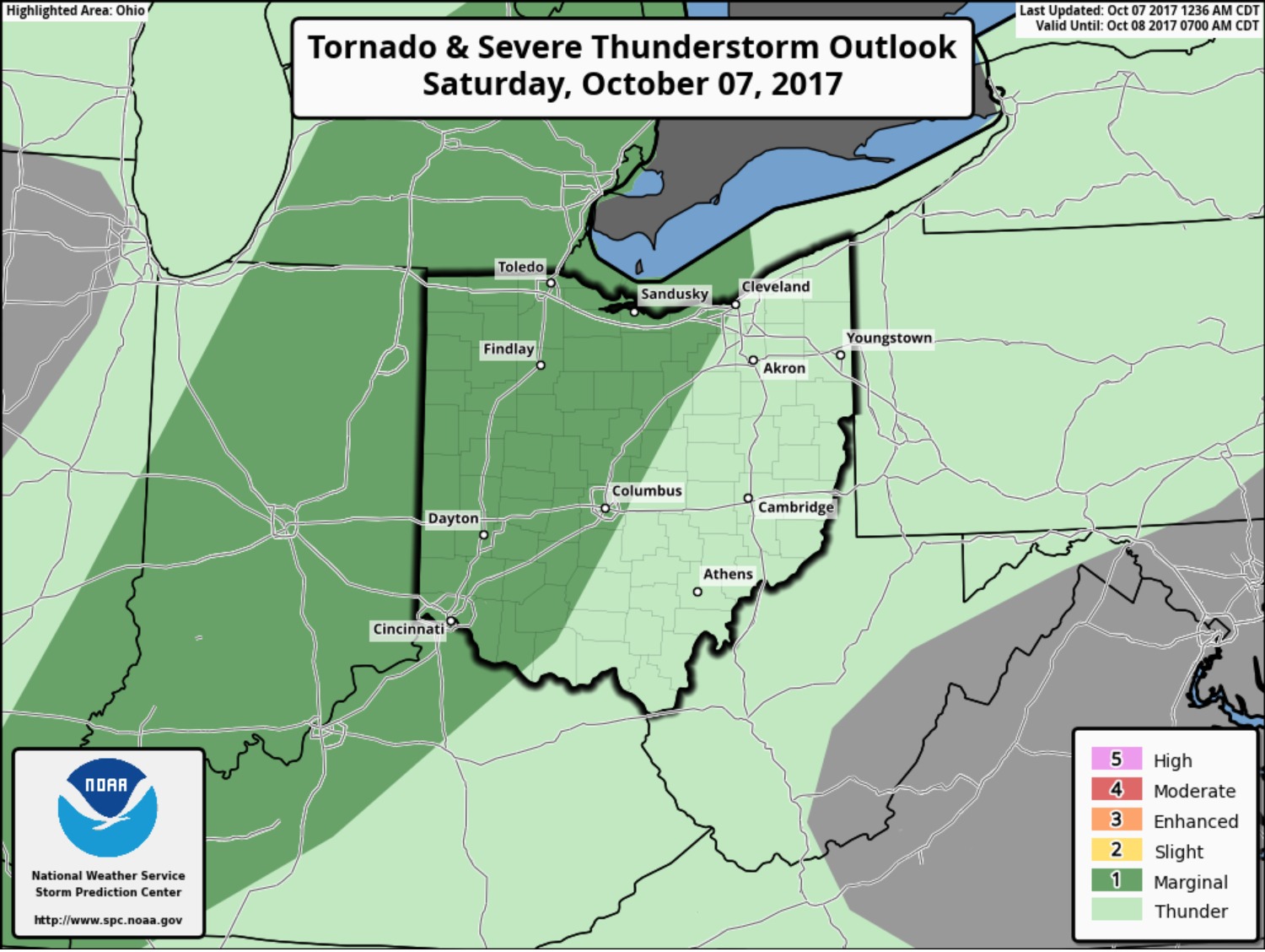
Key Points - Friday, October 6, 2017: Synopsis: Good Friday morning! It's an unseasonably warm and mainly dry forecast today with a warm front situated just north of the area. We are eyeing a cold front to push through Saturday evening, bringing scattered storms along with warm and windy conditions…