
Video (6 min):
Good Friday morning everyone!
Snow is falling in portions of the Northern Plains this morning and continue into the afternoon and evening hours especially for South Dakota and Minnesota. Snow should exit North Dakota early this afternoon. This storm will produce a solid swath of accumulating snow.
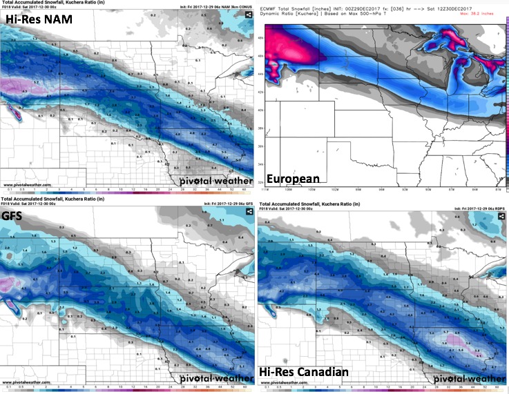
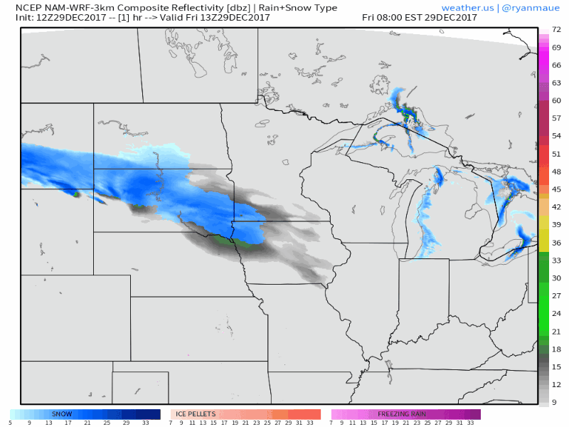
Another piece of energy will dive into the western portions of the Dakotas overnight, spreading an additional area of snow into the Northern Plains. Here’s a look at the simulated radar until Saturday night. Parts of South Dakota will not really get a break at all in the snow until overnight on Saturday. At this time, given the upper-level energy, we’re thinking the precipitation shield in Southwest Minnesota is slightly underdone and we can see the picking up some snow accumulation late Saturday.
Combined snow accumulations for Friday and Saturday could reach 3 to 6 inches for most of South Dakota, Southern Minnesota and extreme Southwest North Dakota with lighter amounts in the northern portions of North Dakota and Minnesota.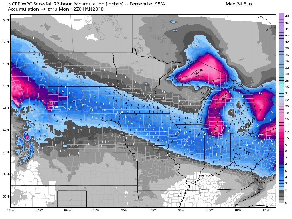
Perhaps the bigger story will be the dangerous cold air working into the Northern Plains later tonight. Morning lows will be well below zero over the entire Northern Plains each of the next three mornings. Many areas will dip 20 to 30 degrees below zero with a solid snowpack in place.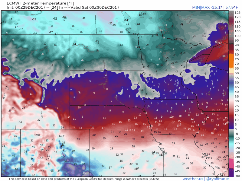
Wind chill values will be even colder than this on some mornings. Be sure to take proper safety precautions for what could be a record breaking cold event this weekend and early next week for some stations in the Northern Plains.